Tuesday 18th June 2024
Day 4: WAW – Dungloe to Slieve League (Sliabh Liag)
It was a quiet and comfortable night in Dungloe carpark (classy!). I had the company of a couple of other vans, all parked discreet distances from each other.
Waking at 4:30 AM with catastrophic thoughts of being found dead at the wheel from carbon monoxide poisoning, I really shouldn’t Google late at night.
There was a stream behind the van, and at first light, it was wonderful to watch House Martins dart up and down, catching their breakfast. Speaking of which, I’m still hunting for that elusive Irish breakfast. The Co-op up the street had a cafe, but alas, no Irish brecky. I took coffee to go and hit the road. The coffee was awful, by the way.
Freezing my butt off but staying alive!
My tactic today was driving short distances with the air circulation on and the windows open to keep fumes out of the cab. It seemed to work. I’ve had plenty of fresh air today, particularly in the mountains.
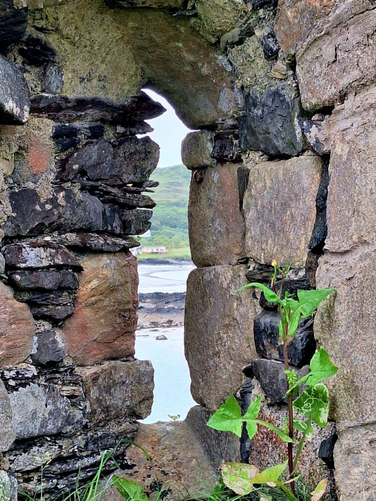
First stop was Narin Beach, and I was instantly wishing I’d stayed here last night. It offered free parking with fabulous views over to Inishkeel Beach and its monastic site. You can walk across at low tide, which is exactly what I did.
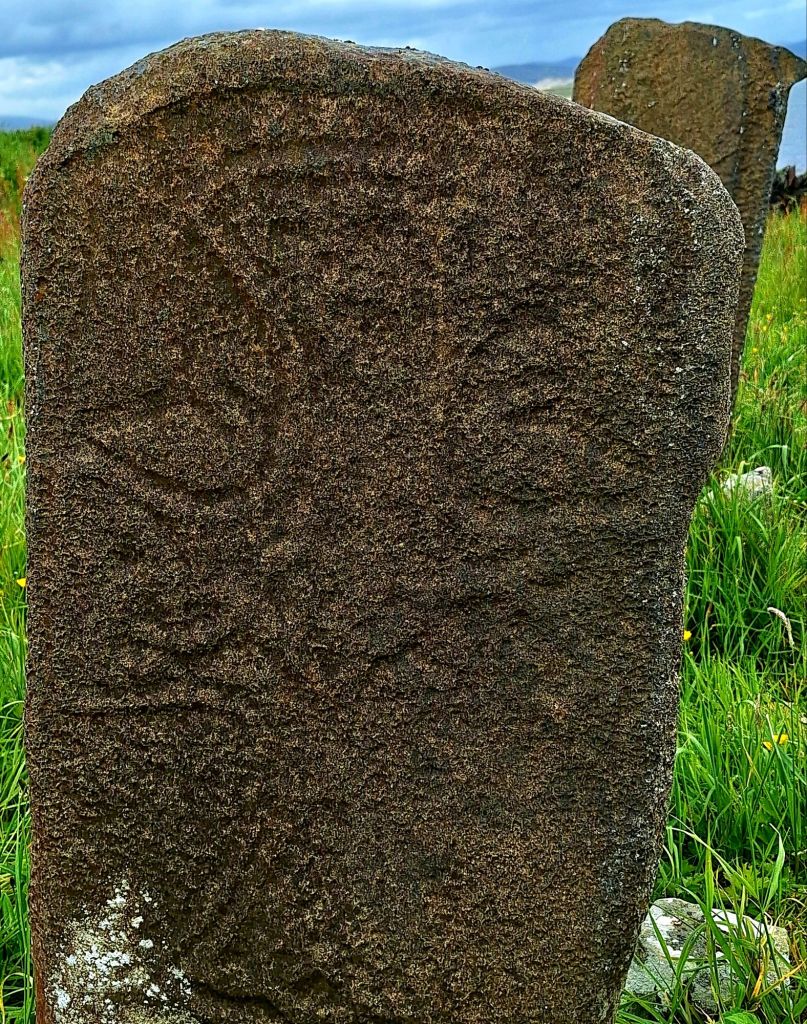
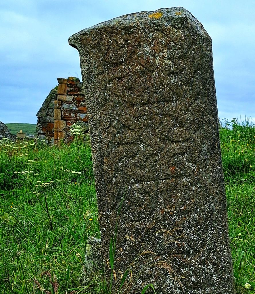
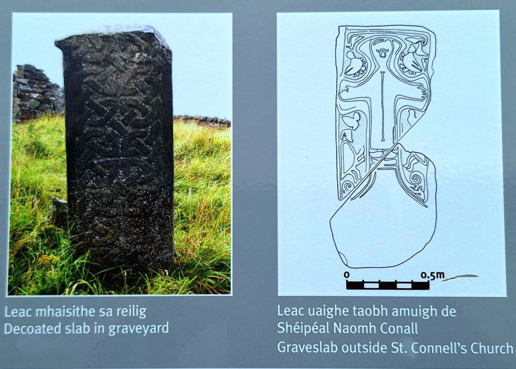
The island itself is home to the ruins of a 6th-century monastic settlement, founded by St. Conall Cael. As I explored the remnants of the ancient churches, I also spent time with the early medieval grave slabs. These weathered stones, some dating back to the 8th or 9th century and adorned with intricate carved patterns, marked graves from centuries past.
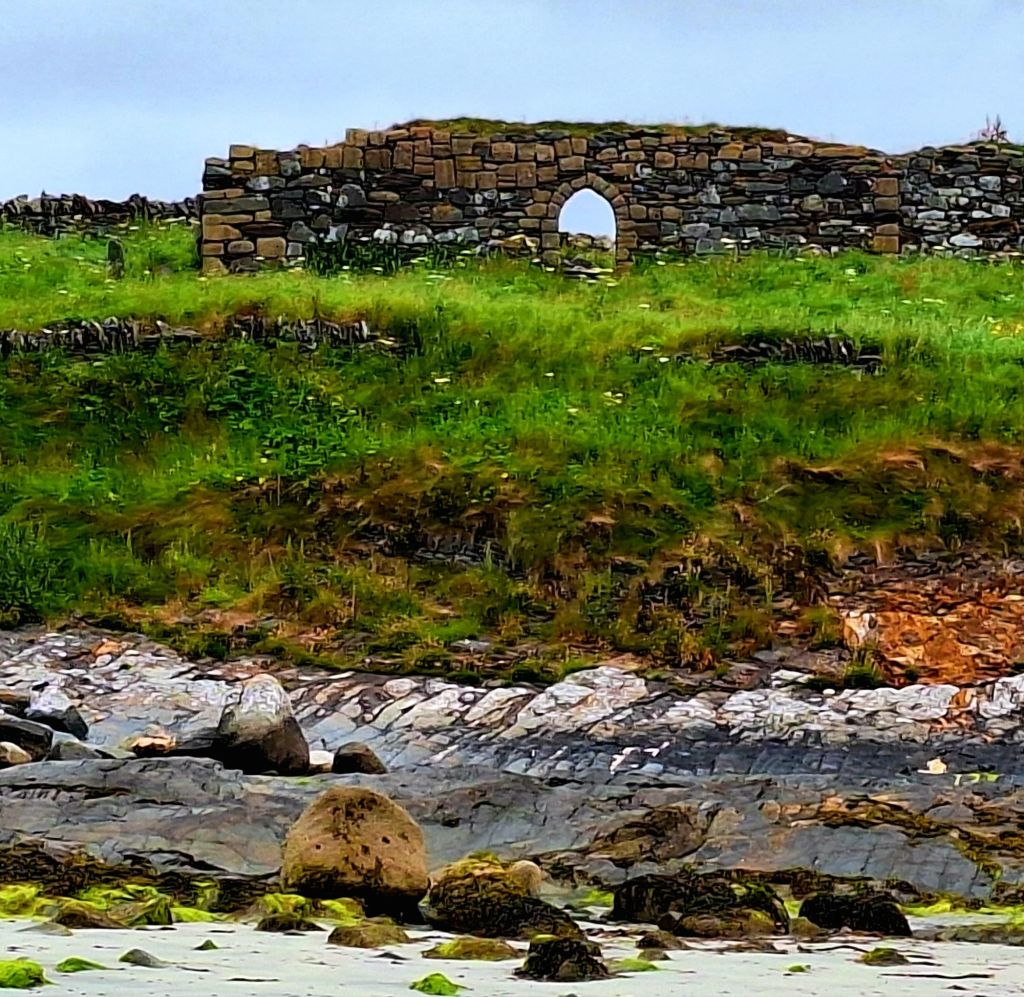


I sat for a while, listening to the birds and the gentle lapping of tranquil waters, wondering what life must have been like here hundreds of years ago. It reminded me of my Viking island on Orkney, which I visited during the NC500.
Back at the beach carpark, there were two cafes: one closed, the other only selling cakes or lunch toasties. Still no sign of an Irish breakfast! The toilets, shut overnight, had just opened at 10:20 AM. There were also outside taps and a cold shower point, which was very handy.
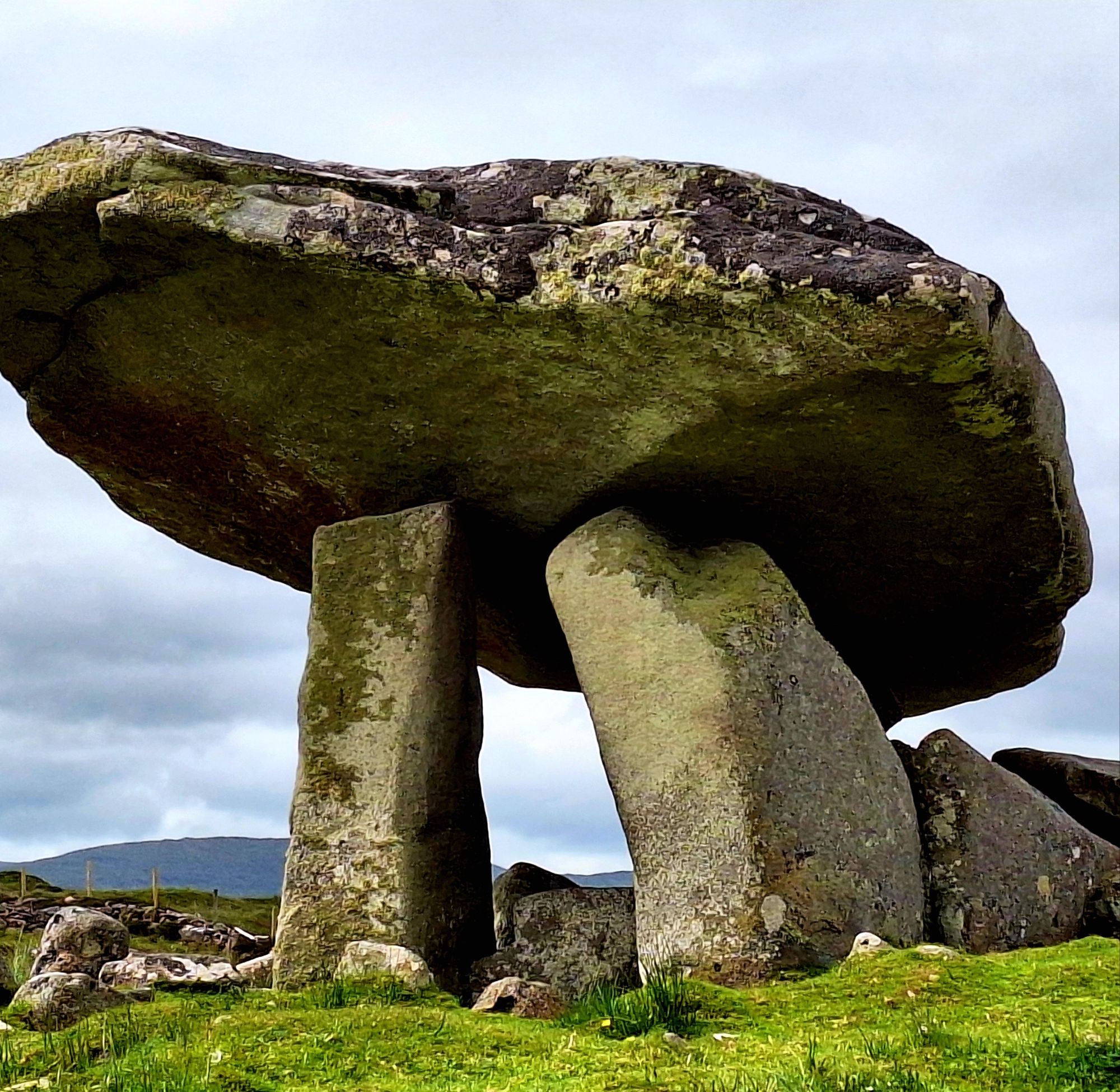
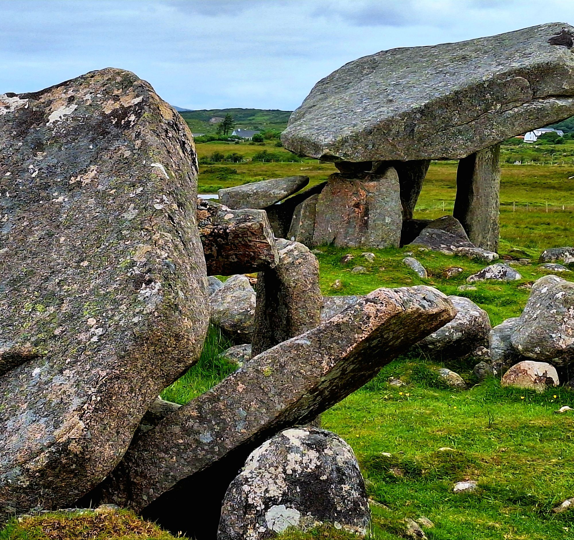
Further down the road, Kilclooney Dolmen was pretty impressive. This Neolithic structure dates to between 4,000 to 3,000 B.C. and is one of the finest examples in Ireland.

A couple from Scotland were taking pictures, and we got chatting about road trip van woes. He’d once travelled over from Scotland with a dodgy wheel bearing and had similar fume issues with a T4. He advised, “just keep the windows down, you will be fine.” I felt a little more reassured.
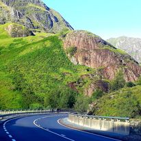
The route then moved inland to cross Glengesh Pass (Malaidh Ghleann Gheis). It’s a glacial valley that links Glencolmcille to Ardara and is on my route to Slieve League, my final destination for today.
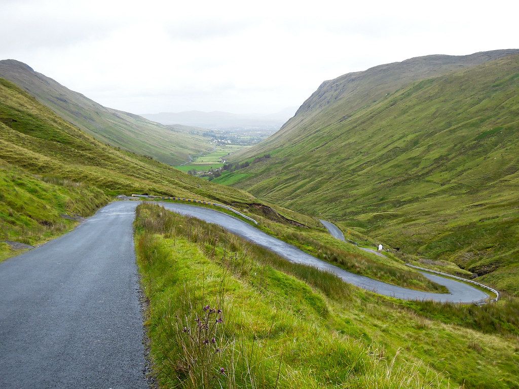
A spectacular drive. Imagine Dartmoor with knobs on. A vast bogland landscape that goes on forever—a very important landscape, as sphagnum moss sequesters carbon. The roads crossing this expansive moor were wonderfully bouncy and undulating. Just like in Scotland, if you caught the humps at the right speed, it felt like you were flying. These little things make me happy.
The road gently winds its way up the pass, and a tight chicane leads up to a viewing point and a little coffee wagon. Time for travel cake!
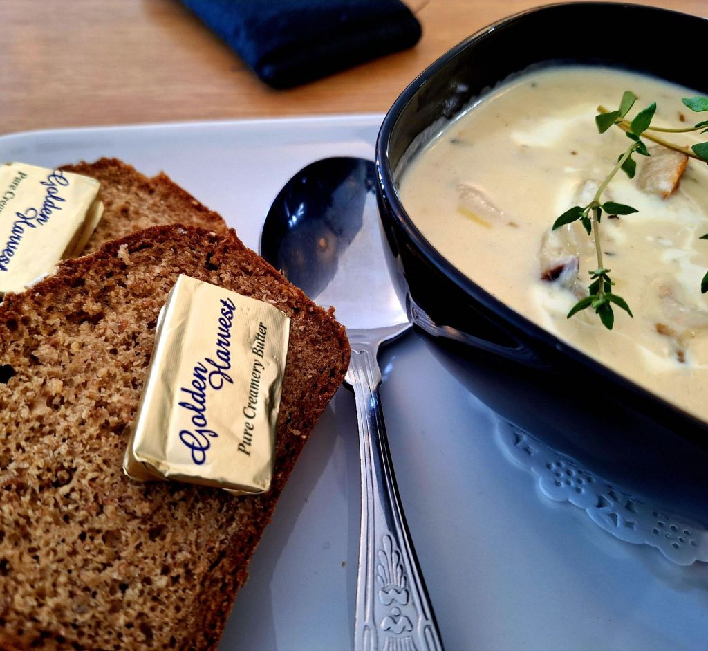
On the other side of the pass, I found a nice cafe, O’Deas Galley. And finally had some decent food: seafood chowder and Guinness bread. Delicious!
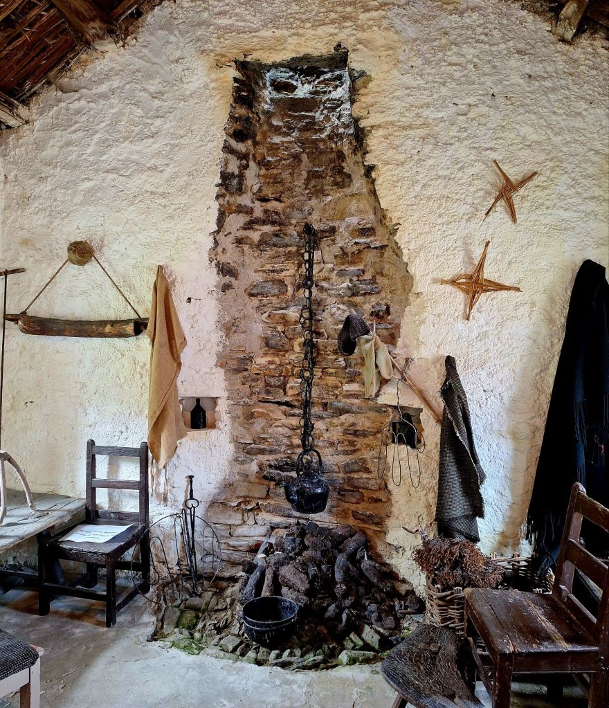
Another 20 minute drive and I arrived back on the coast in Glencolmcille Folk Village. Also known as Father McDyer’s Folk Village Museum. An enjoyable diversion, the thatched-roof replica of a rural village, offers a glimpse into daily life in 19th century Ireland
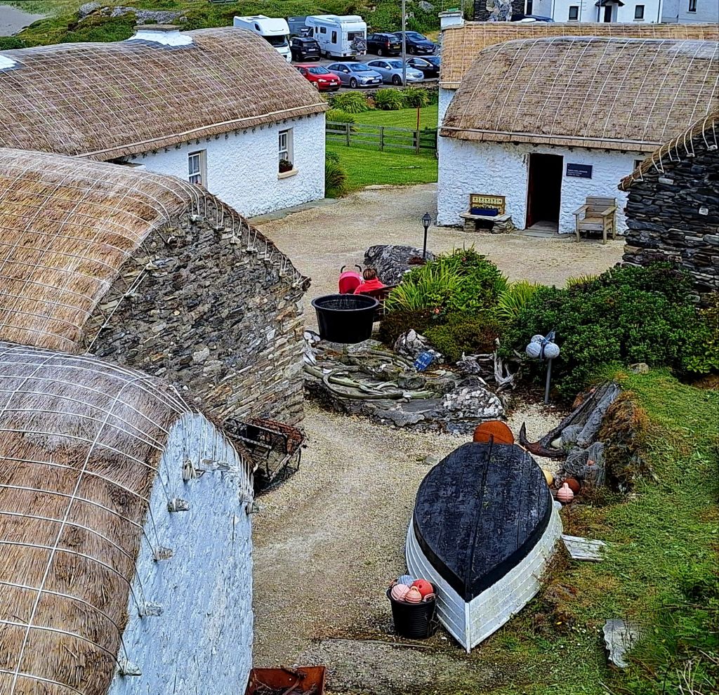
The thatch was fascinating, lashed on with rope


As I was leaving, an American woman told me I was the spitting image of her cousin in Montana… we all have a twin somewhere.
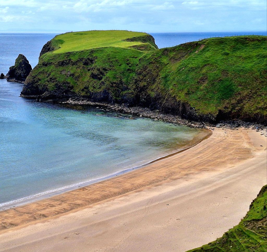
The WAW continued along the coast to end at Malinbeg (Màlainn Bhig) a sheltered sandy cove. It was quite the walk down, so I viewed it from afar
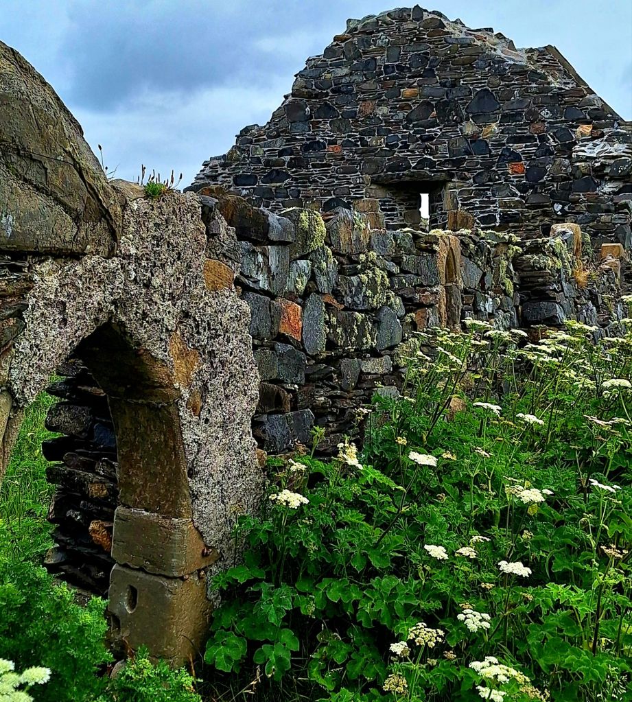
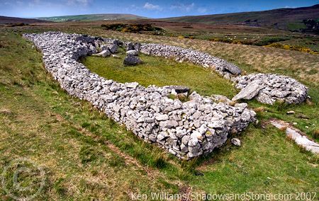
Backtracking a little, I then headed inland to Slieve League (Sliabh Liag), meaning ‘mountain of stone pillars’. On the way, I had a very lucky find: Malimore Court Tomb, a quite sizeable structure dating back to 3000 BC.
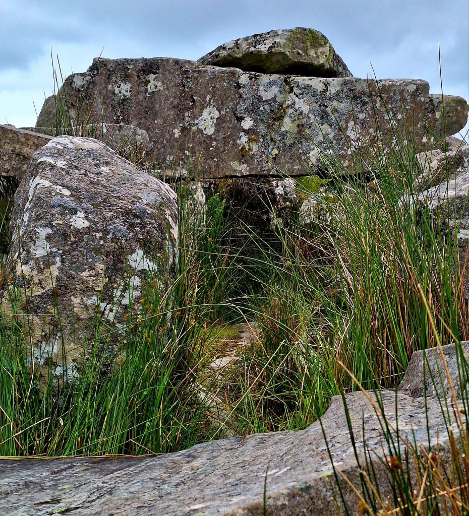
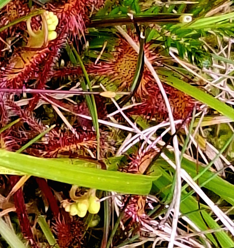
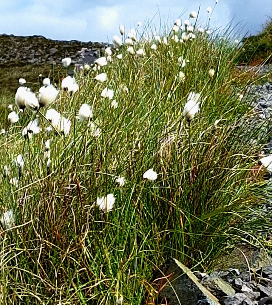
It’s about a 100-yard walk from the road, across the moor. I couldn’t believe that sundew grew all along the path – amazing, in such an inhospitable place. I can’t even keep one alive in my kitchen!
Two Irish guys were also looking around, and we engaged in lively conversation about the structure and the local fauna and flora. I was able to share some interesting facts about lichen with them, and pointed out the sundew. It’s so wonderful to be around your tribe!
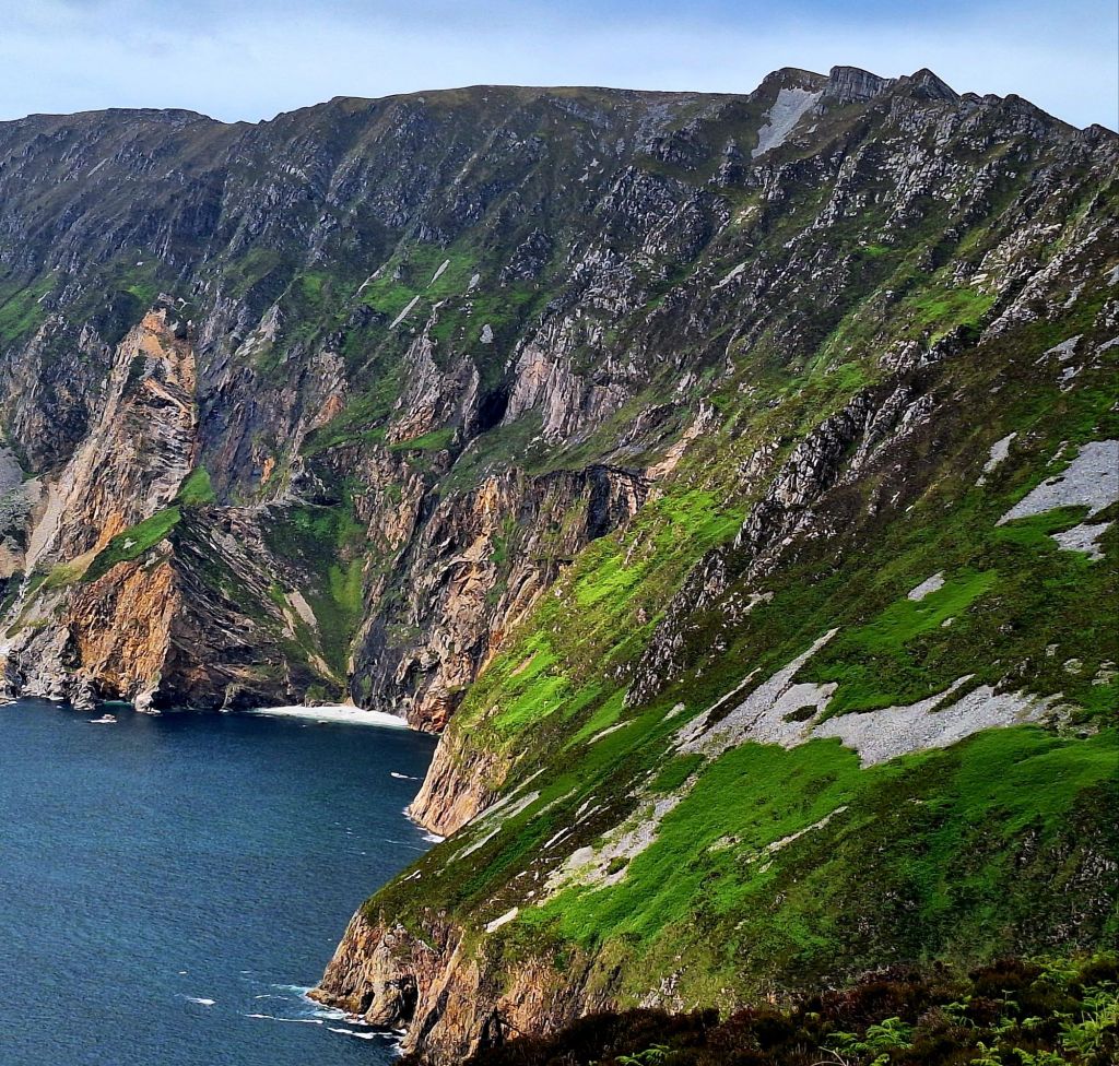
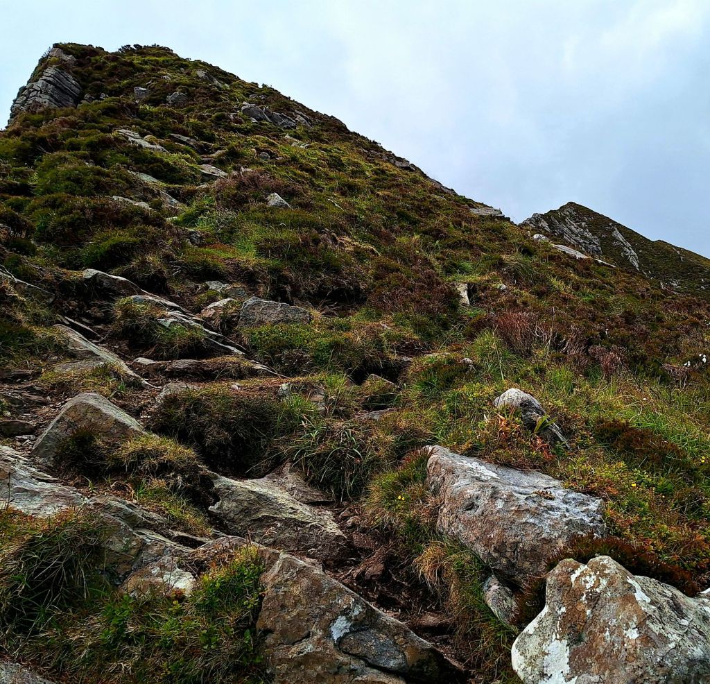
Cleverly, I’m staying at a campsite at the foot of Sliabh Liag. It’s €30, but I’ll avoid busy car parks and fees, as you can reach the trailhead directly from the camp. Sliabh Liag is 601 meters (1,972 ft) high. It boasts the second-highest sea cliffs in Ireland after Croaghaun, and some of the highest sea cliffs in Europe. There are a few ways to walk it, but due to my late start, I walked from the Bunglas Viewpoint, accessed by road from the visitor centre. This is a 4km access route onto the plateau of Sliabh Liag. You can catch a bus up for €7 and learn a lot about the place from the chatty driver.
The first part of the trail follows a well-worn track along the cliffs to the summit of Cnoc Ramhar, where the path becomes eroded and boggy. There are spectacular views of the cliffs from here.

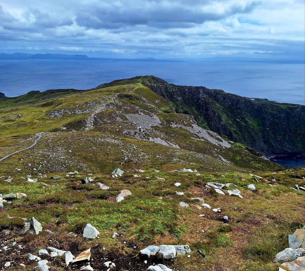
The next section is the infamous One Man’s Pass. A narrow, 400 m craggy ridge – think Crib Goch – where the land drops dramatically on each side. It is only recommended for experienced hikers. It was definitely worth a go.

It was gusting up there, and my hat got blown clean off twice. I climbed about a hundred yards or so to the first peak. But it was 4:30 PM, and it would take at least another hour to climb the rest of it. So I made the sensible decision to retreat.

I was back down by 5:15 PM, just in time for a well-deserved ice cream. The bus driver picked me up and drove me back to camp. He was a nice chap; the Irish are always so chatty. He regaled me with stories about the area and apparently… we even passed Sinead O’Connor’s husband’s house.
If I’d had more time, I would have walked the Cosán an Oilithrigh or Pilgrim’s Path at Sliabh Liag. It follows the ancient path up a U-shaped valley nestled between Leargadachtan Mountain and the sea cliffs at Shanbally, overlooking the small fishing village of Teelin.
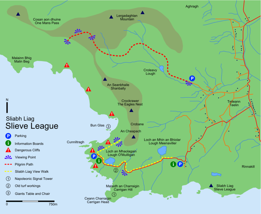
The Pilgrim’s Path is about 3km in length and takes two to three hours out and back. Alternatively, you can continue along One Man’s Pass, along the cliffs and back down to Bunglas. Something to do another day…
All the ingredients of a fabulous day were present. Back at camp, I had a much-needed shower, did some laundry, and made some van grub. Then, snuggled in the van, it was a tad cold up there, but thankfully, the tap water was scalding, so I filled a hot water bottle.
It’s a good site, plain and municipal, but with all the necessities: hard standings, so the beast can’t sink, a cafe at the visitor centre next door, and a pub in the village that I couldn’t be bothered to walk to.

A Guinness is on my list, though

Leave a comment