For our Mum, who never got to see us do this together, RIP 14/10/2024
Sunday May 4th 2025
CWT Day 10 Strath na Sealga to Inverlael Bridge – Approx: 12 miles
Strange sounds in the landscape last night. I think they may have been Ptarmigan or Grouse. Ptarmigan are fascinating birds that change their plumage to white in winter for camouflage in snowy conditions, while Red Grouse are famous for their distinctive calls and are often found on heather moorlands.
There were also strange noises emanating from my brother’s tent this morning, like a grizzly bear waking after a long winter. After much ‘zipping’, muttering and groaning, his first words were ” ahh more of this shit this morning”
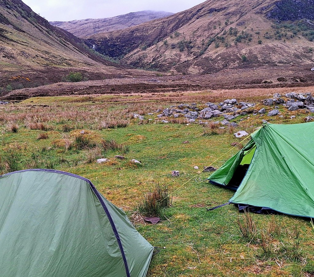
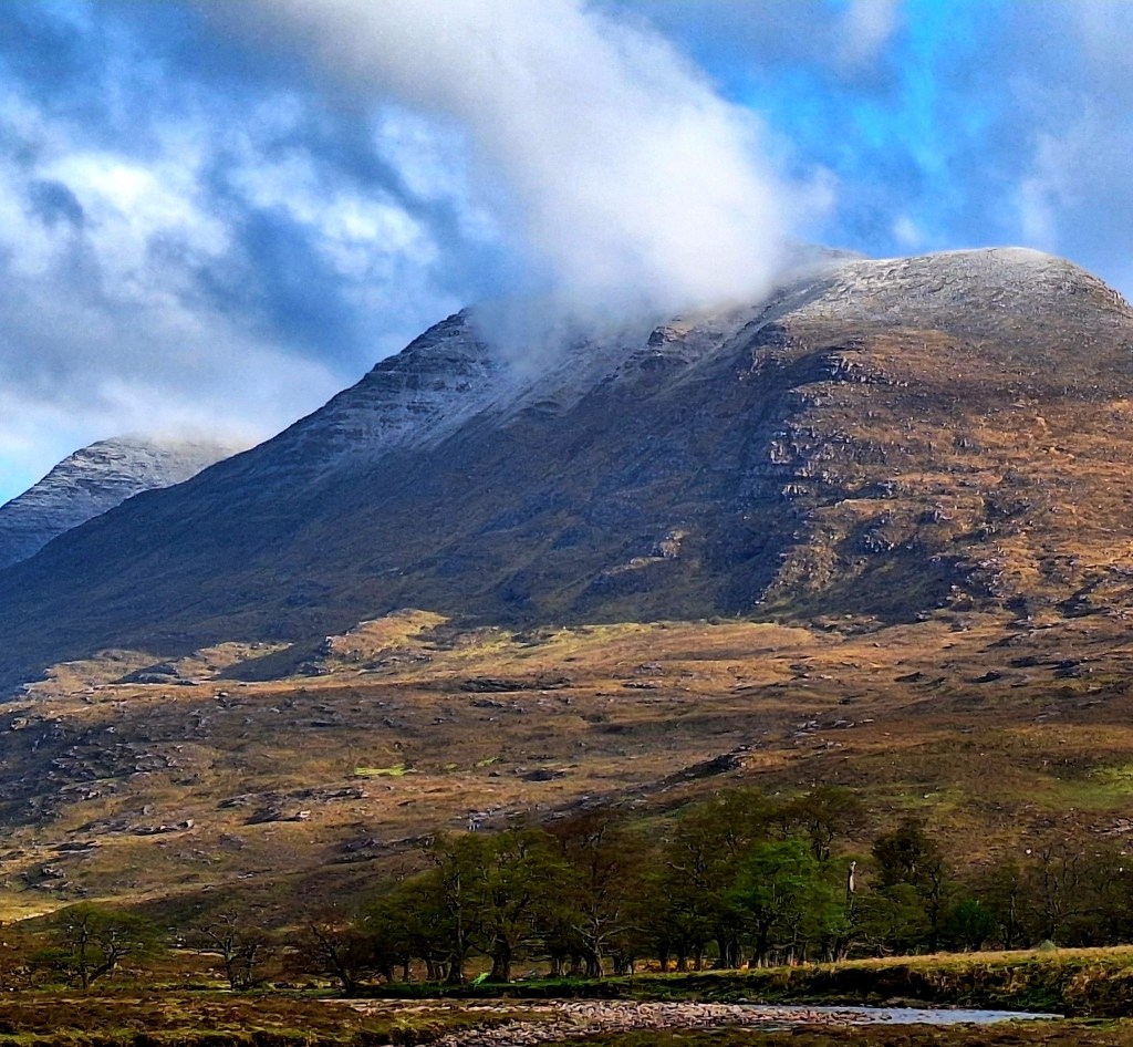
There was some rain on and off overnight, but nothing too bad. Once my legs warmed up I slept well. My routine of taking co-codamol at night, stops hip pain, the result of long days walking. It was a cold night and we woke to snow on the mountains, and lots of hikers. This is Munro country and the baggers were out in force. They marched through our little camp while we ate breakfast. I was glad we decided to stop here last night; the bothy would have been heaving.
With so many people passing and not a bush in sight, morning ablutions was a tricky affair.
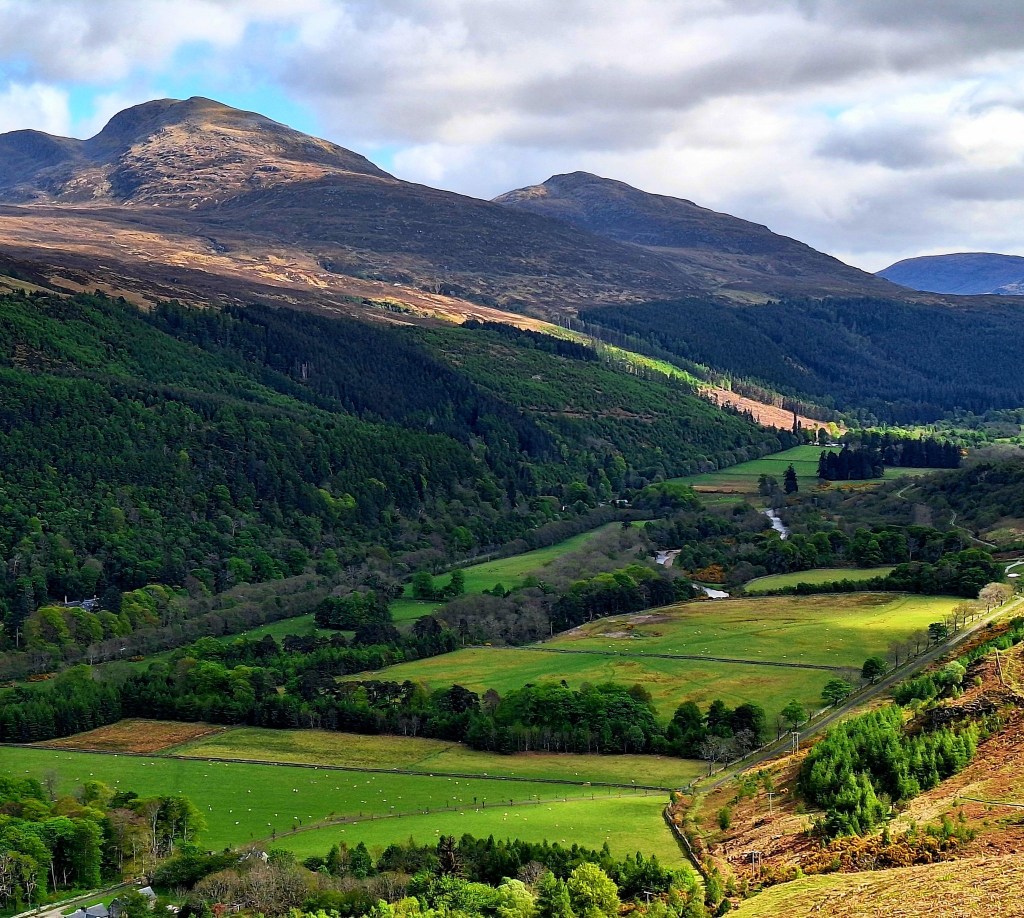
Our camp at Strath na Sealga placed us deep within the heart of the Fisherfield “Forest.” This vast, remote area is often called the ‘Great Wilderness’ of Scotland, but the name is deceptive, you will notice a distinct lack of forest.
Historically, this term referred to large tracts of upland reserved for deer hunting. This tradition dates back to medieval times, and these “deer forests” became particularly prominent in the 18th and 19th centuries when large estates were increasingly managed for sport hunting (especially after the Highland Clearances reduced human populations, freeing up land).
While parts of Fisherfield (and many other “forests”) would have been part of the ancient Caledonian Forest, hundreds or thousands of years ago. By the time the term “deer forest” became widespread, much of the area had been deforested due to logging, burning, and heavy grazing by sheep and deer. Today, it’s largely an expansive, rugged landscape of mountains, glens, lochs, and open moorland, with few signs of human habitation.
To the right of our trail today, what maps might label as Dundonnell Forest is also, in reality, largely an expanse of open moorland and mountains, much of its original tree cover having been lost over centuries. This vast, exposed environment creates a sense of isolation and challenge on the trail.
With dry tents, it was a swift decamp and a long ascent out of the valley. Although not a long day (12 miles), it was surprisingly tiring, heavy packs taking their toll. The physical exertion, lack of sleep, and for me, not enough snack stops, just accumulates.
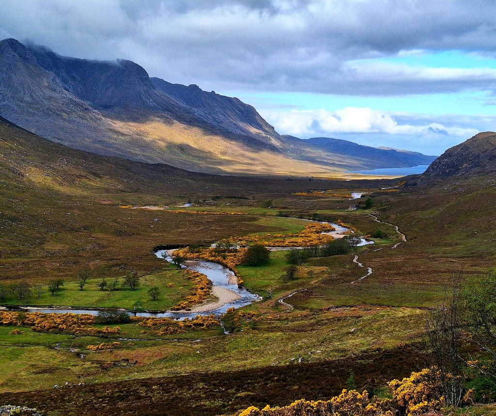
The tracks were well defined today, mostly rocky, slow going on long elevations and it was cold. Simon, who camped with us last night, forged ahead, we were too slow for his young legs. When the sun did appear, we were quickly roasting. Peaceful woodland trails as we got closer to Corrie Hallie and from time to time we hit grassy tracks, the stuff of dreams …

We paused at Corrie Hallie. Our guide mentioned the ‘possibility of coffee and cake’ but did not elaborate on where. The map indicates an art gallery. Disappointed, we found neither. But a tree-lined area with logs provided a handy stop for a rest and snacks. Corrie Hallie is a small settlement often noted as a checkpoint or transition point on the Cape Wrath Trail, marking a shift in the landscape.
From here the trail crosses the road and a river into fields. As ever, the tactical navigator, I spotted a shortcut, a ‘desire path’ contouring the field rather than the indicated trail heading up the steep incline. My brother struggles to deviate in such situations and wants to stubbornly ‘stick to the trail’ – even though the CWT does not have an official route. Acquiescing, at his insistence we took the steep route, only to see it blocked by a large fallen tree. Much scrambling and climbing later …. ‘don’t listen to my brother!’
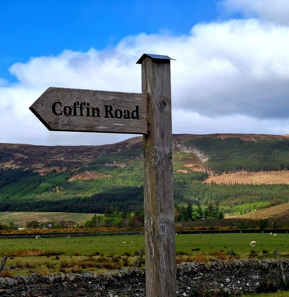
The long descent from Clachan to Inverlael ended with signs for a “Coffin Path.” These historically significant routes, also known as corpse roads or kirk roads, were once vital lifelines for remote Highland communities. They were used to transport their deceased, often over many challenging miles, to distant, consecrated burial grounds. While it might seem difficult to see the destination today, research confirms a notable burial ground existed at Inverlael itself (grid reference NH 1868 8543), complete with an 18th-century mausoleum. This path serves as a tangible link to the customs and resilience of past generations living and dying in these wild glens
Inverlael sits at the mouth of Glen Lael and is a common access point for the surrounding Fannich mountains. We arrived around 4.30 pm, there was a bit of road walking and some wandering about, before we found a suitable place to camp at the edge of the forestry woods.
Finally camped and water collected, my brother pulled off another tic on his leg. How on earth do they get up there. Ticks seem to be an issue. Is it just the men? I have not had any problems at all.
An early night tonight, we have a long and potentially tough day tomorrow. We are heading for Glen Douchery …
Beware the Firepot Spinach Dhal, I think someone must have sneezed and added too much chilli to this batch, it made my eyes sweat. But I ate it anyway, starvation is a strong driver. But not the most sensible thing to be doing where there are no toilet facilities! Such is the reality of dehydrated meals on the trail – sometimes a fiery surprise!

Leave a comment