For our Mum, who never got to see us do this together, RIP 14/10/2024
Thursday May 8th 2025
CWT Day 14: Inchnadamph to an outcrop outside Kylestrome – Miles: Approx 13 miles
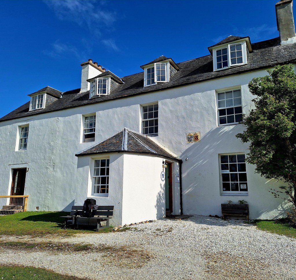
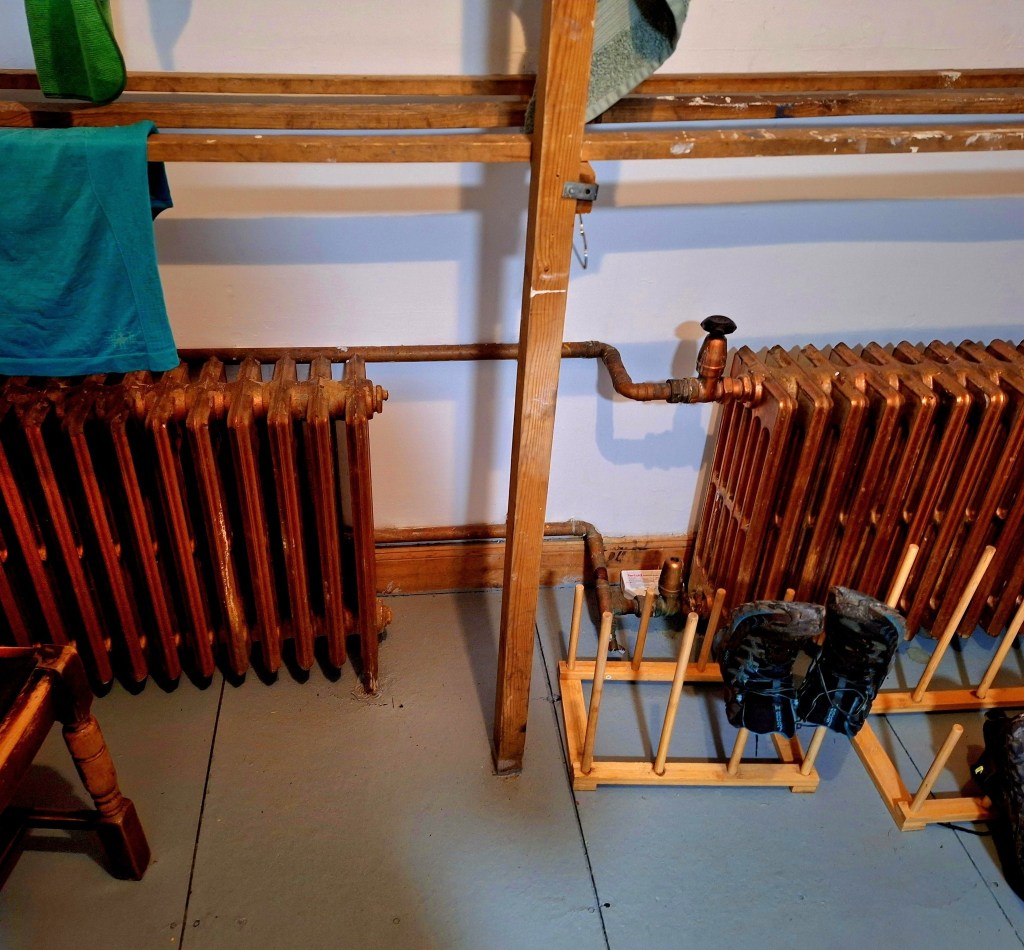
The drying room here at Inchnadamph Explorers Lodge is phenomenal. There are six of those huge old radiators. It’s like walking into a wall of heat and your clothes dry instantly.
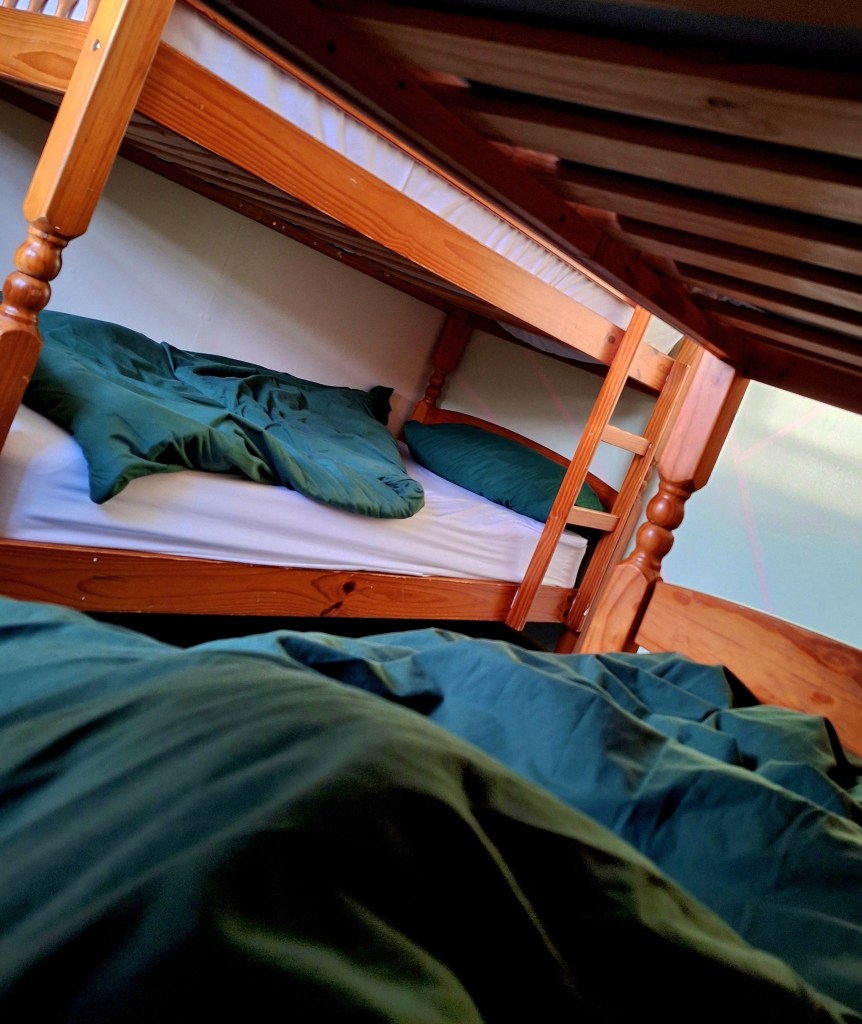
We had an early and comfortable night, but after days of sleeping in the wilds, I was boiling hot. It was still nice to be in luxury.
Strange dreams in and out, and an early waking to another glorious day in paradise. Some strange side effects of thru-hiking: I can no longer walk in a straight line without my backpack on. I look weathered, as if I’d been at sea for months, and I now have the physique of a racing whippet, if only I could move as fast. Lots of repacking, the sweet scent of clean dry clothes, a joy after days wearing the same kit. A casual communal breakfast, we were joined by Larse, before setting off for a leisurely day.
The section route today unnecessarily meanders all over the place and can take 2 days. Our guide described it as “A majestic and tough day, route finding can be challenging, particularly in poor visibility”. We are done with tussock and bog hopping so we followed our guides suggestion, because weary we were “If you’re feeling weary or want to steer closer to civilisation, you could follow the A894 north from Inchnadamph for a couple of kilometres to the famous Aid Breac (Ardvreck Castle)“.

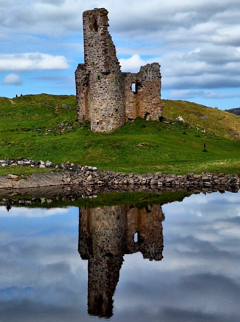
I’d been there before, a few years back on the NC500 (North Coast 500, a popular scenic driving route in the Highlands). Ardvreck Castle, now a ruin on the shores of Loch Assynt, is nestled amidst the iconic mountains of Assynt, forming an impressive backdrop. This includes the prominent Quinag with its three summits, Ben More Assynt, Canisp, Cul Mor, and the famous, distinctive peak of Suilven. So many tempting peaks, so little time! Suilven was featured in the film ‘Edie’, it’s on my list and a reason to come back.
The castle itself has a history dating back to the 16th century and was once the seat of the MacLeods of Assynt. There are a few paths from here that skirt Glas Bheinn and return to the road again after 5km. Glas Bheinn is a prominent mountain in Assynt, part of the region’s distinctive geological landscape.
It was a baking hot day, and walking on road is tough in the heat, so we hitched a brief lift to the ‘Rock Stop’ part of the Assynt Global Geopark at Unapool, with promise of coffee and cake. Terrible luck, it was closed, and we were left stranded. The Assynt Global Geopark is a designated area in the Northwest Highlands, showcasing a landscape of outstanding geological importance, and ‘Rock Stops’ are interpretive sites within it.
We walked the last 2km to Kylesku for lunch at the Kylesku Hotel. Enquiring about sandwiches, I was informed curtly, “this is a fish restaurant.” Undertered, I have had issues such as this on other trails, I quipped “OK, how about a fish lunch then”? My cheeky retort was rewarded with some Cullen Skink, my favourite and delicious thick Scottish soup made of smoked haddock, potatoes, and onions.

But I thought the barman was going to have a conniption when David asked for coffee and cake. I overheard the next customer ask for a beer and heard the barman say, “thank God I don’t have to make another coffee.” I’m guessing he was having a bad day.
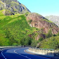
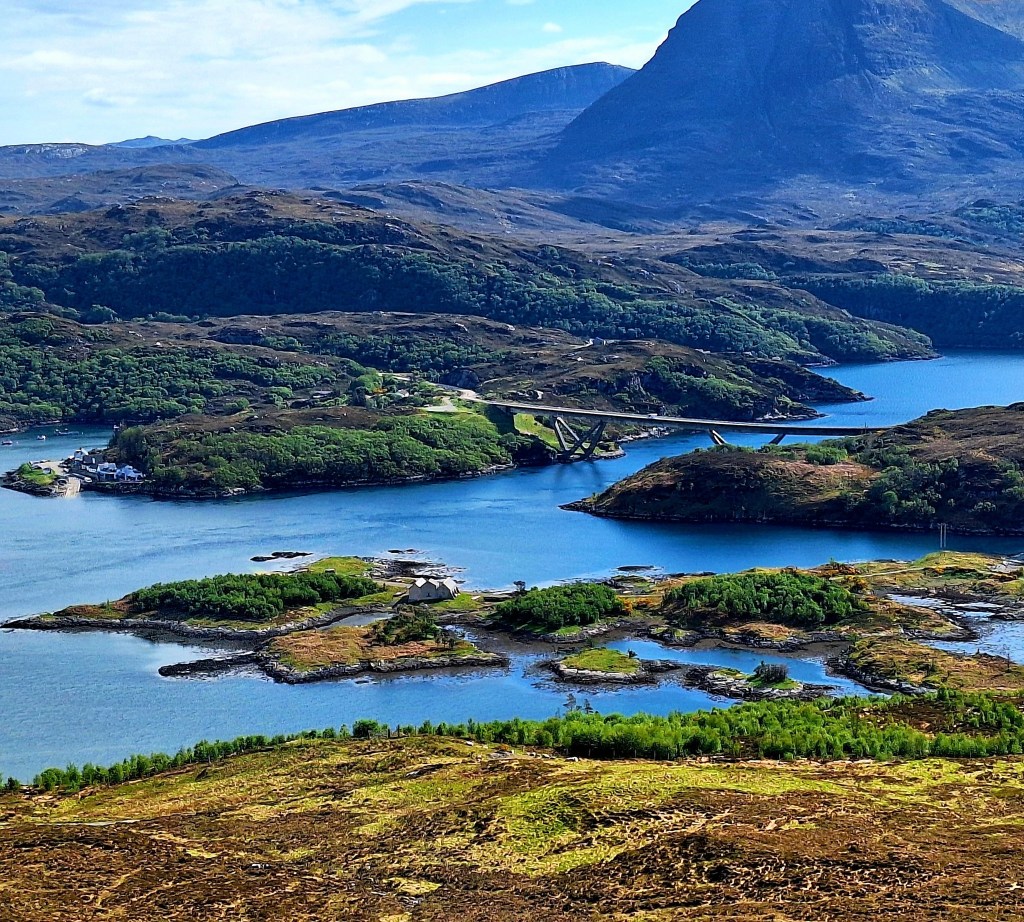
Larse caught up with us and we passed the time catching up with route stories and plans. There are fantastic views from the bar deck across Loch Gleann Dubh. Refueled, we set off about 3pm to break into the miles for tomorrow, crossing the rather impressive Kylesku Bridge. Opened in 1984, the Kylesku Bridge is a distinctive concrete box-girder structure spanning the sea loch of Loch a’ Chàirn Bhàin, replacing a ferry service and significantly improving transport links in the remote region.
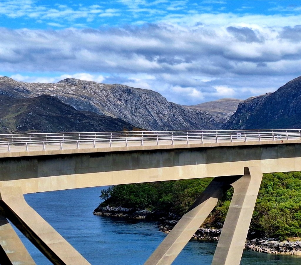
The area around Kylesku is renowned for its dramatic beauty, characterised by a complex network of deep, narrow sea lochs, including Loch Glencoul and Loch Glendhu, which merge into the wider Loch Cairnbawn. This ‘tangled’ landscape of water, hills, and rocky outcrops creates truly stunning coastal scenery. I remember driving through here on the NC500 and I parked up for a while to soak in the landscape.
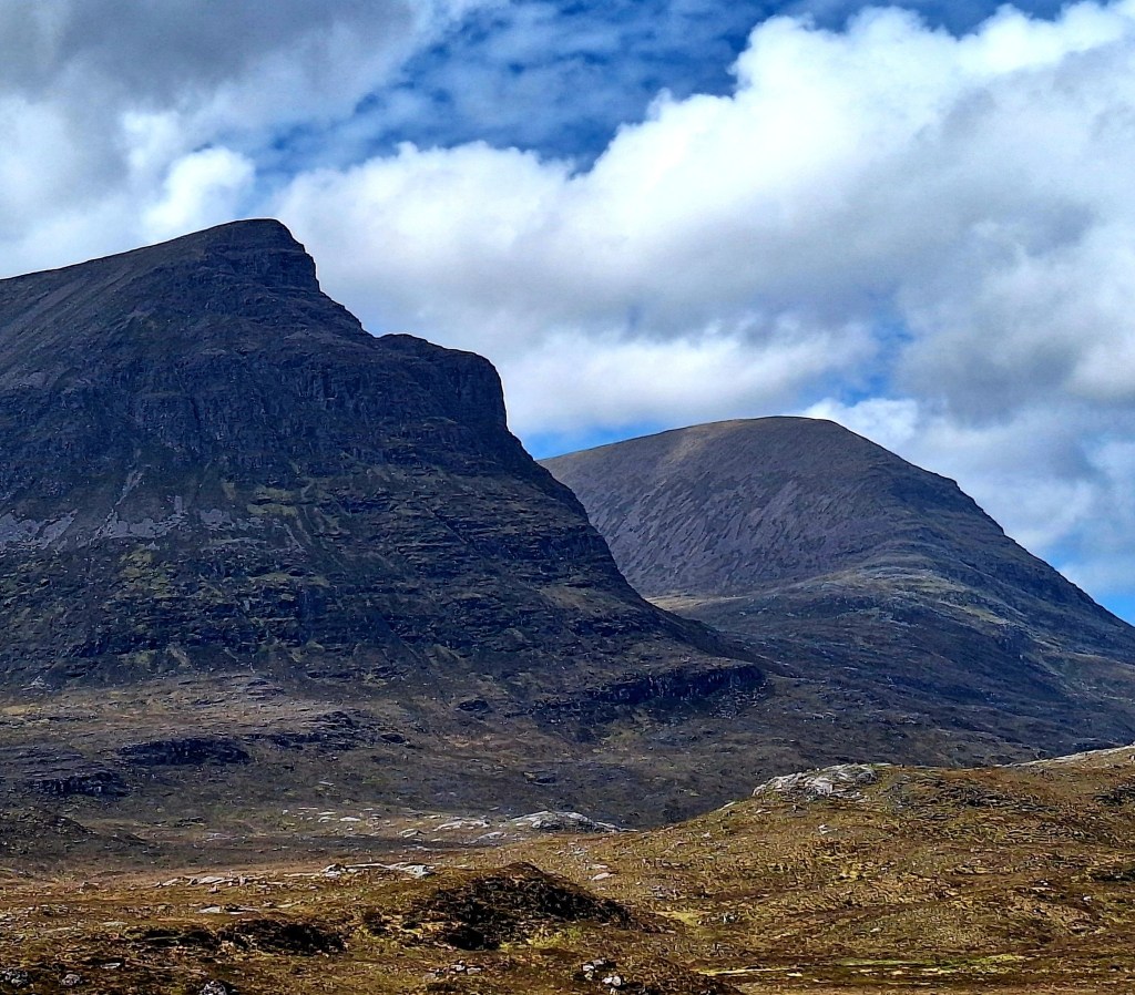
Climbing out, you get fantastic views of Quinag, a distinctive mountain massif with Corbett status. Ascending all three of its peaks – Sàil Gharbh, Sàil Ghorm, and Spidean Coinich, is considered some of the best hiking in Scotland. Translated from Gaelic, the ‘little milk pail’, rises impressively from the landscape, adding to the wild beauty.
Walking up the hill, we met Ally sitting on a bench, looking a bit worse for wear. He told us he had walked from Craig, which is several stages earlier, six days ago for us. He would have covered a significant distance across challenging terrain, to reach this point. He looked a bit heat-stroked so perhaps confused? He walked with us for a while, then left us behind, we were also overtaken by Larse who was headed for a bothy tonight we think.

After an hour or so climbing out of Kylestrome, we passed Ally pitching his tent. We stopped further on near a lochen. We wanted to get close to the top for an easy start tomorrow. It was a long steep climb, and I am so slow with my heavy pack. The spectacular views and pretty orchids were a consolation, and our camp had the best views.

Handily there was a network mast not far from us and we had an epic phone signal.
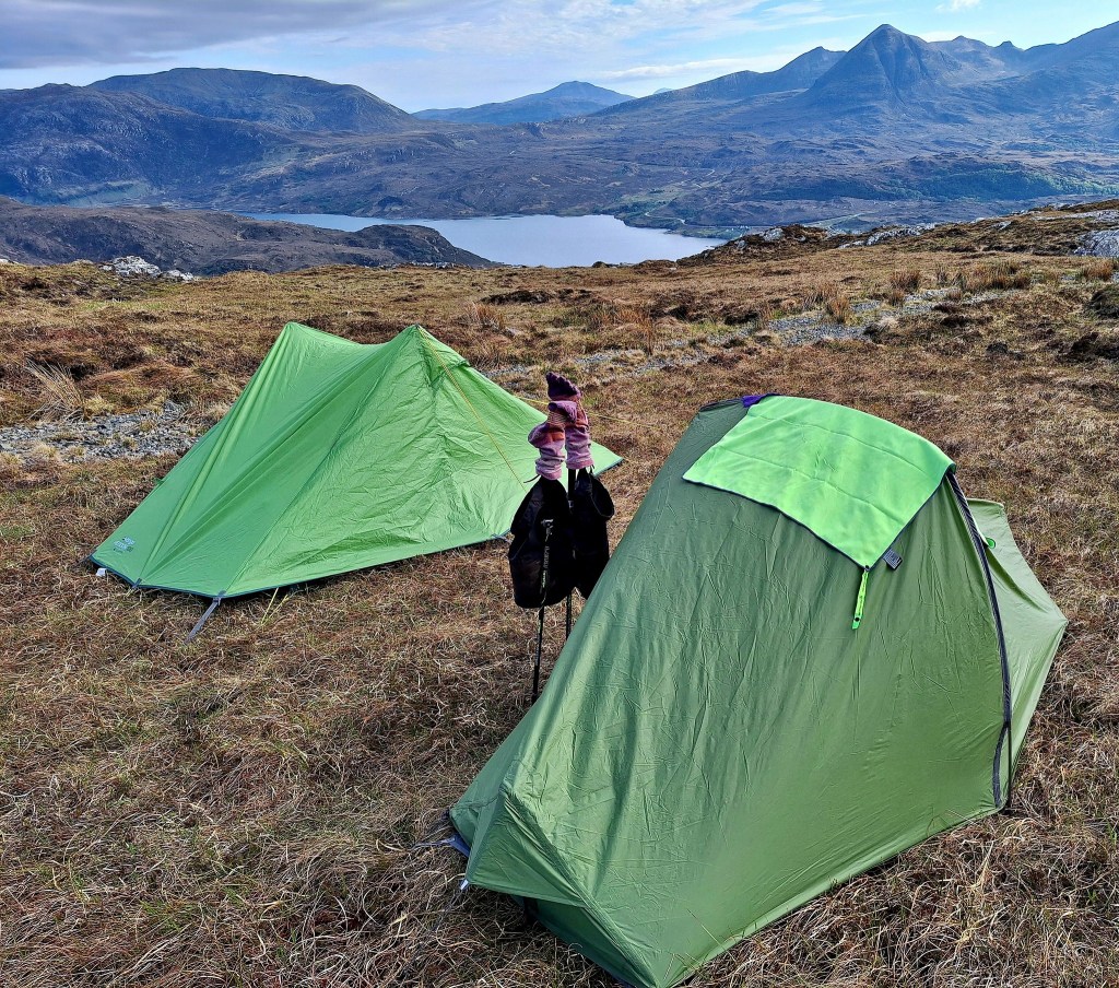
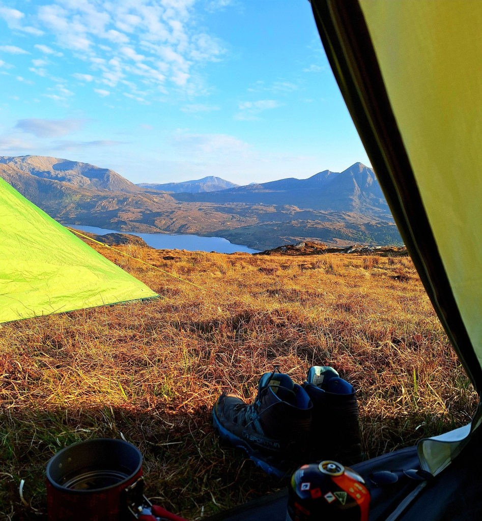
A refreshing wash in the lochen and camp dinner, we could see the sea, and we are nearing the end of this crazy quest.

Leave a comment