Part 1: Ivinghoe Beacon or Bust
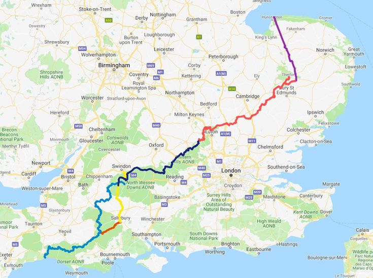
The Greater Ridgeway, also known as the Great Chalk Way, is a 362-mile long-distance footpath from Lyme Regis (Dorset) to Hunstanton (Norfolk). The trail ‘roughly’ follows ancient trackways/highways, thought to be an important trading route, for at least 5,000 years.
It is comprised of four long-distance footpaths:
- The Wessex Ridgeway (Lyme Regis to Overton) 136 miles
- The Ridgeway National Trail (Overton to Ivinghoe Beacon) 87 miles
- The Icknield Way Path (Ivinghoe Beacon to Thetford) 110 miles (the oldest road in Britain)
- The Peddars Way (Knettishall to Holme-next-the-Sea) 46 miles
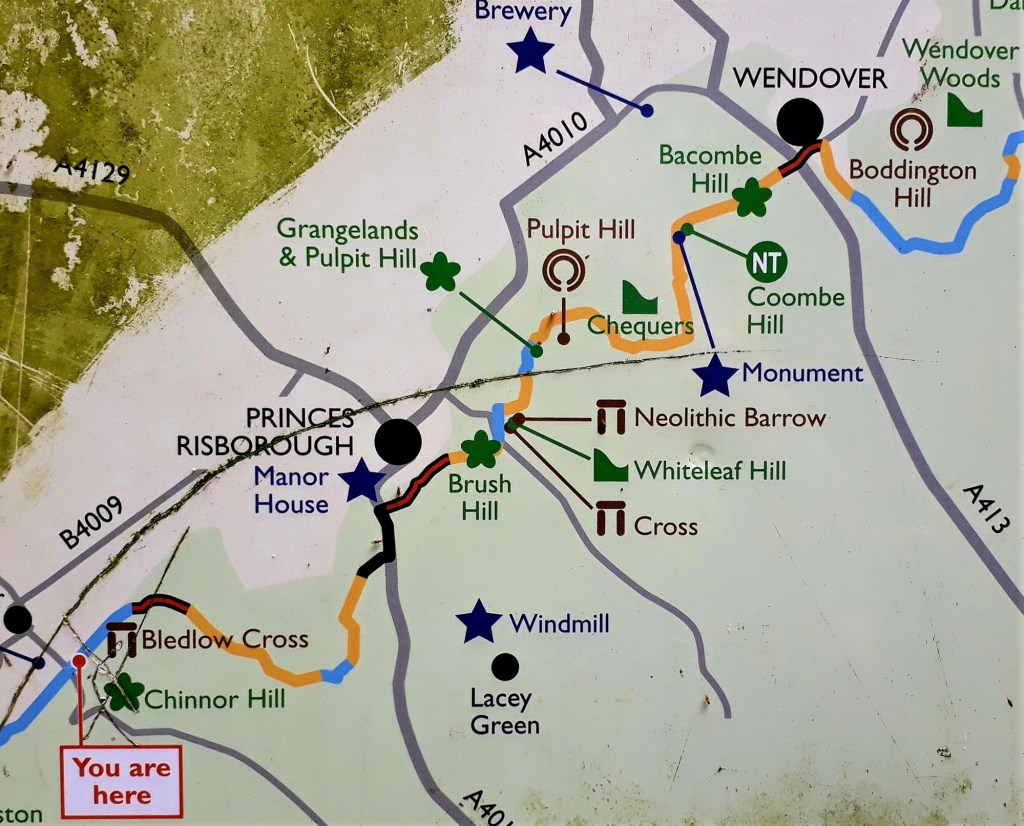
The first two route stages as documented in various guides and websites
The Wessex Ridgeway
1. Lyme Regis to Synderford 11.8
2. Synderford to Beaminster 8.6
3. Beaminster to Sydling St Nicholas 14.4
4. Sydling St Nicholas to Dorset Gap 11.3
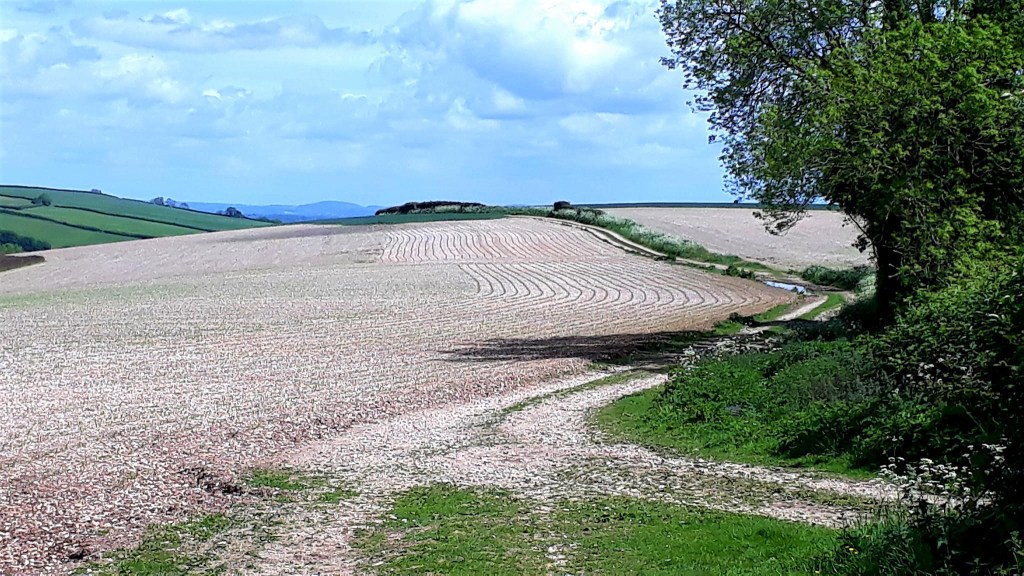
5. Dorset Gap to Iwerne Courtney 11.5
6. Iwerne Courtney to Ludwell 13
7. Ludwell to Hindon 10.6
8. Hinden to Heytesbury 8.4
9. Heytesbury to Bratton Camp 11.1
10. Bratton Camp to West Lavington 9.1
11. West Lavington to Devizes 10.7
12. Devizes to Avebury 11.5
Wessex Ridgeway merges with Ridgeway (Overton Hill or Overton Downs)
The Ridgeway National Trail (Ridgeway)
13. Avebury to Ogborne St George 15.5
14. Ogborne St George to Sparsholt Firs 16
15. Sparsholt to Goring/Streatly 17.4
16. Goring/Streatly to Watlington 15.3
17. Watlington to Wendover 17
18. Wendover to Ivinghoe Beacon 11.8
But, as I was about to discover… some of these end stages were impractical
May 18th 2022
The Eve before …
Sofa surfing in Penzance, to catch the 5.15 am National Express in the morning. As I lay there, reflecting on the journey ahead, I was acutely aware of how unprepared I was.
The route was straight forward enough. But two years of lock down life, left me in poor shape physically and mentally. Dispirited, I didn’t have the focus or energy, to prepare as I normally would.
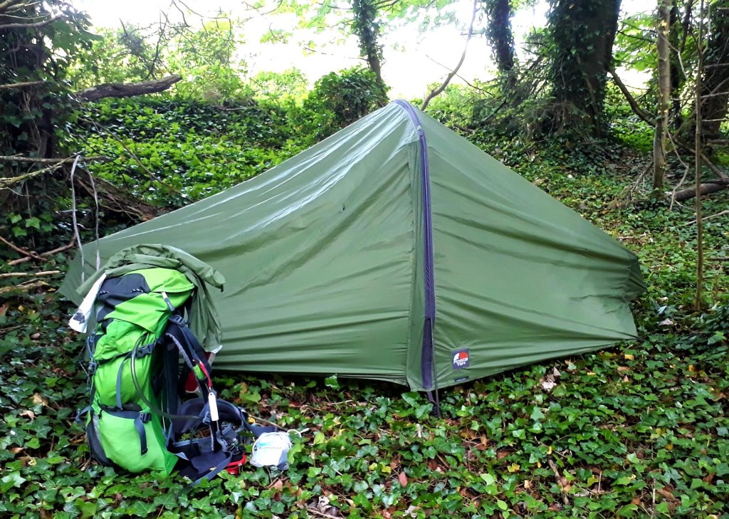
Additionally, I hadn’t walked with a tent since 2015. Now 57 years of age, I was apprehensive to say the least. With a pack now weighing nearly 12 kg, including food and water, it was going to be a tough few days until I acclimatised to the load.
Keeping phone and battery packs charged, wild camping, would also be a challenge. I had also miscalculated my stages, leaving me 14 days to walk 18 stages and reach Ivinghoe Beacon, for my connections home on 4th June
Ivinghoe Beacon or Bust was born…
May 19th 2022
Day 1: Part one – The Journey Begins…
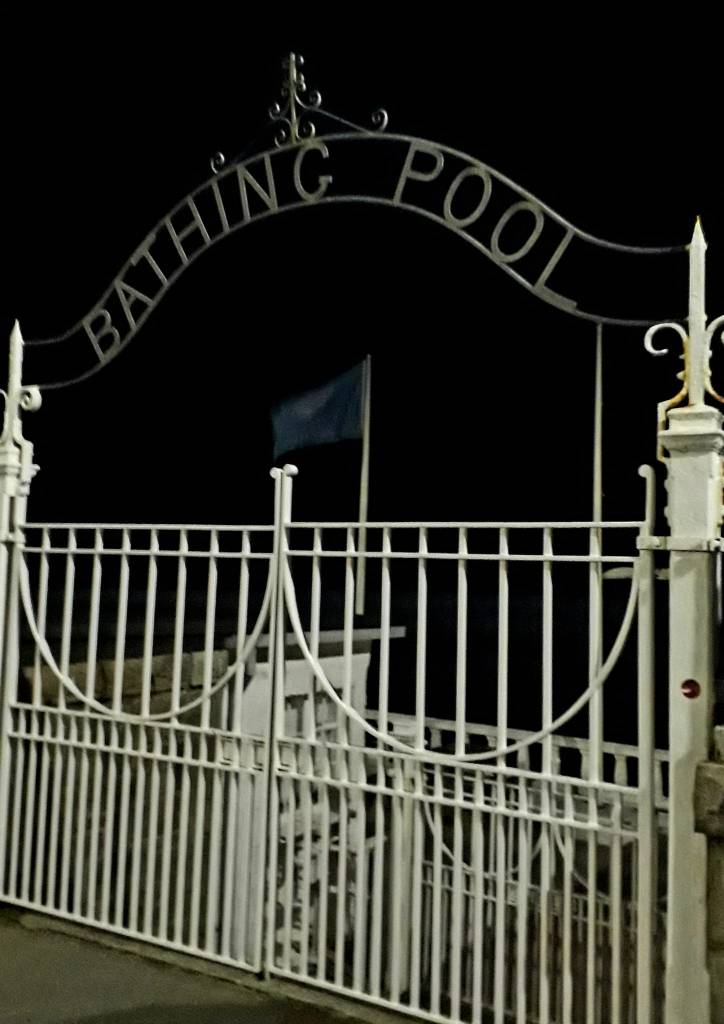
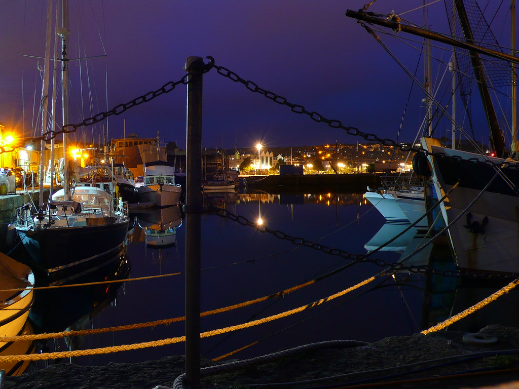
Leaving my cosy sofa at 4.30 am, I was greeted by a dry, still day. It was a quiet stroll to the bus station, passed Jubilee pool. The harbour was all lit up in the darkness, with the gentle clinking of boats on the water.
Already feeling the weight of my pack, I wondered how I was going to crack out 15 miles, later that day. I hadn’t even walked up any hills yet.
I’m always intrigued by the people who are around at this hour, a couple of joggers and a cyclist, the seagulls are awake of course and Sullivans was setting up as I reached the coach station. Cars were pulling into the station, their occupants heading off on their own long journeys.
The journey started well, the National Express to Exeter £16, then a bus to Lyme Regis £8. The best seat in the house was all mine, the one with the leg room. The driver was pleasant and chatty, as I was the only one on board. The air con was already freezing, and I was glad that I bought warm clothes.
My ‘adventure’ ahead caused much rumination of late… ‘why’ was I walking across the country with a tent? Normally I plan two hiking challenges per year. But I stay in hostels/albergue or my van, I’d never wild camped before.
Part of this decision was practical. Sadly our beautiful national trails have little in the way of affordable accommodation. Few bunk barns, hostels or campsites on route. What are we to do, if we want to walk our beautiful land?
After devouring the whole collection of Bernard Cornwells ‘The Last Kingdom’, over lock down. Fascinated by the historical reference, I had the whimsical notion to visit the places described within its pages. Stories of Wessex and Alfred’s dream of Inglaland. Utreds dogged quest to reclaim his homeland. Set across the ancient Wessex landscape and the great chalk way. What better way to experience our ancient land, but to walk its ancient paths.
Stewart Harding’s daily posts, The Long Walk to Glastonbury, also greatly inspired. They kept me sane, made me laugh, cry, and yearn for days gone by. The three lovable fools on a sacred mission… I needed to escape my humdrum lock down existence.
What was my sacred mission? my journey would be challenging. I could have chosen to sit by a pool in an exotic country. Perhaps this question like all questions will be answered on the way… Stewart Harding offered me a quote “A path is made by walking on it.” Chuang Tzu. But after two years working in isolation, attending others mental health, I now needed to attend to my own.
‘The Journey’
One day you finally knew what you had to do, and began, though the voices around you kept shouting their bad advice…
Though the whole house began to tremble and you felt the old tug at your ankles.
“Mend my life!” each voice cried.
But you didn’t stop.
You knew what you had to do, though the wind pried with its stiff fingers at the very foundations, though their melancholy was terrible.
It was already late enough, and a wild night, and the road full of fallen branches and stones.
But little by little, as you left their voices behind, the stars began to burn through the sheets of clouds, and there was a new voice which you slowly recognised as your own, that kept you company as you strode deeper and deeper into the world, determined to do the only thing you could do… determined to save the only life you could save.”
(Mary Oliver)
May 19th 2022
Day 1: Part 2 – Lyme Regis to Pilsdon Pen (Approx 14.28 miles – Wild Camping)
Finally I arrived in Lyme Regis (approx 1 pm) in glorious sunshine. The gateway to the Jurassic Coast and start of the Wessex Ridgeway. As much as I love Lyme Regis, sadly I didn’t have time to explore, I had many miles to go.
Sensible people would have started the next day, but due to miscalculating my stages, I was eager to get going. After a quick coffee and a bite to eat, I set off. Wearing my big pack for the first time in years, I staggered on Bambi legs, I hadn’t yet found my centre of gravity.
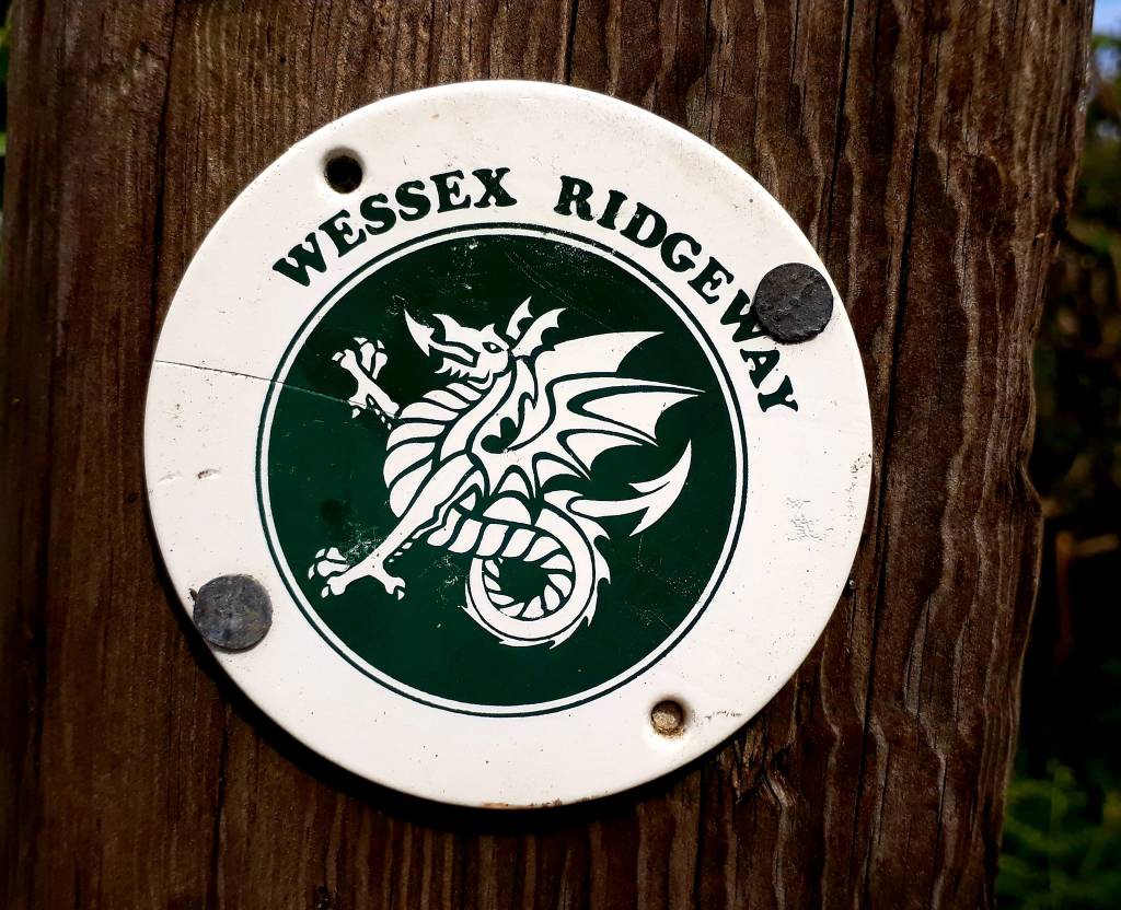
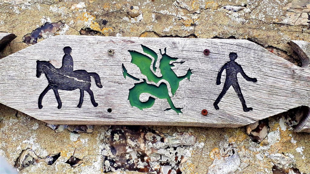
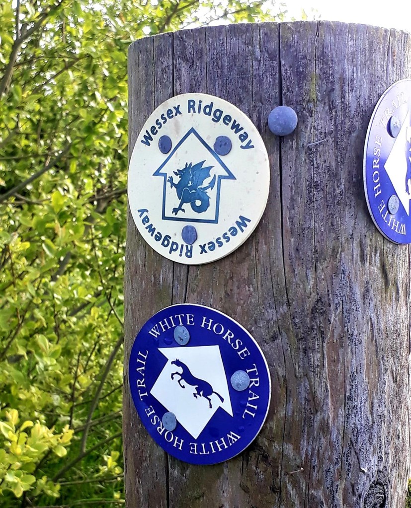
After navigating my way out of the town, I found the trail head, signed by round way markers with an image of a Wyvern. A two-legged dragon associated with the ancient kingdom of Wessex. Evidence of our ancient past can be seen all along this route
The trail is pretty well marked, but I still veered off a few times. You definitely need a map or a Garmin device. I got a bit pixie led at one point and a ‘helpful local’ walking her dog, told me the path had been rerouted… it hadn’t, and that was a 20 min diversion I didn’t need. As I left as directed, she called after me to “beware of the ticks, my husband got Lyme Disease walking through there”. Yeah alright Debbie downer…
The route was a bit tricky after this. I got a bit lost around Wooten Fitzpain. An unlikely path, through someone’s back garden, caused me to walk straight by. Backtracking, I quickly slipped over the low wall, into the garden, passed their shed, their back door, and out their garden gate… awkward…
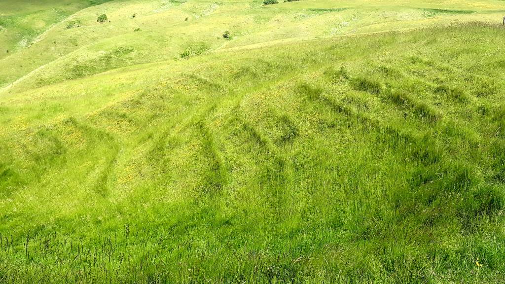
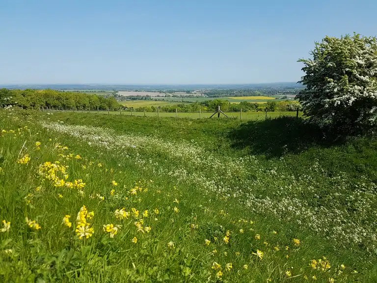
The weather was amazing, sunshine all day, but it made for hot and thirsty walking. The trail started off on pretty woodland tracks and meadows, all very civilised. Then some climbs up to Coney Castle and Lamberts Castle (Iron Age Forts). Stopping for a well deserved rest, I cooked up some Reindeer Stew for tea.
Fortified, I continued, but the weight of my pack meant progress up hills, was a snail’s pace. The landscape changed after some miles, to rolling lush green hills as far as the eyes could see. The great Kingdom of Wessex. No wonder our ancestors fought so hard for it. The Wessex Ridgeway, also shares its route with the Monarch Way and the Liberty Trail
Since leaving Lyme Regis, I hadn’t passed a single shop, pub or church. By the evening I had reached Synderford, my end stage for today, but I carried on to get ahead of myself. Curiously, Synderford had no shops, or transport links, the only accommodation on route, was Synderford Lodge, an odd end stage…
After a hot day, I was also getting low on water so I asked a local at Coles Cross for a refill. He was very obliging. It was getting late, I was tired, and I lost the trail and ended up on the road for a while. It was fine, I could move faster, but had to climb a steep bank to get back on the trail.
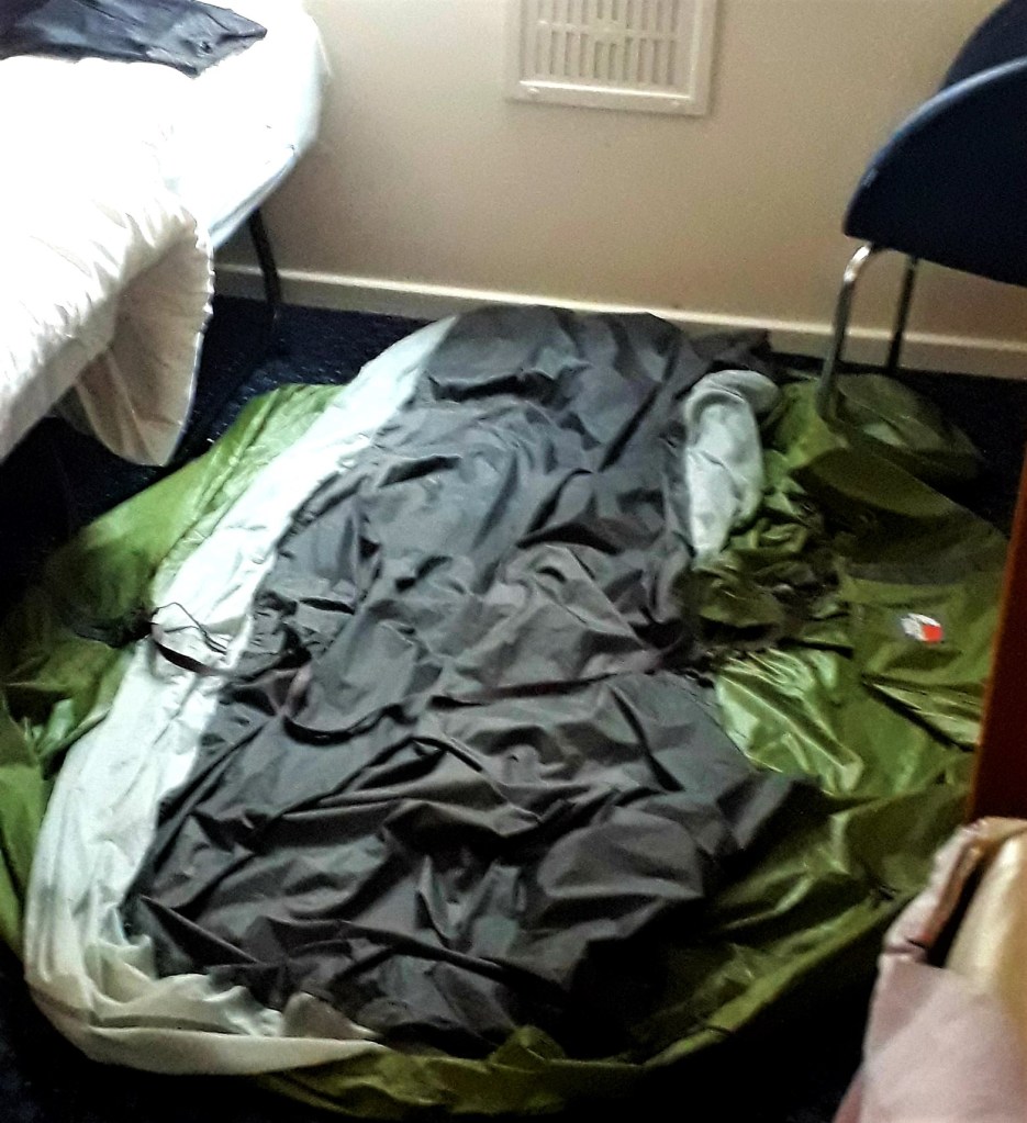
I walked till I lost the light, then found a nice flat field. Too tired to mess about with a tent in fading light, I hunkered down in my bivvy bag for my first wild camp ever. Time for some shut eye, it had been a long day, and it would be another long day tomorrow to get to a campsite
May 20th 2022
Day 2: Pilsdon Pen to Giants Head (Approx 24.49 miles – Giants Head Caravan and Camping)
What a killer – hills, hills and a few more miles than planned
The romantic notion of ‘wild’ camping is more challenging that you think. Firstly, Dorset is not the wilds, its farm land. Consider cows, sheep, the poo, hills and a discrete place to hide. Nonetheless, I survived a chilly night in the bivvy. Spooning my backpack, to keep the chill off my back. I didn’t really sleep, I was toasty one minute and chilly the next.
There’s an art to sleeping in a bivvy, which I do not possess. Snuggle in, zip up as much as you can to stay warm, without suffocating. I woke many times in the night, a chilly fog had descended, and I must have been close to a kennels, dogs barked all night long
At 3 am there was the pitter patter of rain, which became more persistent. I stuck it out till first light, then, was literally up with the larks. They, like me, could see no point lying around in wet grass. Whilst they sang cheerily above, I packed away my wet kit, (more weight) and headed for Beaminster 4.30 am
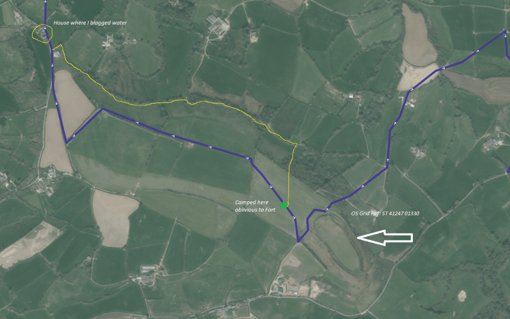
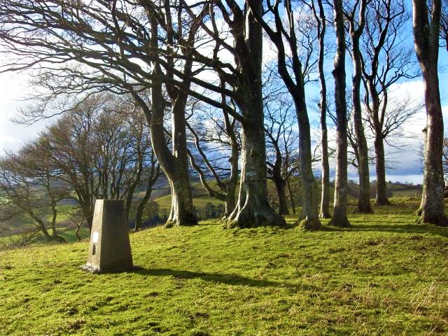
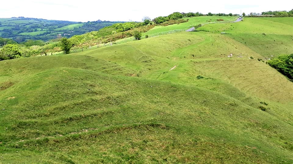
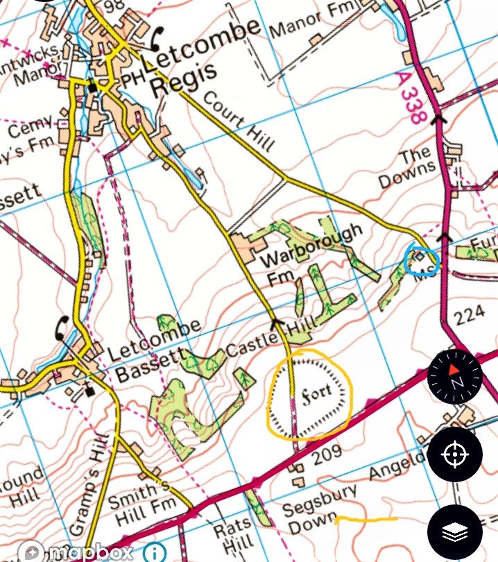
Later that day, I realised the great bank I’d scrambled up last night, was Pilsdon Pen. A 909 ft hill, 4.5 miles west of Beaminster, and Dorset’s second highest point. Also the site of a Iron Age Multivallate Durotrigian hill fort
Completely unaware, blundering about in the dusk, I was meters away. My route in Yellow, parallel to the Wessex trail in blue. The fort would have made a wonderful spot to camp, sleeping with the ancients. If only I’d known it was there – it pays to research your route thoroughly – I was kicking myself…
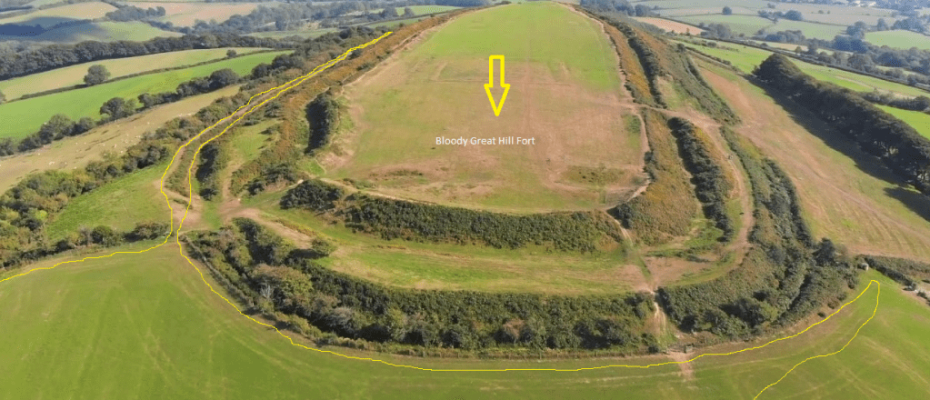
Sleep deprived and still oblivious to my surroundings, it was challenging to pick up the trail again. Whoever created the gpx map, that I followed, needlessly walked to the corner of the field. Perhaps they had been lost in the dark too, maybe they camped there…
Confused by the coordinates, I then took a wrong turn, along a well worn path, still unaware it was along the walls of a very large fort (Yellow). Realising my error, I then back tracked… I’m sure the trail Gods were much amused at this small creature, lost in the landscape, wandering back and forth, when the view from above was all so obvious…
A soggy walk, through beautiful hollow ways and ancient lanes. Sheep Wash Lane then Lewesdon Hill Lane, the site of the ‘Lost Pilot’, according to an information plaque. Lewesdon Hill at 915 feet, is the highest, quietest and most remote place in Dorset. Owned by the National Trust it is the site of another Iron Age hillfort.
Too tired to detour up the hill, I stayed on route, hunger called. But, I bagged the Trig on Gerrards Hill, before heading down into Beamister town.
Early and still raining, I sheltered in the square chatting to an equally soggy cyclist, until a cafe opened. Peeling off wet layers, I sat and enjoyed a bacon butty and a steaming hot coffee. Tired and bedraggled, I wasn’t looking forward to a long day in the rain. My spirits were low, would the rest of my journey be like this…
It was not a good start, I’m usually so lucky with the weather. But this is Wessex, land of lush, green pastures, for that you need rain… sleep deprivation was taking its toll, I considered home…
Fortified, I continued, my pack weighed heavily, I lost count of the hills, my heart pounding with every step, I stopped frequently. On one such hill, two ‘runners’ caught up with me. An abundantly cheery pair, they stopped and we chatted about the ‘joys’ of hiking and running.
It was good to rest for a while, they checked I had everything I needed, especially water. Then off they sprang, effortlessly up the hill, like two gazelles. Leaving me behind, to puff, my way to the top
The rain stopped at 10.30 am, giving way to mist and humidity, then glorious sunshine, it raised my spirits a little. Lots of mud, cow poo and soggy fields to negotiate. My feet were wet all day, a few road stretches were welcome. I could move faster without the uneven, slick surface of the tracks
The tracks were chunks of flint, commonly found in chalk, which I started to see patches of today. Water continued to be an issue. I had a 2.5 L bladder and a spare 1 L bottle, for drinking and cooking. But still had to sponge from a local again. By end of day I was down to my last mouthful. When I asked locals about shops nearby, they looked at me like I just landed from Mars.
By the afternoon a strong wind was getting up, rain was forecast again at 4 pm. So when I reached Maiden Newton around 2.30 pm, I tried to get a taxi to Sydling St Nicholas… not a chance, all booked up for school runs.
My pack now weighed a tonne, my shoulders felt bruised, but I had another 3 miles to go. On I trudged, up up and up more hills, reaching Sydling St Nicholas around 5 pm. Again I tried to get a taxi to the campsite in Cerne Abbas. They would have to come from Dorchester, costing me £30 just to travel 10 minutes up the road.
So, onward, just another 4 miles to a hot shower, the longest 4 miles of my life, strong winds threatening rain. Tired and fatigued, I took a short cut that cost me more hills. The recommended route, although longer and circuitous, runs along the top of the ridge, take that route…
Just after 7 pm, I finally arrived at camp, had a glorious shower, washed my stinking clothes, ate and fell into a deep sleep. A tough two days, but I felt better for getting to a campsite. The only one on the trail so far. I’m now ahead by a day, so I could relax, more leisurely days to come…
May 21st 2022
Day 3: Cerne Abbes, Giants Head to Belchalwell (Approx 12.44 miles – Lowbrook Camping)
I slept like the dead last night, and woke much refreshed, had a leisurely breakfast, then started to decamp. First, dry my laundry, wet clothes are heavy to carry. Also charge my phone and battery packs.
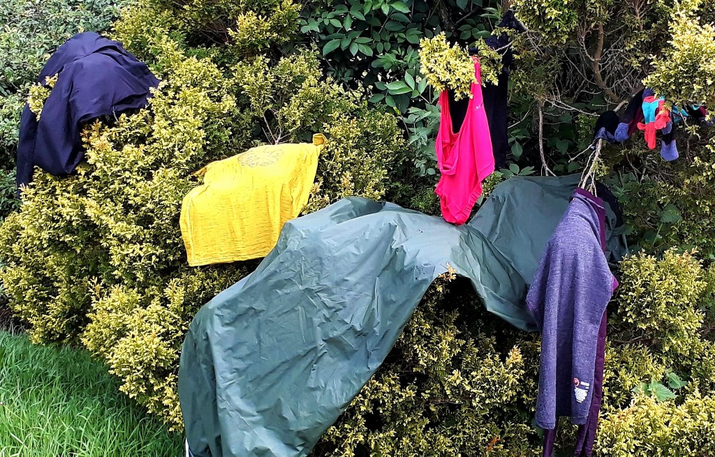
Not an electric socket to be found anywhere last night, no washing lines, and the laundry room was locked. Apparently it has the only electric socket on site. People keep using it, so the owner locks the door at night. Tight gits, but I can’t complain, she only charged me £10 for my pocket size tent.
After tumble drying my clothes, I left about 11 ish, or so I thought. I went down a hill, up a hill, around a field, and found myself back at the campsite. Only to discover the path was behind where I’d pitched my tent. The trail gods were laughing at me. I had yet to orientate myself to life outdoors…
Back on route, it was smooth walking, perfect weather and mostly good trails. Uneven flint paths caused blisters. I had to fight through overgrown paths and negotiate thick mud in places. Chalk mixed with cow poo is extra claggy.
A confrontational border collie plastered me in mud, he charged me a couple of times. The owner appeared to have little control, lovely dog though.
An abundance of lush green fields today, woodland tracks and some hills to climb. It was not as arduous as yesterday, which already felt like a distant nightmare. I felt a lot more relaxed, lost in my thoughts, and gradually began to immerse myself in nature.
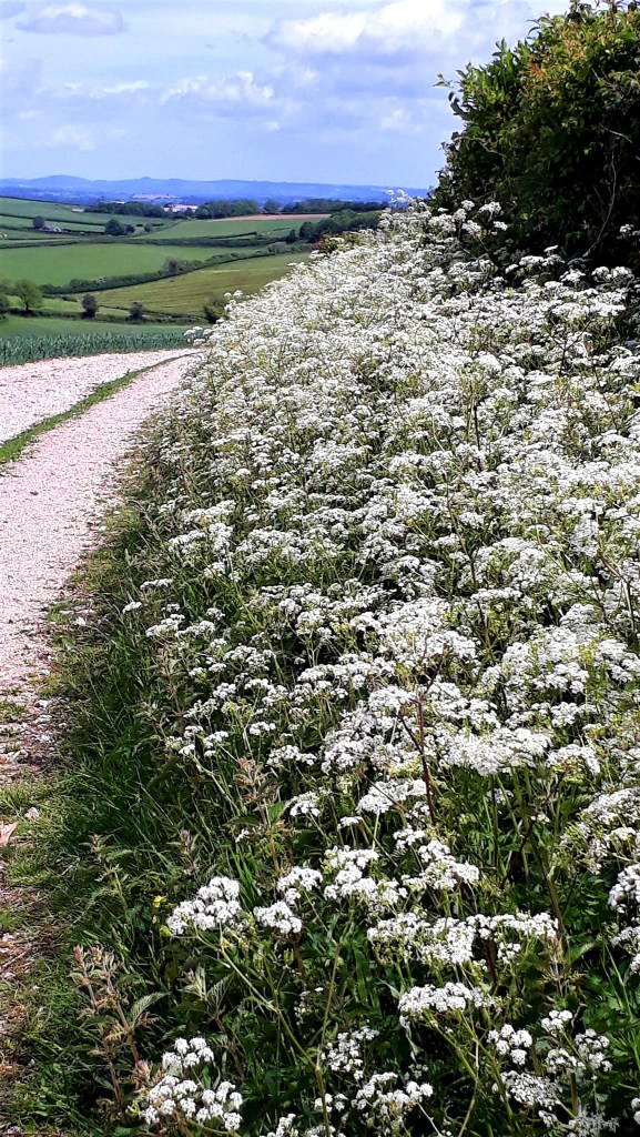
About 3 pm, I saw a sign pointing back to Dorset Gap. That completely confused me, I thought I’d gone the wrong way, as I’d arrived so quickly. But then I remembered that I’d walked additional miles yesterday.
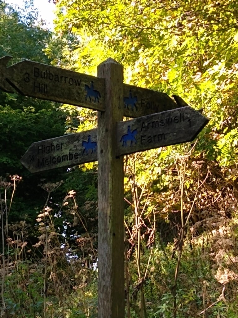
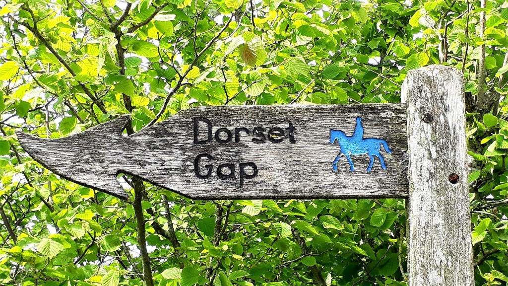
Here’s an interesting link to the history of the Dorset Gap and surrounding areas. I paused briefly at the cross roads, but as the article suggests, it has become very neglected and passers-by, like me, would not immediately be aware of its significance. Sadly I had breezed through without really noticing this once important place.
Dorset Gap, is another unlikely end stage. The path pops out at Melcombe Park Farm, the closest accommodation, is a 4 min walk to Higher Melcome Manor. At £153, I gave that a miss. Moonfleet Farm Campervans, Shepherds’ Huts & Holiday Cottages, is a 30 min walk. Camping at £22, I wondered what they might have charged for my tiny tent. There were no shops, pubs and transport links, that I could see.
The Wessex Ridgeway is little known and not often walked. I can see why, it’s so off grid it makes it very difficult, you can’t readily access food and drink unless you have transport to get to a large town. I was starting to get a little anxious, it’s the third day without access to provisions.
My game plan needed to change, instead of walking the listed stages, I needed to walk from campsites/towns with facilities. Just as I was wondering where the hell I could top up with food, water, electric etc, I bumped into a frightfully posh fellow who suggested the pub in Ibberton.
Highlights of today were Bulbarrow Hill and Rawlsbury Camp, an extensive Hill Fort, in an epic landscape of rolling hills. Here I met a fellow hiker, who used to live in Morrab Place, Penzance, small world. We chatted about hiking and breathed in the landscape together, before bidding each other farewell.
The uncertainty and scarcity of provisions, drove me on, but I wished I had wild camped here. A bit further on I found the turning to Ibberton, and walked a mile, down the steepest hill, to the pub. Hopeful, of food and a place to sleep, otherwise I would have to walk back up …
It was 5.30 pm, and the pub opened at 6 pm. I chilled in the evening sun on the tiny green, in the elegant village. But alas, no B&B, the owner wouldn’t hear of me pitching my tiny tent in the grounds. But she did direct me to a campsite at Belchalwell, 1.5 mile further, so off I went again on weary legs
As always, the last miles of the day seem further, trying to remember the directions with my fatigued brain was an effort. But eventually I arrived at Lowbrook Camping, a pig and dairy farm. What a nice place, and I was the only one there. £10, no showers, but I had access to their downstairs loo and she rigged up a lecky cable for me to charge my phone.
She directed to a spot near a lovely pond, and advised this patch would catch the early sun, great for drying the tent in the morning.
My evening was spent enjoying the tranquillity. From my tent, I could see the big climb back up to the Wessex Ridgeway. But tomorrow should be a relaxed day, I’m sorted with a campsite, at Six Penny Handley, its rather popular with us crazy hikers apparently… until tomorrow
May 22nd 2022
Day 4: Belchalwell to Sixpenny Handley (Approx 19.39 miles – Church Farm Camping)
An unsettled night, strange dreams, waking with dead arms from lying on them. A Tawny owl screeched, her call echoed across the darkness.
Morning began with a wonderful dawn chorus, a large boisterous rookery, peacocks called in the distance, seeming out of place, blackbirds, cockerels and the sound of cow’s going out to pasture.
My pitch really did get the early sun, and the dew dried off the tent quickly. I lay there, basking in its warmth, absorbing the sounds around me, pondering…
My hikes are normally planned with military precision. But two years of isolation, and falling into a mental abyss, much of my time was spent procrastinating. Planning a hike, with scarce resources, felt like an insurmountable challenge. But, the urge to break free and flee into the great unknown, just me, a tent and ‘some’ idea of where I’m going, took hold.
My impulsive side said “just do it, it will be an amazing adventure” and my other more cautious, practical side, got dragged along for the ride, ever protesting and predicting doom. Ying and yang, light and dark, negative and positive… hopefully in the middle there will be balance and compromise.
Time to get on with the day… I’d heard strange noise outside the tent earlier, something scampering about. On my way to do my ablutions, I was accosted by two large lambs, they ran right up to me and let me pet them… awe
After breaking camp, I walked the lanes to the public footpath, that lead back up to the trail. Someone from the farm drove by me in a truck, they didn’t stop to give me a lift…
It was a mile climb back up to the Wessex Way, and a physical feat I never want to experience again… ridiculously steep, the weight of my pack, and the exerts of previous days, actually reduced me to tears
It wasn’t the hill of course, or the physical effort, it was two years of bottled stress and emotions, that burst forth like a cracked damn under pressure. Despite my fractured self, I kept putting one foot in front of the other until I reached the top.
A wind sock informed me that I was on Bell Hill, at 846ft, it’s another of the highest hills in Dorset, a high point on the Wessex Ridgeway, and a designated paragliding site…
Pausing, I looked back down at the climb, the campsite now a tiny spec in the distance, I felt good. There were two fields yet to cross, through a pig farm… I hate pigs, the high pitched squeal, I was chased by a drove of them once
Safely back on the Wessex Ridgeway, it was fairly smooth walking on nice sensible trails. Through Oakford Hill, Forestry Commission, passing frightfully posh Sunday dog walkers. I bumped into collie dog guy again, at Shillingstone hill, we chatted as his collie harassed another dog and refused to come back. He still had no control of it
Wandering off trail a few times, I was angry with myself, wasted time and energy that I don’t have grrrr. Its easy to get lost in thought and not pay attention to the route, but sustained focus is tiring.
The trail went through Shillingstone, a little town with a pub, shop and the first bus stop I’ve seen since leaving Lyme Regis. There was a cacophony of noise, apparently the local steam festival, quite the shock after being in the wilds.
Then there was ‘Roast Gate’
After three days out in the wilds, it was like finding an oasis in the desert. I popped into the The Old Ox Inn, to grab a light lunch and a long cooling drink. But they refused a weary traveller a sandwich, it was Sunday roast or nothing.
Sitting outside with my refreshing beverage, the owner came outside… eating a sandwich. So, I said ooh you could have made me one… then he pushed his half eaten limp sandwich in my face. I thought he was joking at first, but then he did it again and again, aggressively. What an unpleasant encounter with a very unpleasant little man… sandwich wanker.
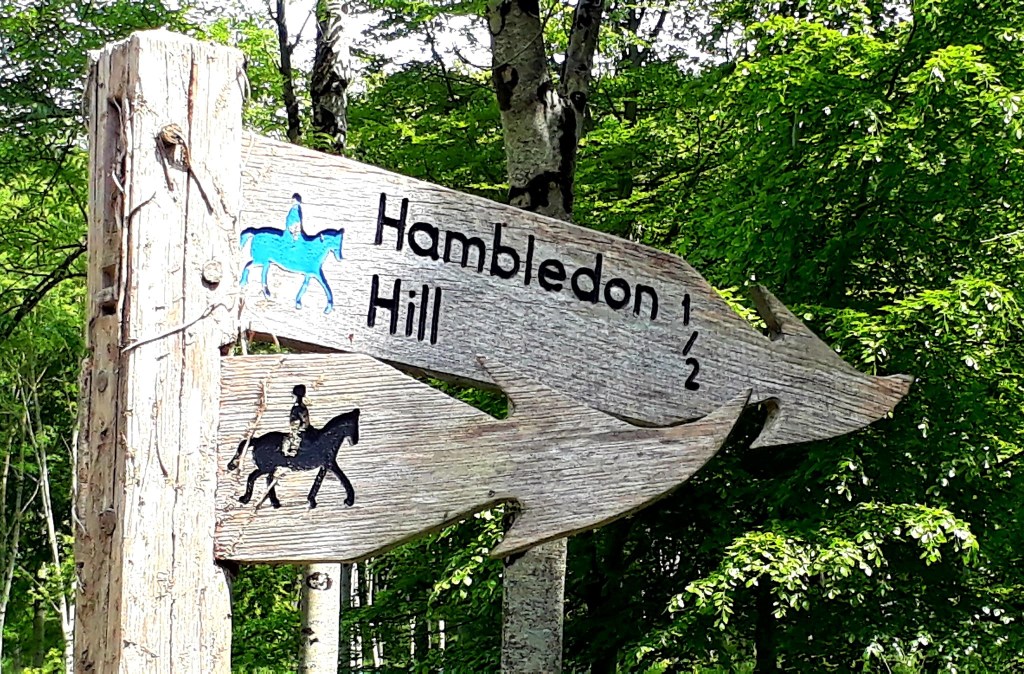
Outraged, I shared my encounter on FB, now everyone is suggesting I order a roast, which annoyed me further. Indignant, I explained Hambledon Hill, to non-hikers. You don’t eat a roast then climb a 629 ft bleddy hill. The tone of voice in my head, sounded oddly like Michael Cain. I also wouldn’t be able to ‘carry’ the said ‘Roast’ in my back pack (as someone suggested)
Readers may be pleased to know, I bought a sandwich in the local shop and enjoyed it atop Hambledon Hill.
Hambledon Hill is an Iron Age hillfort, and evidence has been found here dating from Neolithic times. Including two causewayed camps, a long barrow and numerous cross dykes.
Cranborne Chase, the last part of the walk today, was indeed of outstanding beauty. The trees and grass meadows, were the greenest green I’ve ever seen. I barely saw a soul the whole way across
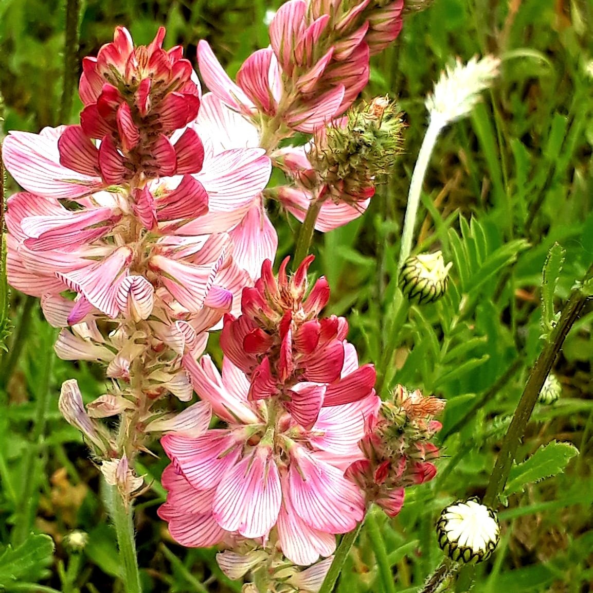
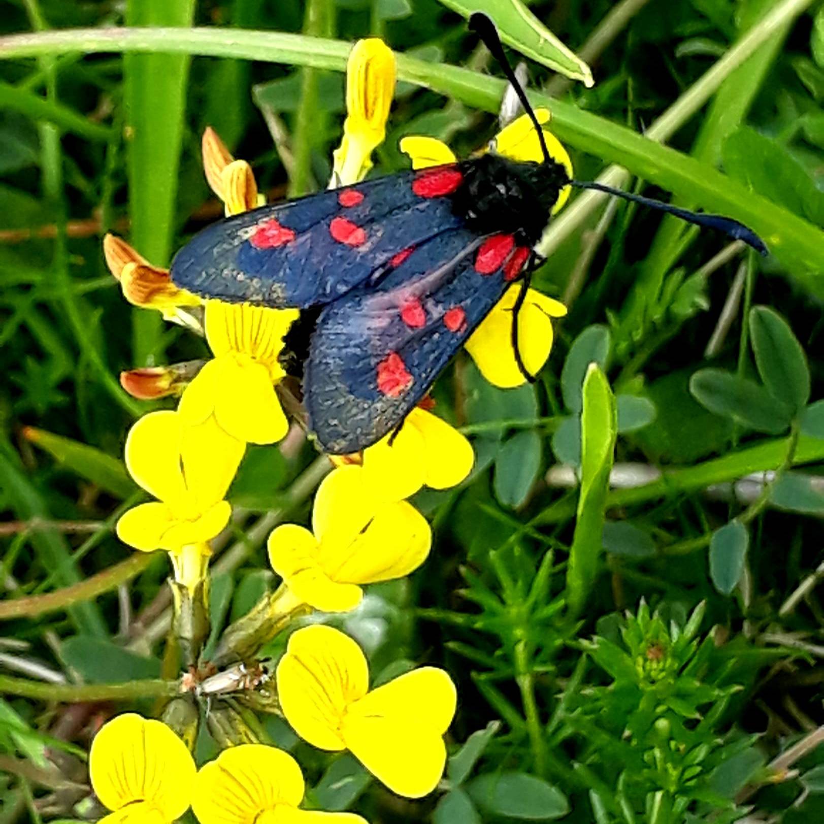
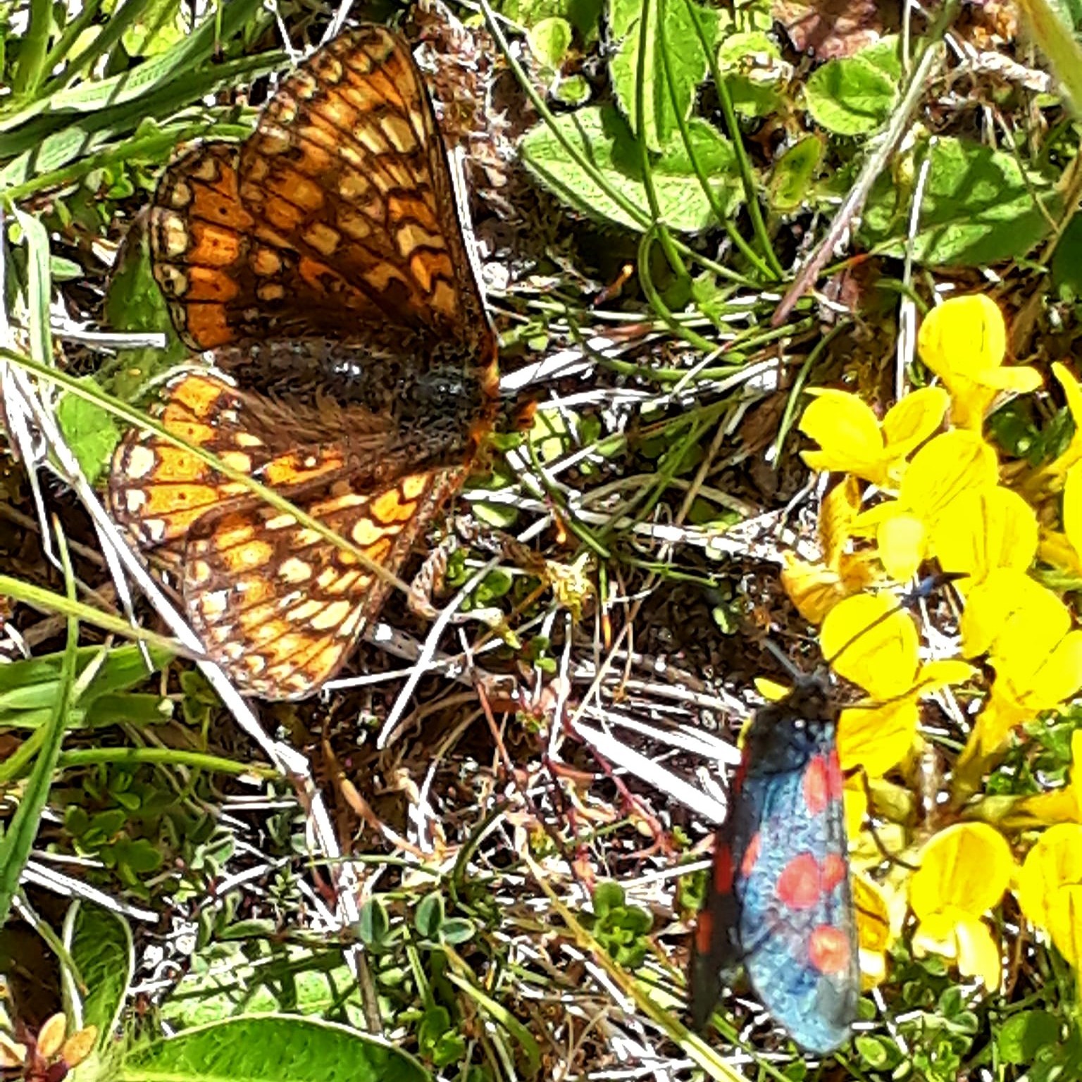
The rapping of a Woodpecker, and the honk of Ravens, echoed across the quiet woodland. The calming repeating song of Chiffchaffs, colourful Spotted Burnet Moths on pretty wild flowers and caterpillar nests galore, delighted my senses
A heavily laden hiker, walking in the direction of Lyme Regis, stopped to chat. His pack vastly outweighed mine. I wondered how he carried it mile after mile. Even with his extra provisions, he was still having issues with resources. He was planning to wild camp on the chase that night.
Slightly envious, I’d rather be camping on the chase too, but I was still low on resources, so I continued toward Tollard Royal. There was a campsite at Six Penny Handley 3.8 miles further. I would need to back track in the morning. I keep making decisions that cost my feet
It was a long climb up to the campsite, on a busy back road. Exhausted, I tried thumbing a lift, another first for me. The middle class in their extravagant cars, drove on by. I wouldn’t have picked up this grubby backpacker either.
Then a car stopped and a lovely family picked me up. Not only did they drive me the last couple of miles, they offered to pick me up in the morning and drop me back to the trail…awe thanks trail angels. Sadly they were passing through too early and I needed to find provisions before leaving. But, I had a base for the night, showers, laundry and a village shop in the morning.
After passing the halfway mark today, Lyme Regis 62 miles, I realised my Garmin etrex 25 was over estimating (82 miles). Going off trail a few times, and elevation, wouldn’t add 20 miles. I switched to the OS app, but I don’t think this accounts for elevation either
Either way, I’m officially halfway through the Wessex Ridgeway, and a day and half ahead of schedule. I may also have a couple more campsites for the next two stages. I seem to be pulling them out my ass daily, I also asked the Facebook mind hive for ideas
Washed, fed and cosy in my tent, it was now dark outside, a chorus of distant church bells and the call of Tawny owls, lulled me to sleep…
May 23rd 2022
Day 5: Six Penny Handley to Ludwell (Approx 8.54 miles – Ye Olde Whealwright Campsite)
After a fare night’s sleep, I was awoken by noisy amorous wood pigeons. It was far too early for all that flapping and cooing, I sank my head into my sleeping bag
A cooler day, with a fresh breeze, and some showers predicted. A campsite in Ludwell, my next destination, was a short distance away, so I planned a later start. It will be nice to take a break from the long miles
The early rude awakening, gave me time to dry last night’s laundry under the hand driers, and look for charging points, none again. One day I will own a back packing hostel/campsite and provide ALL the important necessities…
It wasn’t long before the campsite owner found me, a very jolly, energetic chap, who after I’d paid my dues, steered me in the direction of the village shop. He assured me it had everything, including a costa. I was down there faster than a racing ferret.
And… came back with meagre rations, but its food… the Vikings had an easier time finding food in the Kingdom of Wessex… perhaps I should try raiding…
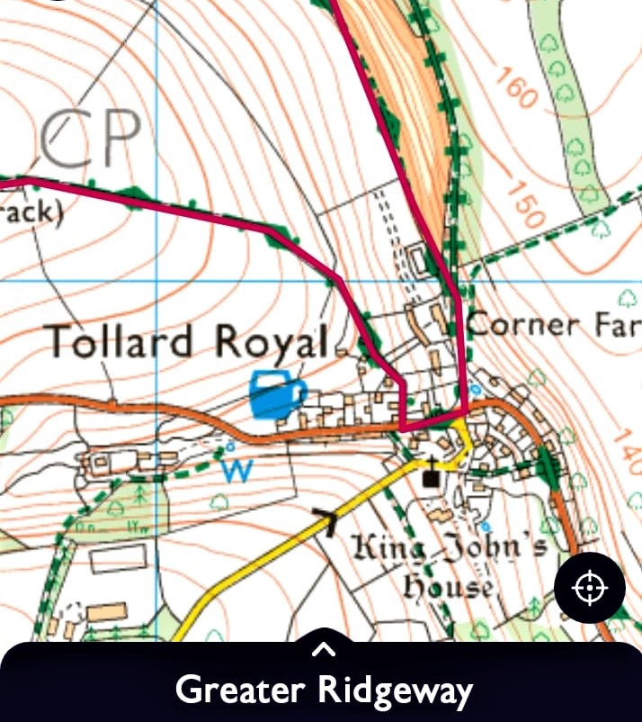
He also showed me a route off road to get back to Tollard Royal. So a leisurely enjoyable breakfast for me, with my first coffee since Beaminster.
It all started so well, my spirits high, now that I’d found some ‘food’. It took a couple of hours to walk the convoluted woodland paths (Shire Rack Woods) back to Tollard Royal.
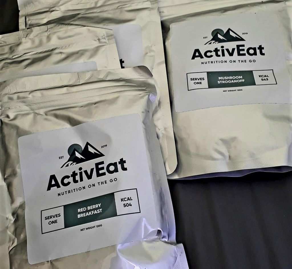
Stomach cramps, caused me to nip with urgency, into some country gents woodland estate. Sneaking furtively back onto the trail, I felt a bit rough for a few hours. I suspect the ingredients in my freeze dried expedition food, that had been my main staples so far.
Back in Tollard Royal, distracted, I took the wrong path and walked a mile and a half before I thought, fuck this looks familiar. An hours walking in the wrong direction, more wasted time and energy on an already fatigued body.
Cursing myself, I took a short cut through a hedge to make up lost time, only to get caught in brambles. Now losing my temper, I tore the cover on my tent. gahhh why do I keep making costly errors – always so unforgiving of myself.
Thankfully the tent was not damaged. I back tracked to Tollard Royal, and took the correct path. So much for an early, easy day
Once on the right path, I walked mostly green trails and woodland tracks, through country estates. Lots of deer bounding out of sight. Some heart pumping, gut sucking hills, to negotiate, but nothing like the last few days.
A rain shower half way, and wet grass, soaked the feet again. On one soggy hill I contemplated falling face down and just lying there, not caring whether I ever got up again. But that other self quietly said “come on, just one foot in front of the other, you can do it, you are nearly done today”.
Finally, I reached Ludwell 4.30pm, a sensible hour compared to previous days. The residents hereabouts are terribly well spoken. Covered in mud, and looking like a vagrant, I headed for the village shop and post office, I felt apologetic…
Posting the bivvy bag home, to lightened my load a minuscule amount, it made room for ‘artisan’ pitta bread and cheese. Emergency food, at least I won’t starve. But, in this hot, damp weather, the cheese would likely add a whole new level of flavour, alongside my odorous wet feet
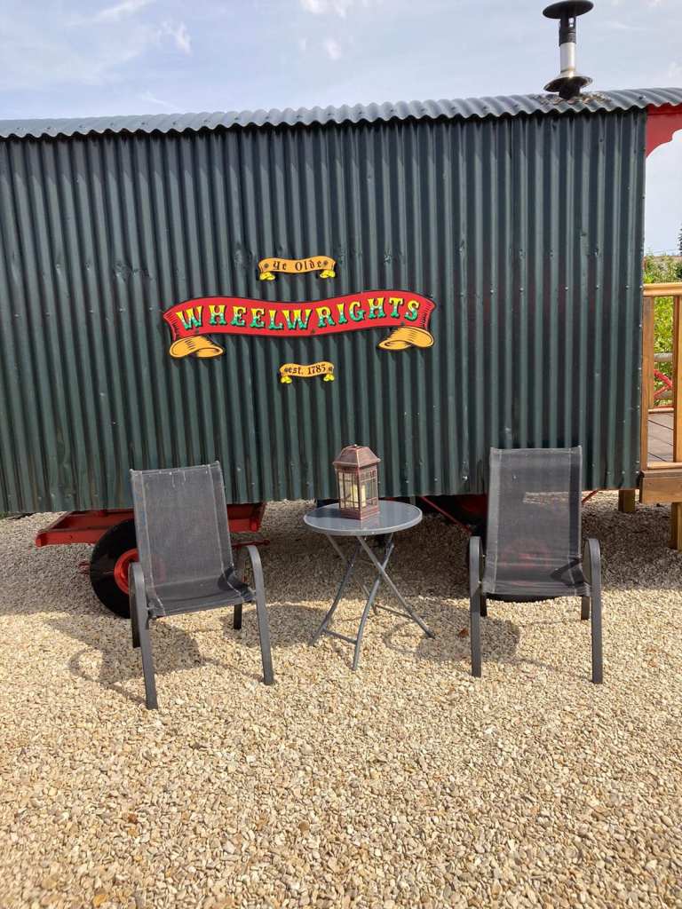
Ye Olde Whealwright Campsite was my stop for the night. The owner went above and beyond to help this soggy trail urchin. She let me stay in her rather lovely Shepherds Hut out of the rain, and I was super grateful – perhaps the mood of the trail gods has shifted?
After a lovely hot shower, I headed to the Grove Arms, a 10 min walk, for my first proper meal since leaving Cornwall. Chatting at the bar, a lady said she had just returned from Newquay Cornwall.
After living off rations, and the rigors of the trail, my stomach wasn’t quite ready for the delicious sausage and mash. I ate slowly, felt full and a bit ill.
Fortified, I wandered back to camp in the drizzle and snuggled down on a proper bed and listened to the weather outside. Tomorrows forecast was dire, and I hoped the bad weather came early, but at least I would set off dry.
May 24th 2022
Day 6: Ludwell to Hindon (Approx 11.3 miles, Marthas Down ‘Wild’ Camping – £22!!)
Being with other humans in the pub last night, and eating a proper hot meal, was lovely. I realised on my walk back to my lovely bed, that I was on the A30… constant reminders of Cornwall, again I thought of home…
Currently I’m sat in another pub, the Lamb at Hinden, abusing their electric, and Wi-Fi to write this blog. It’s hugely surreal, the landed gentry having lunch, with the Red Hot Chili Peppers, Californication, playing in the background.
What a fabulous day, today and the first that I could honestly say I enjoyed. I woke feeling anxious 5 am, in anticipation of foul weather all day. Popping out for a quick pee, it was dry, but the wind howled and the sky looked malevolent. My bed for the night was like a warm little nest, that I was reluctant to leave
My reflection in the mirror, was an absolute fright, puffy eyes, and I’d broken out with a cold sore. Typical, on a Long Distance Walk, due to physical stressors, and burning through body fat quickly. But it’s usually a turning point in my fitness, feeling horrendous the first week, then I start to get fitter and stronger… we shall see.
I’m also asking a lock down body to do something my fit body would find challenging. It’s incredible that I’m doing this day after day, when I couldn’t drag my butt out of bed at home, to do a workout. Interestingly, I’ve had very little foot and hip pain, which I would have expected.
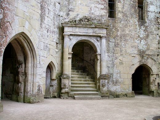
My hiking shoes were still wet from yesterday, dog poo (for rubbish) made great shoe liners. The weather was lovely, chilly first thing, but sunny by the time I reached Old Wardour Castle. One of my favourite places, and perfect timing for a rest and a snack in the sun. Finally I felt more like a hiker than an endurance athlete/survivalist.
The temperature plummeted around midday and the skies darkened, threatening rain. A few spots of rain, but it blew over, perfect hiking weather all day. Feeling quite optimistic now, at this stage, I should be approaching many of the exciting landmarks that the ‘Ridgeway’ is associated with.
The walking was easier, gentle undulating paths, through Wardour Estate, wild flower meadows, woodland and rural tracks. I saw few people all day.
Sign posts are now scarce, it was a challenge to spot the tiny trail makers, and they don’t always point in an accurate direction. Navigation and focus was essential, without a walking buddy, and that extra pair of eyes, it’s hard to relax and enjoy the hike.
Sometimes the paths are overgrown and hidden. My Garmin came in handy for checking the route. But I had no navigation errors all day, I think some good food and proper sleep, reset my fatigued brain.
Arriving super early, just after 2pm, in the small village of Hendon. I pooped into The Lamb, for a swifty, before a short walk to Marthas Down ‘Wild Camping’, my destination for today. It sounded so exotic, in reality, it was an empty field with a mobile toilet block (£22). I was the only one there, hilarious and so ironic I could have ‘really’ wild camped for free.
As luck would have it, the trail continued right next to the campsite. It felt like the planets were finally aligning, the trail gods on my side… for today at least… and I’m slowly transitioning from desk bound human to hiker. I’m all out of campsites now until Sparsholt Firs.
I need to get ahead by another day if I hope to get to Ivinghoe Beacon on the 3rd June. It can be done if I average 13 miles p/day, taking into account places to pitch up. Fingers crossed for good weather. I’m aiming for Warminster tomorrow and I should hit Devizes by Friday
After pitching my tiny tent in the rather large empty field, I showered, then spent the evening back in the pub and dined on Cornish Mussels with a pint of Proper Job, home from home
May 25th 2022
Day 7: Hinden to Warminster (approx 13.41 miles – Awful Emergency Travelodge)
After a sumptuous ‘Cornish’ meal, I headed back to camp and hunkered down for the night. Sleep was fitful and restless, I woke in the night to a clear sky, full of the brightest stars. I sat and gazed at them in awe, until I was too cold.
Waking with the dawn chorus, sky larks singing their hearts out. My eyes were swollen again, why is that? 6.25 am and started to rain. The forecast was poor, I recalled that first morning, lying in a bivvy in the rain, how grim it was
Breakfast was tricky, I’d left my spoon at the Old Wheelwright Campsite. But with more frequent shops, and pubs, I won’t have to lug so many provisions. The weather held out whilst I packed the tent, but it was still wet with dew. Its extra weight, and my pack although emptying daily, still felt heavy.
To get my monies worth, I had a long hot shower. Packed my kit in the dry, warmth of the toilet block. There was a heater, I could have slept in there last night if needed… always a first for everything
A Red Kite whirling above the campsite, a good omen. Wiltshire is the land of the Kites, and I had sightings all day. Under grey skies (8.30am) I headed out into the wind, poncho flapping in the wind like a caped crusader
The trail skirted field edges first thing, wet grass, and slick uneven surfaces, twisted my feet. Some paths were overgrown, and easily missed as a field entrance. Some signs were wonky, making navigation essential.
Forestry tracks across, ‘The Great Ridge Wood‘, gave shelter from the drizzle and better paths for walking. I could switch off for a while and enjoy nature, but not for too long, just in case. Also known as Chicklade Wood, it’s one of the largest woodlands in southern Wiltshire
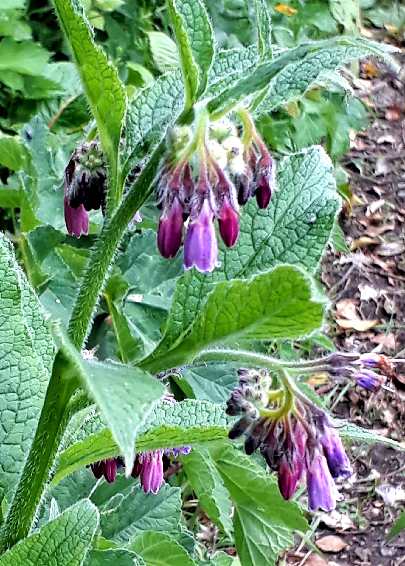
Skylarks were my constant companions all day, well my only companions mostly. I walked through the village of Corton, no facilities there. Then continued to Heytesbury, along pretty river trails lined with comfrey. The Angel Inn was a welcome stop and just in time for lunch.
An opportunity to dry out and recharged phones. The staff were welcoming and chatty. I was back on the trail 2 pm and promptly caught in a squall. Thankfully it didn’t last long and was gone by the time I wandered past the historic Heytesbury Blind House, or lock up. It has a fascinating history.
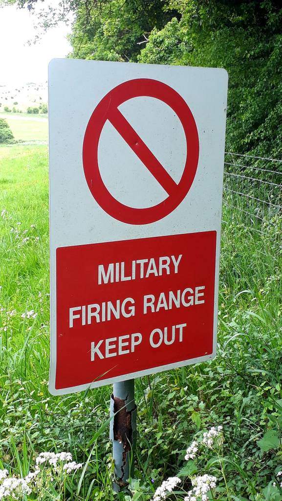
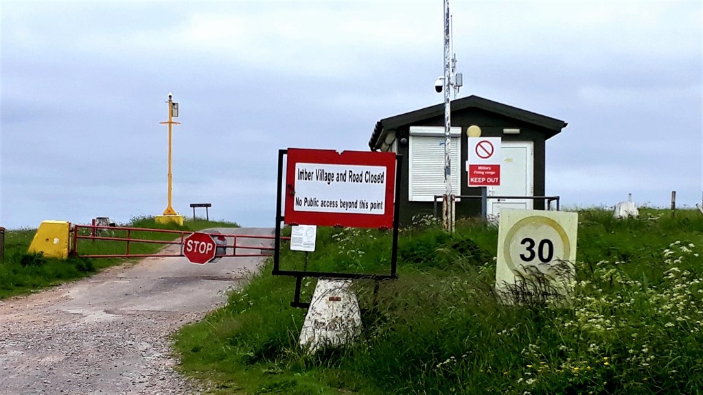
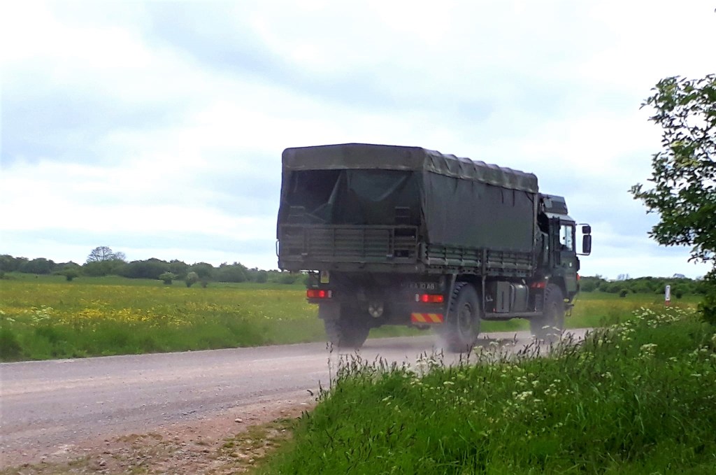
Next, some excellent walking through the notorious Imber ranges. After reading so much about it, I’d was really looking forward to this stage. The military presence was instant, lads on their runs, a huge aircraft flew right at me. A camo clad officer suddenly appeared, dressed in brown in a green environment. A tense encounter, was I off trail? He looked at me, I looked at him, and we went in different directions.
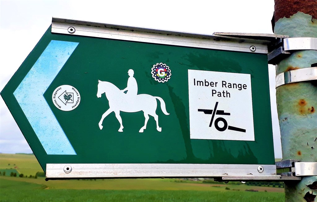
The Imber range is situated across Battlesbury Hill Fort, an archaeological feature, with ancient grassland, and diverse fauna and flora. An abundance of insects, wild flowers, Cinnabar Moths, beautiful. But such a paradox, gun fire in the distance, which I was walking closer toward, with every minute.
The trail skirts the Iron age earth walls and ditch, at the eastern edge of Battlesbury Hillfort. You can clearly see the strip lynchets on the left side, thought to be remains of medieval agriculture, and apparently some of the finest examples in the county.
The trail ended today, at aptly named Warminster, but with a more interesting meaning – The name is of Saxon origin – WAR meaning a fortress and MINSTER meaning a church or monastery
The range continues for some miles across Scratchbury Hills toward Bratton Camp, my route tomorrow. I didn’t want to risk being shot, arrested or both, for wild camping, so I’m now in the local Travelodge, abusing the rudimentary but expensive facilities (£75.99) no soap, the shower doesn’t work, no restaurant, just a burger king… extra for wi-fi and breakfast in a box
But as luck would have it, the trail gods have provided a handy public footpath back to the trail tomorrow.
May 26th 2022
Day 8: Warminster to West Lavington (Approx 15.3 miles – Wild Camping – Woods)
And… I’m officially halfway to Ivinghoe Beacon, it’s all downhill now…
The heating dried my laundry and tent last night, but it was a hot, stuffy night with disturbed sleep.
Forgoing the meagre offering that was meant to be breakfast, I left Warminster, in a grumpy mood, I know not why. Perhaps being in civilisation again, the news had not improved. Being exposed for one night made my spirits sink. Or was I still digesting that burger and chips the only food available last night.
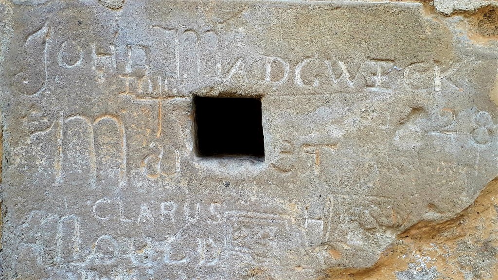
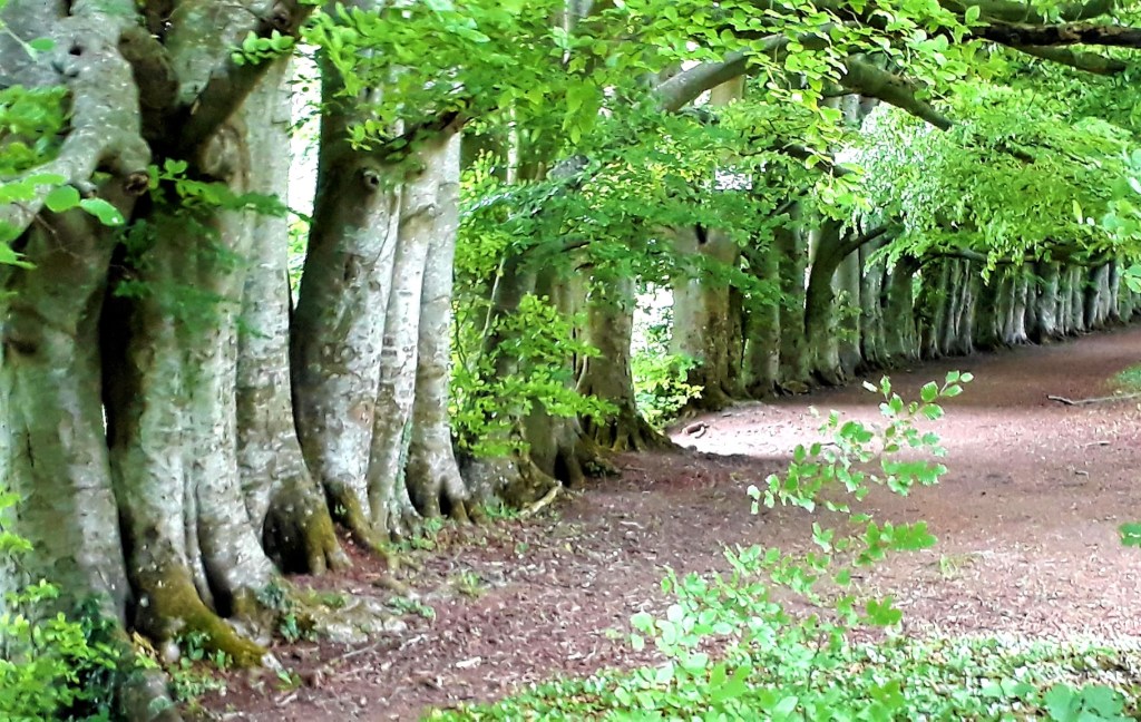
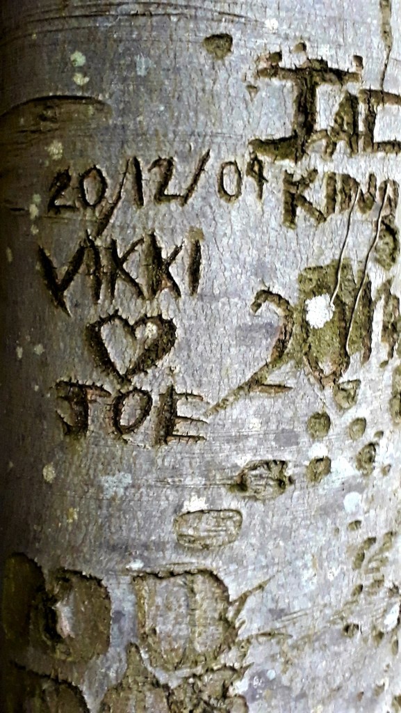
The Mid Wilts Way took me back to the Wessex Ridgeway and I was soon back among woodland trails. An enchanting row of Birch trees, were scarred with names, cut into the trunks long ago. I wondered how old they were.
Walking through remarkable landscapes with infinite views, I was back on the Imber Range pretty quickly. I walked its boundaries all day. The Imbar Range Perimeter Path (IRPP) is a 30 mile long distance walk.
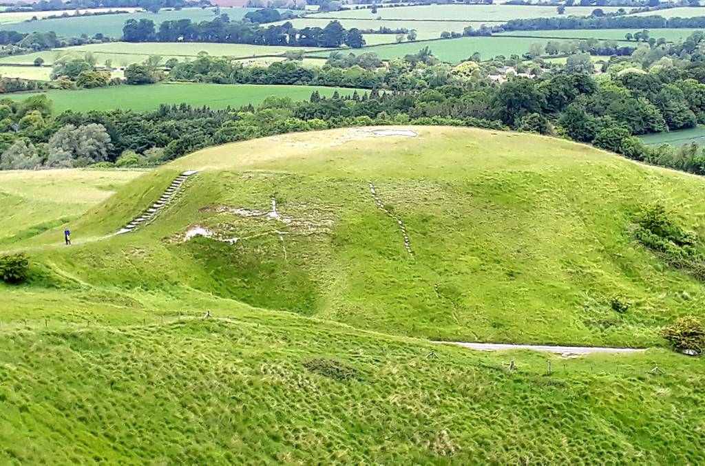
On route to Bratton Camp, I had a momentary fox encounter, and walked and chatted with a dog walker for a while. By midmorning I was at Bratton Camp and Westbury White Horse. It was the perfect place to pause, explore and soak in the atmosphere. I was excited to be there after reading so much about the place over lock down.
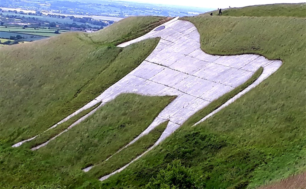
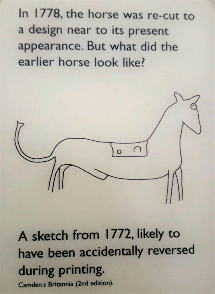
Local records from 1742 suggest that the horse was originally cut in the late 17th century, probably to commemorate the supposed Battle of Ethandun, (King Alfred defeated Guthrums Viking army) which was thought to have taken place at Bratton Camp in AD 878.
It’s incredible to think that an ancient battle happened on this escarpment. Most 21st century people would struggle to walk up here let alone storm the hill, with swords, shields, battle axes and mail. These lands, of such importance, that people would die for them in such a brutal way.
In many ways it’s still a battle ground, I could hear the distant sound of guns. As I walked the escarpment of Bratton Camp, I imagined the blood and bones of the ancient people that died here, that I now walked upon…
The rest of today’s stage followed the IRPP on metaled roads that went on and on and on. It was hard on the feet and hips, but little navigate was required, I could relax a little. Imber Village itself has a fascinating history and I wished I could take a sneaky peak. I saw the odd military vehicle, the passengers all waved politely.
At the sign for Imber Village, I should have turned off left along a field edge, but I was lost in thought and had to back track. I could have continued down the road, it went to the same place, but it was longer
Occasional grassy tracks and field boundaries gave some respite from the metaled surface. The weather was cloudy all day with fresh winds and the walking was easy. Just one moderate climb first thing out of Warminster.
Pausing in the middle of nowhere to eat lunch, bread and cheese, proper traveller’s food. A huge crop sprayer appeared from nowhere, the wind dispersing its noxious cocktail in my direction.
Another short stage today, I took my time, having nowhere to be in a hurry. But I still arrived on the outskirts of West Levington at 3pm. Too early to pitch up my tent, I looked around for suitable places. Somewhere out of sight, nowhere near the firing range, away from livestock, and on flat ground, preferably.
There’s also the whole lurking around until dark thing, so that you are not discovered by dog walkers, or landowners. It’s fine in hot weather, but not too good when it’s chilly or wet.
Lurking in some woods, hoping I didn’t get busted, I had my first encounter with a Lyme Tick… blur, beastly things, it was on my backpack. The tent went up earlier than I would have liked, I was being eaten alive by flies, all zipped up, I could hear them trying to get in.
Waiting for darkness, I whiled away the time, I would soon be invisible. Snuggling in the sleeping bag to stay warm, listening to the bird song; Black Bird, Swift, Chiff Chaff, Skylark, Rooks
Venturing out in the night to take a pee, I found myself wishing I hadn’t watched Predator on TV last night… My tent was so camouflaged, I couldn’t find it on the way back.
May 27th 2022
Day 9: West Lavington to Devizes (Approx 10.7 miles B&B The Castle Hotel)
The woods were just starting to come alive when I woke 4.30 am; well the Skylarks had been up for quite a while, then the black birds and rooks.
Muntjac had been on patrol all night, I could hear them trotting about, and they barked at my every move, alerting each other to my presence. It was quite unnerving and magical at the same time. As I dosed I imagined they were little fawns dancing about in the moonlight on tiny hooves
It was an uncomfortable night, sliding about on uneven ground, my back hurt, but the tent was dry, no condensation at all. The woods kept the dew off. I worried the tent might get punctured by sharp twigs, but it was fine. A good choice of pitch for a novice wild camper
*Things you learn on the trail… it’s amazing how strong your bladder is when there are ticks outside
Packing up early, I evicted a slug from my shoe, and made sure I’d not picked up any tiny hitch hikers. Breaking camp 6.30 am, just as the first rays of sun threw dapples of light through the trees.
Climbing out of West Lavington, I soon found myself back on the Imber Range, is there no escape. My company, the lively chatter of Skylarks above, Stone chats in the scrub, the occasional dog walker and military traffic. All waving as they went by, sadly I didn’t see a tank.
The same long, metalled roads as yesterday, before Urchfont hill, where there was a bit of confusion. The Wessex Way trail marker pointed straight along the ridge of the hill, taking me away from Urchfont and the Wessex Ridgeway. My gpx, indicated left down a wet grassy path, into Urchfont.
After double checking the other routes, I followed the OS route. Halfway down the hill, I bumped into the village ‘expert’, and his very nice, probably long suffering wife.
He inquired where I had come from/to, and was very interested in walking ‘The Ridgeway’ one day. He scoffed when I mentioned that the trail went through Urchfont and Devizes. “The Ridgeway has never gone through Urchfont or Devizes”. My explanation that Devizes was one of the trail stages on the Wessex Ridgeway was met with further ridicule . “I’ve lived here 20+ yrs. and its never come through here, its back up along the top” (The White Horse Trail)
He walked off, as I tried to show him the route on the map, and left his wife and I standing there… I later saw two Wessex Ridgeway signs in Urchfont. Just to give him the benefit of the doubt, I also consulted the FB Hive Mind.
Possible explanations for the direction of the arrow: the path has been diverted down the adjacent lane (Purple). It pops out at the cemetery, and would avoid the very wet path and the bullocks that chased me. But, being a white lane, I wasn’t sure of access and there was no marker at the trail head.
Or – someone just nailed the marker in the wrong direction?
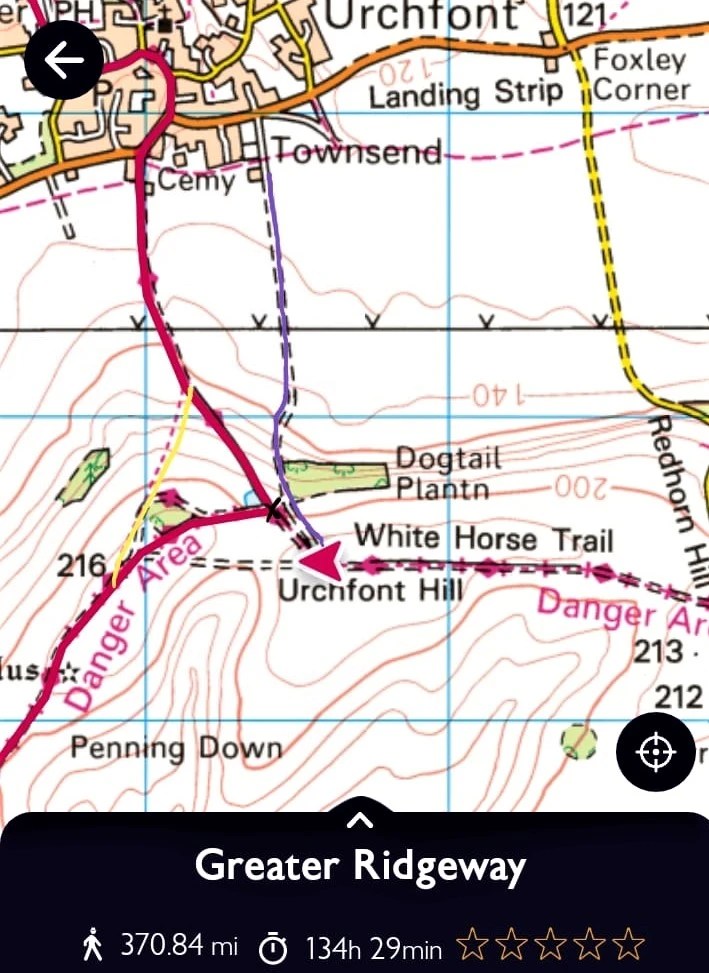
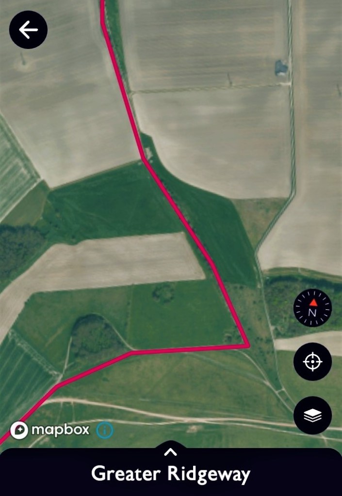
X marks the spot, where you turn left down into Urchfont along the Wessex Ridgeway Trail. There is another path (Yellow) that cuts off that corner but there is no sign of this path on the aerial map (Right)
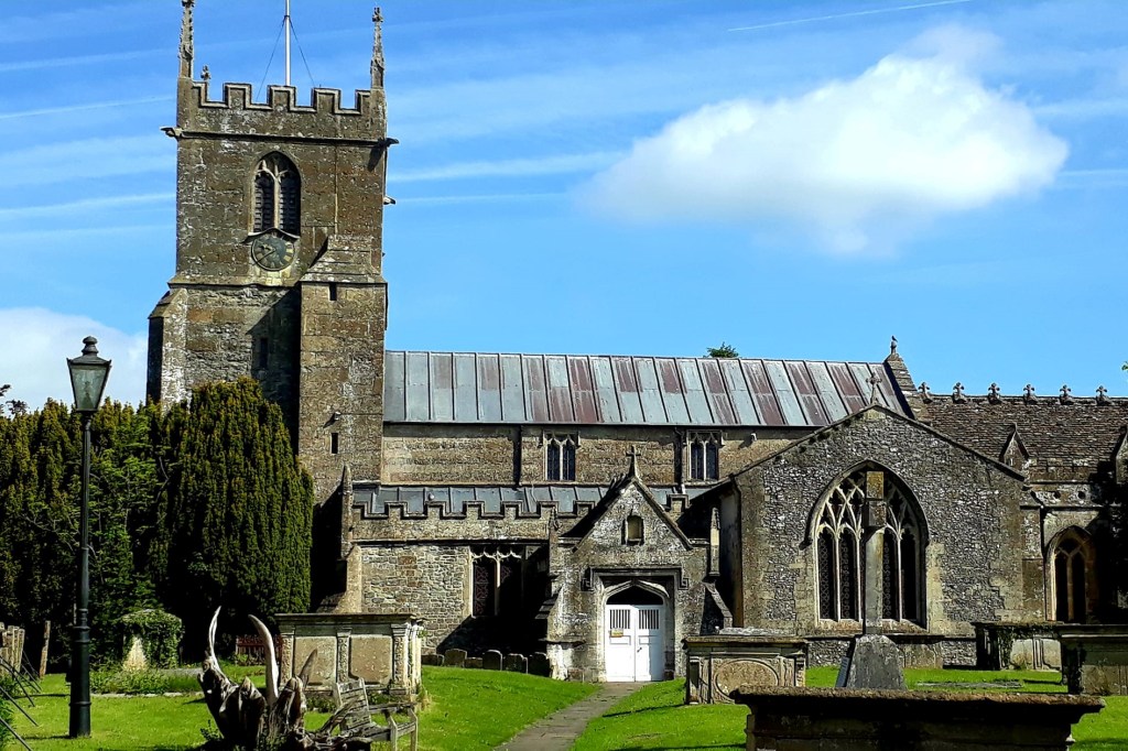
9 am and far too early for the pub, open at 11 am, I arrived in Urchfont with soggy feet. So I communed with the ducklings at the very lovely village pond and wandered around St Michael’s and All Angels Church.
Some very lovely ladies made me a coffee at the village shop, and I bought a sausage roll for breakfast and a cheeky little doughnut for later. Chatting to all the locals, as they came and went, what a nice community
After breakfast, I set off through the pretty village, thatched rooves and cottage gardens, toward Devizes, my stop for tonight. The trail today was mostly rural farmland, with huge crop fields, easy walking along peaceful paths, tracks and country lanes.
As I approached the outskirts of Devizes I watched a Kite and a Buzzard in an aerial dog fight. What a treat, the Kite was a tiny bit bigger, with beautiful colours and a distinct call, but I think they were fairly well matched
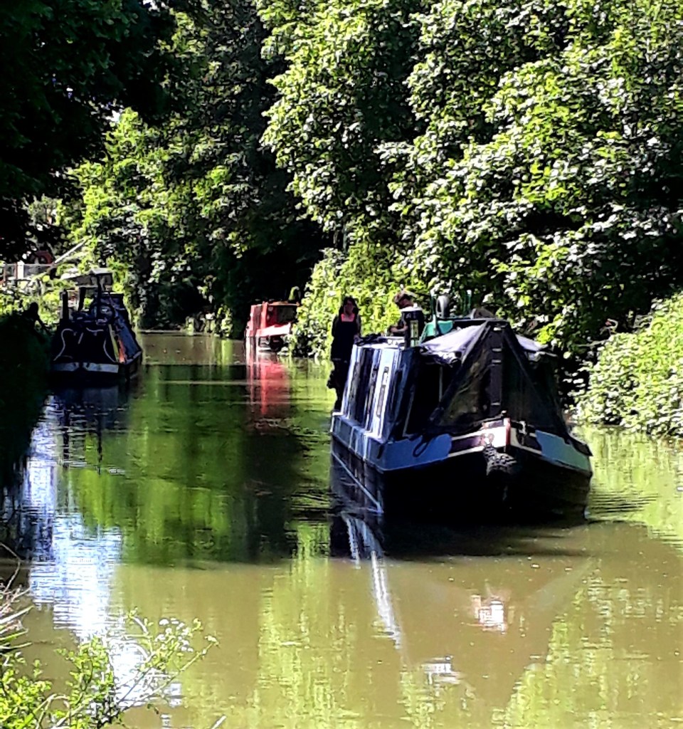
The last stretch into Devizes was along the Kennet & Avon Canal, with some beautiful riverside properties… I can dream.
Arriving too early for my B&B at The Castle Hotel, I found a much needed lunch and explored the town. I also desperately needed to buy some flip flops, my walking shoes were polluting any enclosed area.
The Castle Hotel, a pound more than the travel lodge, included breakfast, and much needed top notch smellies and lotions. Luxury and comfort before the big push to Ivinghoe beacon. I’d left my best tee shirt at the Travelodge in Warminster. Bugger, now I have one for the rest of the trip
More camping from tomorrow, possibly at campsites, but everything seems to be booked for the Jubilee weekend. There is so much to see from tomorrow. I’m headed for Avebury to catch up with my Ozzie pal Gael, the last time I was there it blew my mind. So exciting, and the weather looks promising for the coming week, fingers crossed
May 28th 2022
Day 10: Devizes to Somewhere on New Totterdown (Approx 15 miles – Wild Camping – Woods)
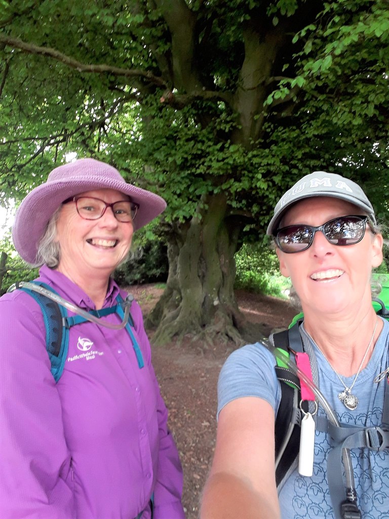
What a lovely day, I was joined by my Aussi pal Gael for this impressive stage. It was nice to have company on what’s turning out to be a lone odyssey.
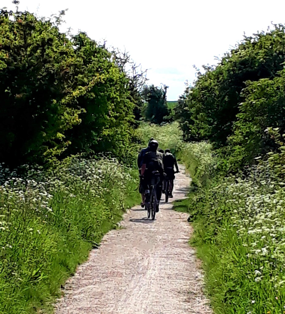
I truly believed I would meet lots of hikers on route… this is no Camino for sure. But there were lots of weekend hikers and cyclists about today, as I now progress onto more popular trails.
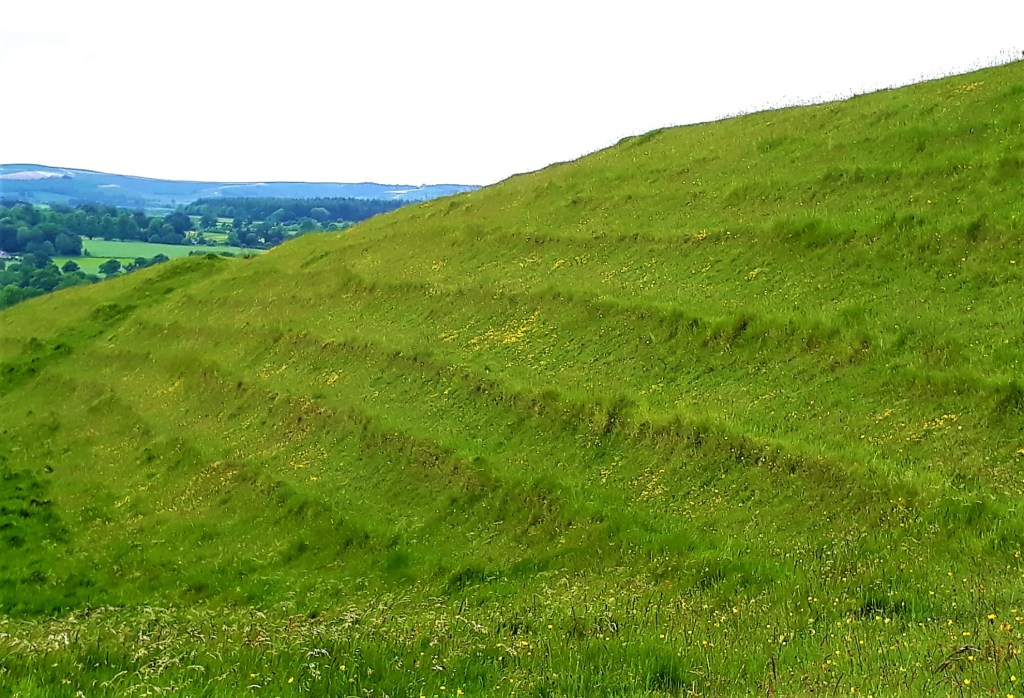
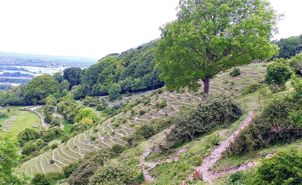
Today’s route travelled through several nature reserves, Roundaway Down and Oliver’s Castle (Fort), North Down, Calstone Down, and Cherhill Down. All with spectacular views of the Kingdom of Wessex
We took a break on top of Cherhill down, pondered the richness of this land, why it was a source of war and conflict, among other deep matters. We decided, if we were ‘invisible’ time travellers, so we wouldn’t get burned at the stake as witches, we could solve all these big historical mysteries.
The downs were beautiful and full of life, wild flowers and very obliging insects, who posed for photos. I’ve never seen so many Burnet Moths
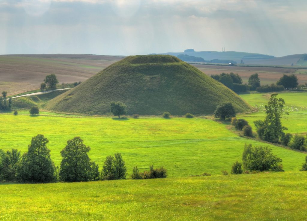
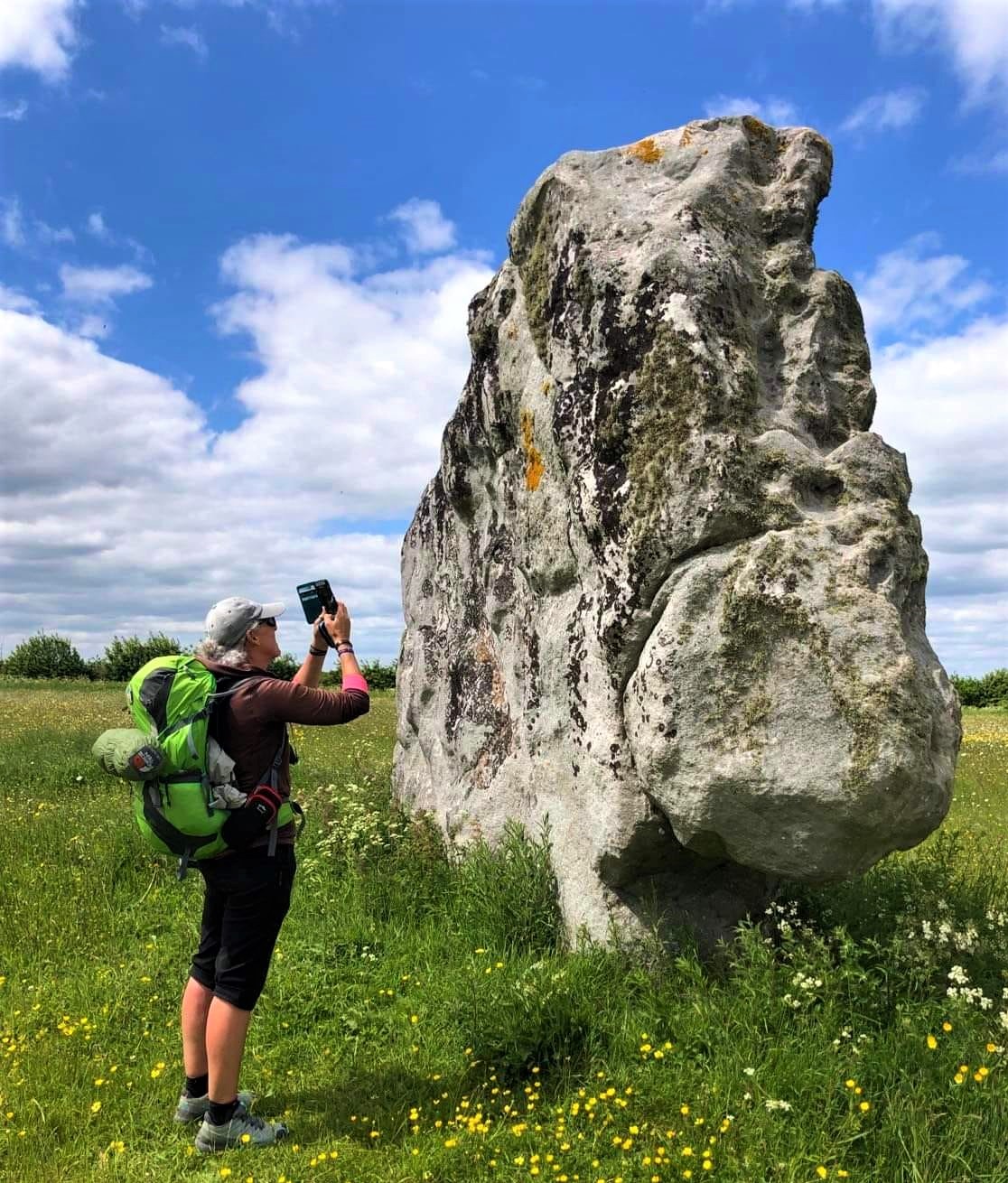
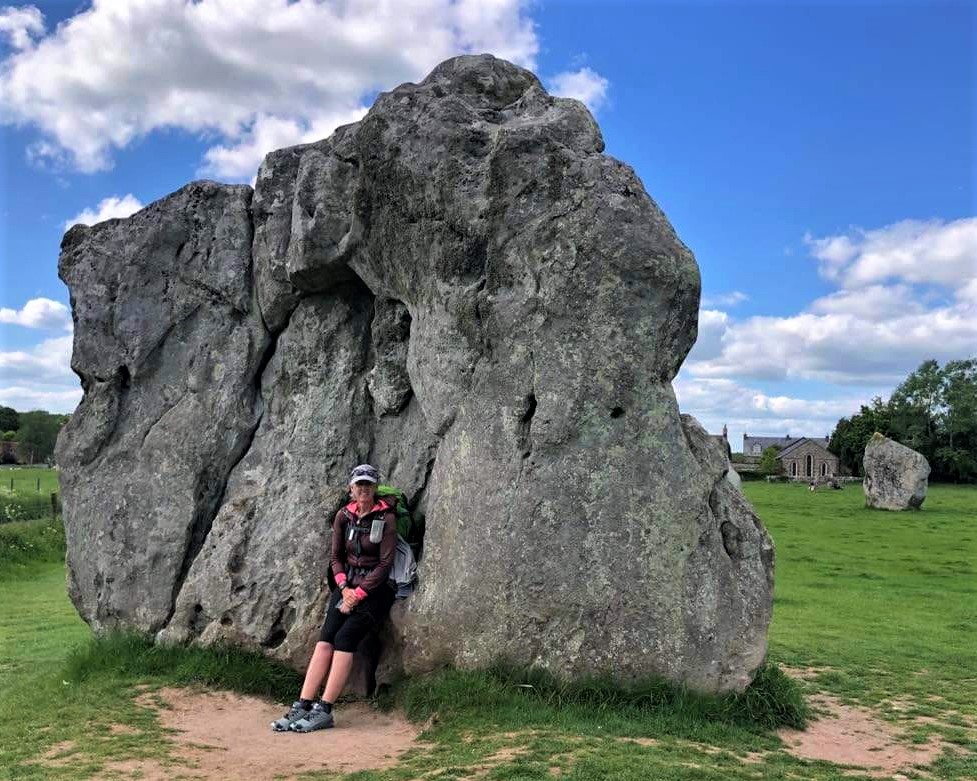
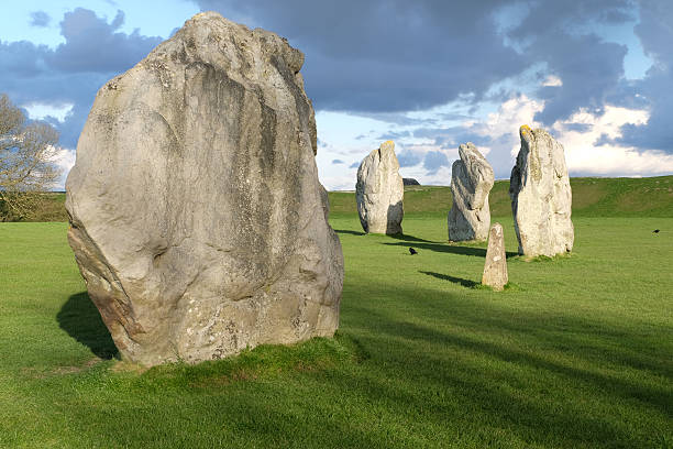
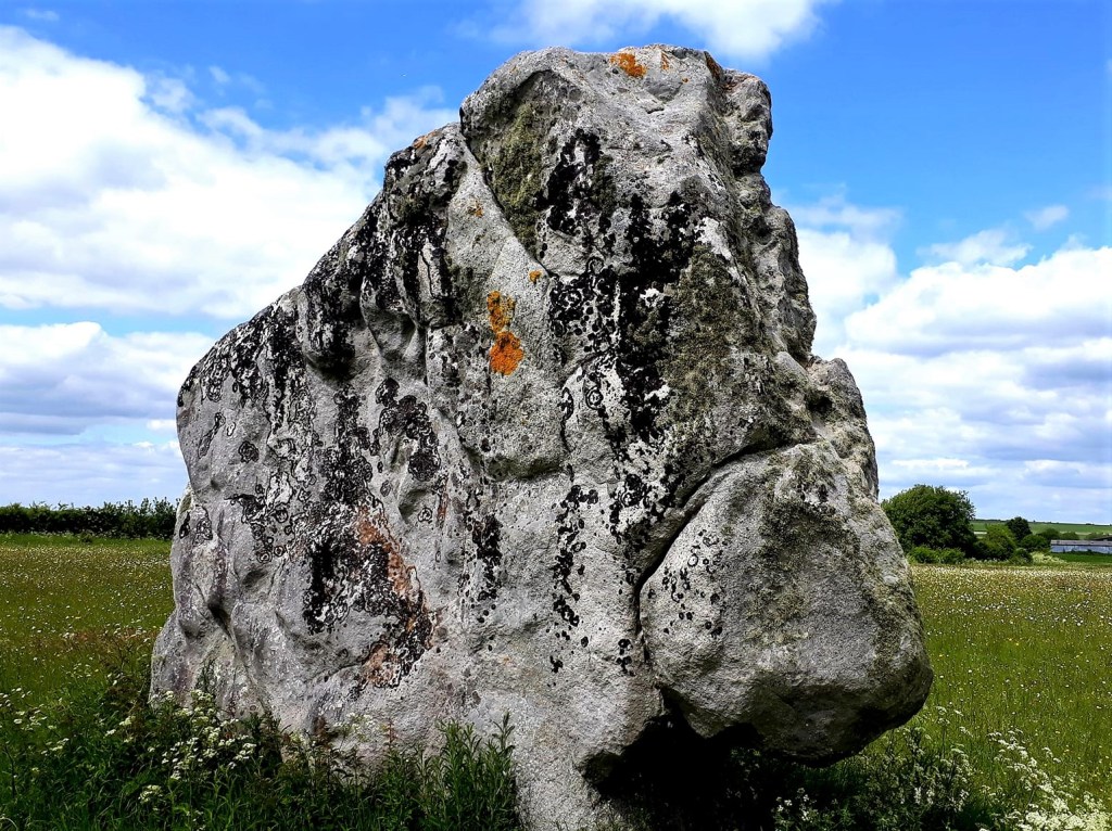
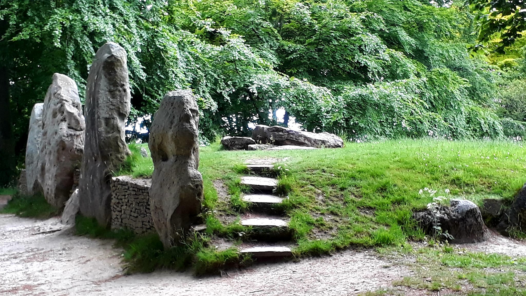
We walked by ‘the gallops’ and saw Silbury Hill in the distance, our route diverted away from it. We arrived on the outskirts of Avebury Trusloe, around 2.30 pm, and came upon the Longstones, called Adam and Eve. I’d not seen these on my last visit, they were really captivating, and once part of a long avenue, that connected to the Avebury circles.
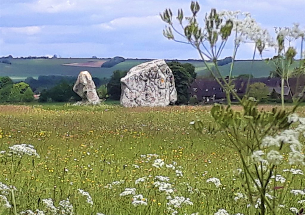
What a fab afternoon, lunching, walking and groping the stones. I’m tactile by nature and can’t experience things without touching them, and now it seems, smelling them… try it… they are kind of warm and earthy
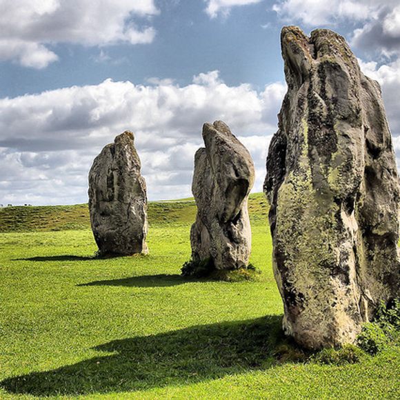
We pondered the ancestors who created this site, how, why, what for… such a peaceful place, I was quite at ease, almost giddy. Was it the energy of the place, my imagination, or it may have been the lemony ice cream I had earlier
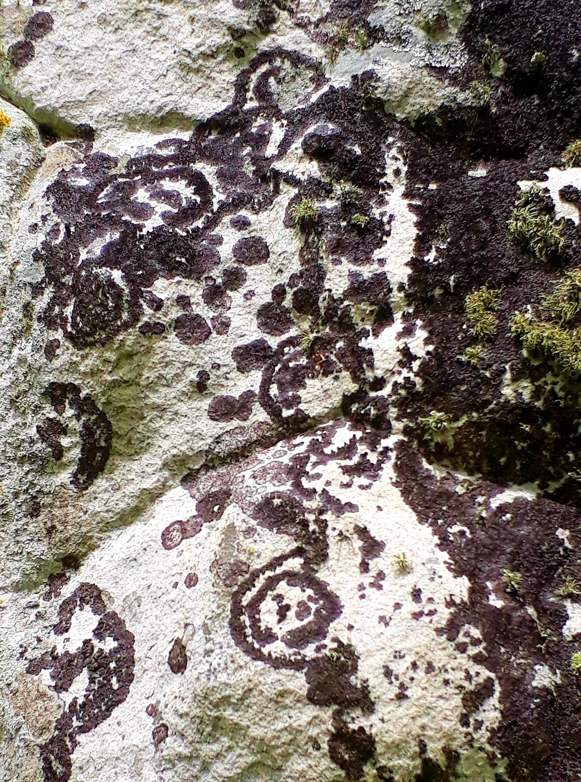
The stones are colossal and incomprehensible, some have faces…
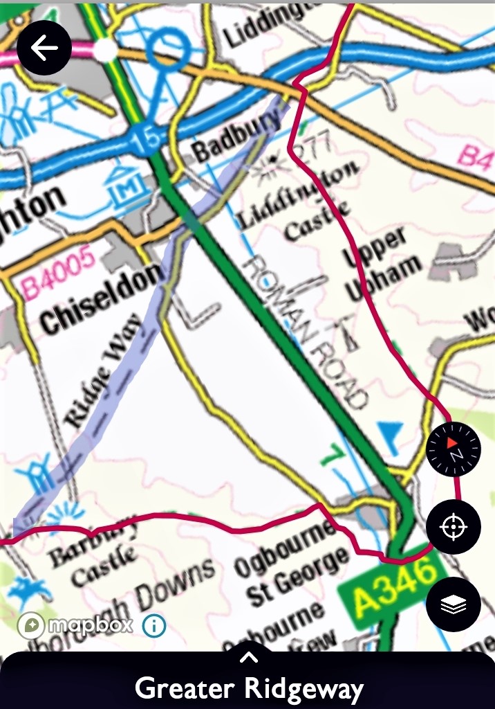
I could have stayed forever, but alas it was getting late, Gael had to catch the bus back to Devizes and I wandered off into the sunset to find a bed for the night. Crossing Avebury Down, Overton down and the Sarsen stone fields, before I realised I was heading to Marlborough…
As you can see, the path just invites you on… but I needed to be elsewhere.
The Wessex Ridgeway continues to Marlborough, and I completely forgot, that in order to continue on the ‘Greater Ridgeway,’ I needed to step off the Wessex trail and onto The ‘Ridgeway’ National Trail. The trails intersect one another on Overton Downs,
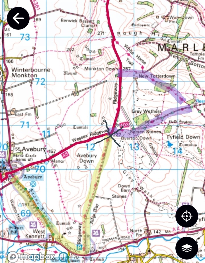
Well, that’s one option, the other is to follow the Stone Avenue out of Avebury, to Overton Hill then turn left onto the Ridgeway (Highlighted Yellow). This would have been the nicer route and I actually walked down the avenue to see the stones and then turned back… plonker.
The Wessex route, stuck firmly in my head, would have been the shorter route, had I not overshot by a mile (Highlighted Purple). My feet on automatic pilot whilst my brain was lost in thought, no doubt about the wonders of the day. Even a big stone marker on route saying RIDGEWAY, didn’t alert me to step off the Wessex trail… doh…
Smeathes Ridge was my target for tonight, but I had underestimated the distance. It was getting late, and I was weary, so I hung a left and pitched up for the night in New Totterdown Woods. I would continue back onto the Ridgeway in the morning – highlighted purple on above map
A clearing with a nice patch of grass, was my pitch for the night. A far superior spot than the other wood I camped in. It’s a nature reserve, so I really shouldn’t be there. But darkness would soon descend and my tent would disappear into the landscape. The Muntjac knew I was there, already barking at my presence. It was pleasant listening to the birds calling, then sudden alarm calls from the canopy, made me question… what is out there??
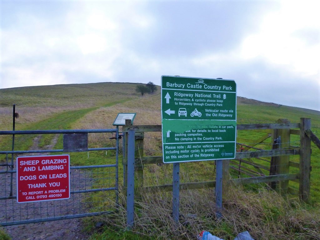
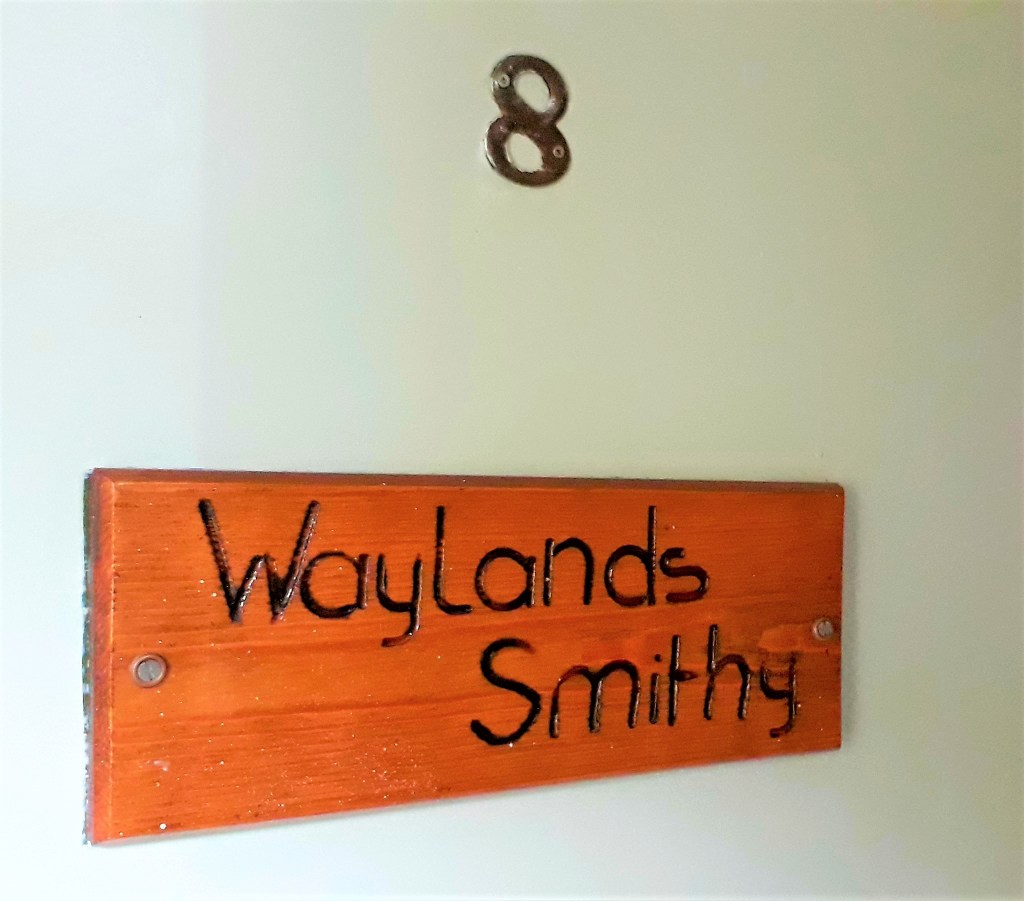
Tomorrow the route will take me up Hackpen Hill, Barbury Hill, Smeathes Ridge, Waylands Smithy, and Uffington White Horse/Castle and hopefully a campsite, but I keep being told they are full.
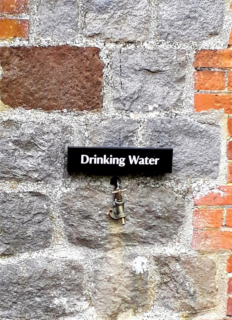
Oh I should also mention, given the water issues along the Ridgeway, there is a drinking water tap at Avebury Visitor Centre
Good night see you all on the trail
May 29th 2022
Day 11: New Totterdown to Wayland Smithy (Approx 19 miles – felt every one of them – Wild Camping – Woods)
The Kindness of Strangers!
After the ruckus died down last night, I was lulled to sleep by the call of a Tawny owl. It was the dawn chorus before I knew it, 4.30 am, it was an uncomfortable and chilly night. Sliding about on my mat, drafts seeping down my neck.
The Muntjac were quiet, until the morning, then they were barking and galloping about on tiny hooves. I lay in as late as my bladder would allow, then decamped 6.30 am, with a slightly wet tent from the cold morning dew.
20 mins later I was back on the Ridgeway, in a brief rain shower. Out came the poncho but the rain soon passed. Saw more Kites today, and enjoyed watching their aerial acrobatics, they can turn on sixpence.
The trail continued over Marlborough Downs, but I didn’t feel it had the beauty of yesterday’s stretch. Paths were well sign posted, and I barely navigated all day. They are designed for cyclists I think, mostly hard rocky tracks, and tough on the feet.
Walking up Hackpen Hill, I missed the White Horse to the left. I saw it in the distance, earlier, from the road. There is apparently a footpath down to it from the Ridgeway, I must have wandered past without seeing it. The route is also now passing more ‘Gallops’ and point to point courses.
Arriving at Barbury Castle 8 am, with superb views all around. The Ridgeway passes right through the middle of it, then across Smeathes Ridge. It was freezing cold up there, and very exposed. I was glad I didn’t camp there last night. It was cold all day, and felt more like March instead of May.
Lots of Sunday joggers, cyclists and dog walkers about today. The route was already starting to feel long, on hard chalk trails. Everything looked so much nearer yesterday when I checked the route. But when you are tired and cold, nothing is clear, I guess. I drifted through the tiny hamlet of Hallam, about five thatched cottages, all nestled close together.
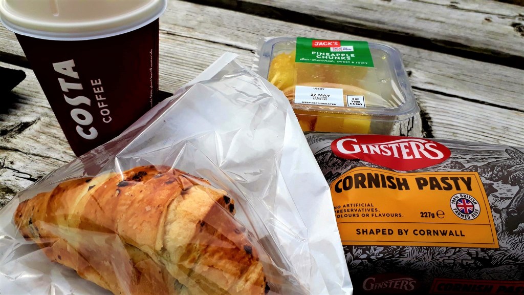
It would be another ‘dry’ day today, so I detoured down into Ogborne St George to seek out coffee and food. Listed in guides as an end stage, it was a wasted walk. The hotel advertising morning coffee, had long since closed. The nearest shop was way out of town, and the only pub opened at midday. But I managed to get some water from their outside tap. And a nice cyclist gave me her huge banana
In hindsight, unless you have accommodation there, you don’t need to divert to Ogborne St George. Keep straight on, along the ‘Old Ridgeway’ (Purple, Script below) it will save you some miles and still leads to Liddington Castle.
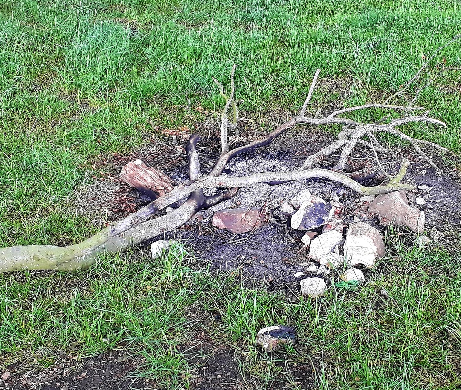
Back up on the ridge, there was a handy bench for a break. It had fantastic views across Marlborough downs, but was too cold to stop for long. Someone had camped up there, a campfire was behind the bench among the beech trees.
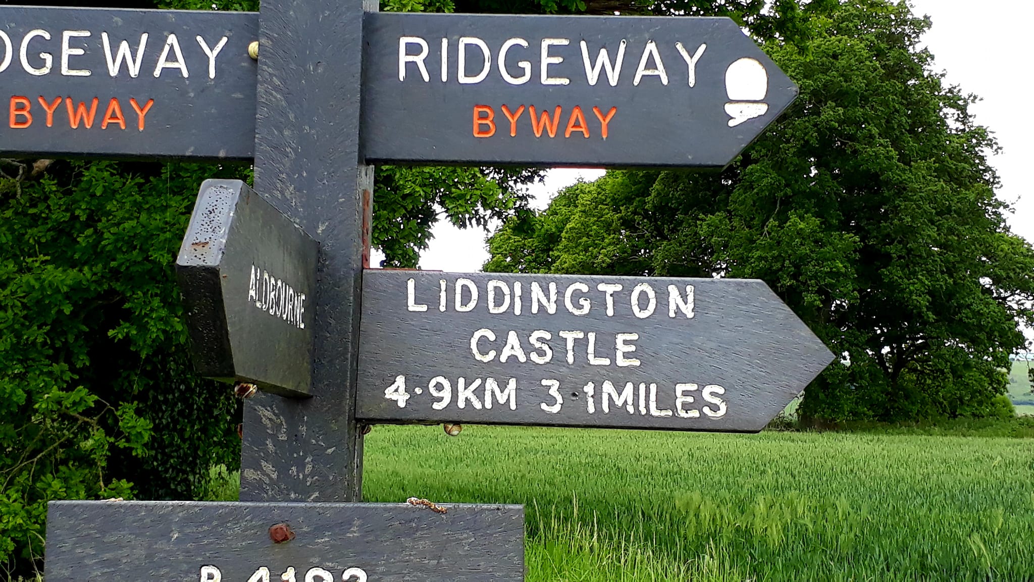
It was a long long stretch to Liddington Castle, the highest point on the Rigdeway. Guides describe is as “a modestly demanding uphill climb of almost a mile. Once thought to be the location of Badon Hill; the mythical site of King Arthur’s great victory over the Saxon invaders, though recent excavations have found no evidence at all to support this“.
The site has commanding views across the county of Wiltshire. On a warmer day, it would have been very pleasant to sit and enjoy the surrounding landscapes. But I was tired and cold and needed to keep moving. The cold also affected my phone and batteries which were rapidly losing juice.
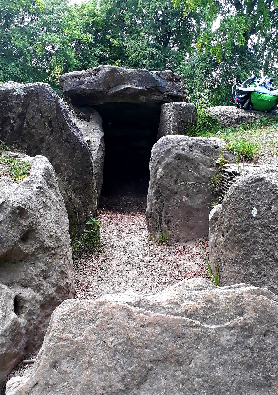
The route crossed over the M4, at Foxhill, a noisy and unpleasant surprise, to continue toward Waylands Smithy
A top trail Angel had been messaging me today, and offered to bring out much needed provisions. So we arranged a clandestine meeting at Ashbury Folly. I was fit to drop by the time I got there. But I was liberally fed the most delicious sandwiches, hot coffee, other goodies, and supplies of much needed compede
We chatted for a while, whilst my batteries recharged, such a lovely thing to do, and most welcome… the kindness of strangers. Then I walked a final mile to Wayland Smithy. Here I lingered, soaking in the tranquil atmosphere and chatting to some lovely people, before finding a suitable place to hunker down for the night
Dog tired, I camped in some woods just across the way…until tomorrow, which will be an easier day, as I did all the graft today
May 30th 2022
Day 12: Wayland Smithy to Courthill Centre (Approx 10 miles – Bunk @ Courtland Centre)
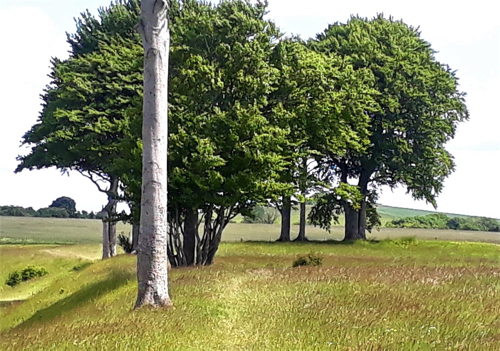
Not a soul around, dead or alive, at the Smithy after 6.30 pm, so it was safe to pitch up. Camping is prohibited in the grounds, but I’m sure people do. Out of respect for the ancients, I camped in the adjacent woods. These Beech copses are a regular, feature of the Wiltshire Downs. As well as a handy place to camp, they also have an interesting history
The kids hereabout, create camp areas which was ideal for my tiny tent. I slept better, but was disturbed by nagging hip pain. Relieving it, by scrunching and stretching all night. No sound of deer in the night, but I could hear things scurrying about in the leaf litter, outside the tent.
Dawn chorus was early again, I lay and listened to the songs from the woods, a woodpecker drumming in the distance. Disturbed by dog walkers 7.30 am, I thought it best to make myself scarce.
Decamped and on my way about 8.30 am, I paid one last visit to Wayland Smithy, just to soak up some of the morning atmosphere. It will be a short walk today, so I ambled gently along, warming in the suns first flush, passing big furry caterpillars doing the same.
It didn’t take long to get to Uffington Castle/Fort and White Horse, about 1.5 miles. Although I did wander past it initially and had to back track a bit. The White Horse itself is quite hard to find as it is situated on a very steep escarpment below the Ridgeway.
To get my bearings, I walked down to Dragon Hill, where St. George supposedly slew a mythical dragon. Climbing to its top, I sat for a while in quiet contemplation. There are views of the Manger to the right, which is a large misshaped valley, thought to have been formed in the last Ice Age.
However, according to folklore, the manger is the supernatural feeding place for the White Horse, “which would travel from its vantage point on the crest of the hill on moonlit nights”. And of course there are the historical, and crazy cheese rolling activities, held down the side of the valley during the scouring festival, when the horse is cleaned and maintained
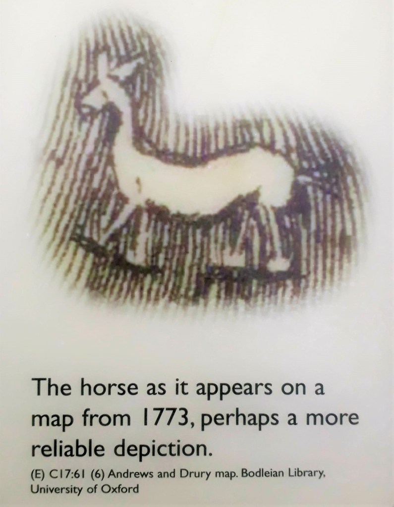
You can see part of the white horse from here, but its headless. At ‘3000 years old‘, its the largest and oldest of the horses, and it is best viewed from the air, or by design, from miles away.
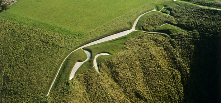
Now that I could see where it was, I climbed back to the ridge for a closer look. But it was roped off to stop pesky tourists trampling all over it. Unable to get a good view from here, I continued on my way, shortly passing the lesser known Rams Hill Fort, on the right.
The trail had returned to isolated stages again, no pubs, shops etc. on route. So I needed to be careful of water and food. A gentleman I spoke with last night, at Wayland Smithy, made a good point. All the castles/forts along the Ridgeway, would have been the places that our ancestors stopped, on their travels, for shelter, food and water… well Ale.
In terms of infrastructure, it’s all still here, it is the people who left. Moving away from ancient ways, and the land, for lives of ‘comfort’, squeezed into big towns and cities, separated from nature by brick walls and cars. It’s the death of a simple way of life
The trail is now passing through the North Wessex Downs which is an Area of Outstanding Natural Beauty. I’m fascinated with the historical names on my map. So I posed the question of the origin of these names to the Facebook Hive mind… read on…
‘Hackpen Hill’, the name is generally associated with the Hackpen White Horse and Barbury Castle, but I saw another on route to Segsbury, at the Devils Punchbowel.
The Face Book Hive Mind reported: “Hack is an Old English word for serpent , and pen in Hackpen can mean head (headland or hill), top, far end of, end of (Cumbric, Cornish, Welsh). William Stukeley was of the opinion that Hack Pen meant Serpent’s Head“
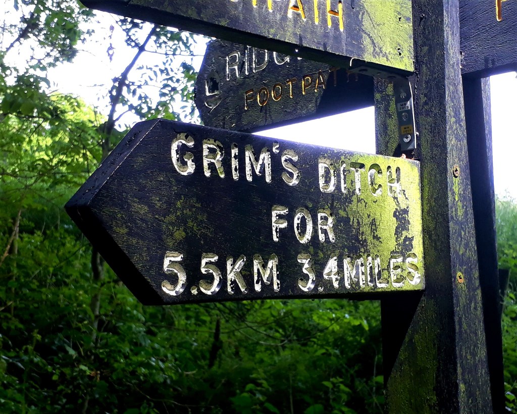
The Devils Punchbowl is one of the iconic land forms along the Ridgeway. There are permissive routes, should you have time to explore, but I pressed on. There are also lots of Grim’s Ditch – (Click the link).
The forts on route today, Uffington Castle, and Segsbury (Letcombe Castle) would easily have held hundreds of people. The ancient Iron Age fort of Segsbury Camp, is the largest of the Iron Age hill forts along the Ridgeway. It covers an area of 30 acres, and is so large that a road runs straight through the middle.
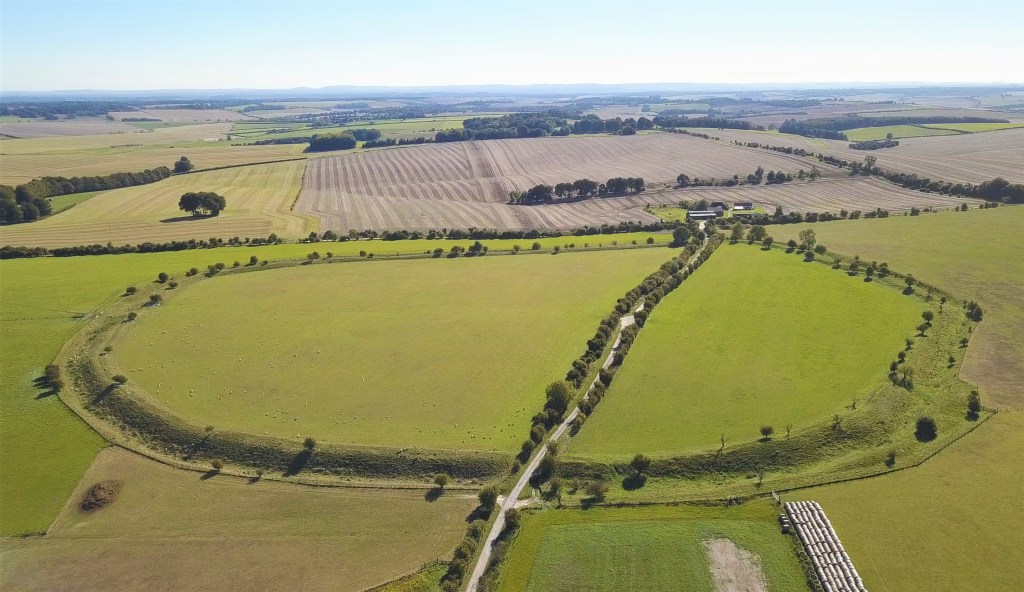
The now empty centre of this huge enclosure, was once a bustling trading place. Now bursting with wild flowers and home to Skylarks and butterflies. The ditches once an important defense, now brimming with cow parsley and Ground-elder, the latter, likely introduced into the UK by the Romans
As I walked ‘half’ its embankment, I tried to imagine the lives they led. Our ancestors were tough indeed to survive such harsh conditions, it is thanks to their survival and tenacity that we are all here today
Contemplating my journey so far, like the trail, it has had its ups and downs, its sunny days and turbulent dark days. The hardship in the beginning feels like a weird dark distant dream, I have weathered and perhaps come out of that storm.
Today’s route, although short in comparison to other days, was still challenging. No great hills but the hard chalk paths, sometimes carved into deep ruts by 4x4s and tractors, made walking difficult at times. The uneven surface twisting my feet, a breeding ground for sores and blisters
Around midday I was caught in a hail storm and rain shower, it made the chalk very slick. I would not like to be walking this trail in wet conditions. The weather turned cold again, and I was glad to finally reach the Courthill Centre, late afternoon. Its a private and very lovely hostel, £19.50 for a bunk, bargain, and it was so good to be indoors.
It’s easy to get to, just hang a left after Segsbury Fort, left again onto Court Hill and you can’t miss it, on the left. Then you can walk straight back onto the trail the next morning on a handy little footpath across the road
Two hot coffees went down a treat, as I sat in the pretty courtyard, watching the swallows dart back and forth. A packed lunch was sorted for tomorrow, as well as hot food for the evening. Then I scrubbed my smelly self and my clothes clean, and fell into a deep sleep under a warm duvet.
It’s been such struggle to find campsites, and affordable B&Bs. I wish I’d booked ahead, but when thru hiking, you don’t necessarily know where you will be. Miles and terrain dictate.
But the good news is, the planets have fully aligned, and the trail gods have shown me much favour. Finally, having access to the internet, and time to sit and google, I secured all the accommodation needed for the rest of the route.
Tomorrow I have a B&B in Goring, and I blagged my way onto ‘full campsites’ for the last 3 nights, thank you kind owners. No more wild camping… wooo. So, I now have the scent of the finish line in my nostrils, it’s on people… Ivinghoe Beacon here I come
It was a relaxed afternoon and evening, just me here and a bunch of guys cycling the Ridgeway and King Alfred’s Way. We shared stories and tips of the trail, it was so good to chat to other people after so long on my own. I had a dorm all to myself, spookily, its called Waylands Smithy.
May 31st 2022
Day 13: Courthill Centre to Goring (Approx 14.63 miles B&B Melrose Cottage)
Having abandoned the recommended stages days ago, I had walked further than Sparsholt Firs. So, I am ahead of myself and have fewer miles to walk again today… huzzah
Slept like a log, right through till 6 am, and dreamed for the first time in days, of what I do not recall. Its was quiet you could hear a pin drop. One of the cyclists, braved the cold outside last night, in his tiny technical bivvy bag. Like us, he had the option to be indoors, now that’s hard-core
Reluctantly, I left my cosy lodgings 9 am, and set off under unpredictable skies and a fresh wind. Such a lovely place, it would have been nice to stay longer. The Met office forecast heavy rain 1 pm, and black clouds stalked me all day. There were two short sharp showers mid-morning and again bang on 1 pm. Other than that, I escaped the worst.
The cyclists from Courthill Centre passed me 90 minutes later, no doubt they had stayed for a nice leisurely breakfast. A monument, that unfortunately, stands on a Bronze Age Round Barrow. Erected by Lady Wantage to Lord Wantage in 1903, sits adjacent to the Ridgeway, at Betterton Down.
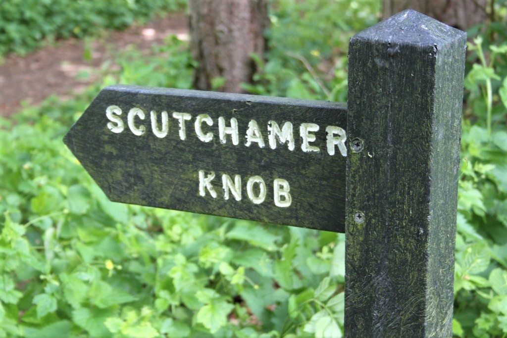
Sadly I missed Scutchamer Knob, passed without even noticing it. I was looking forward to visiting it, after snickering at its name. I spotted a sign for East Hendred, but not the Knob (chortle)… damn it
The route was very straightforward today, and so well signposted, that you could walk it in your sleep. In fact, for most of the day I dozed in my head. It was a long long long, flat, straight route, and popular with cyclists. Wide grassy/chalk tracks, which you would think, would be great for walking. But it was, dare I say, quite monotonous…
For all if its rigours, the Wessex Ridgeway had a much more diverse landscape. There is little change in scenery on this stretch. Other than seeing some race horse’s on the Gallops, there was little to keep the mind entertained. Whatever history was on this route, has been erased.
Nonetheless, West Berkshire is a Wildlife haven, since 2018, The Ridgeway has become an ‘outdoor laboratory’ between the car parks at Bury Down and Scutchamer. A community endeavour, including farmers, students and volunteers, aiming to increase native plants, insects and other wildlife.
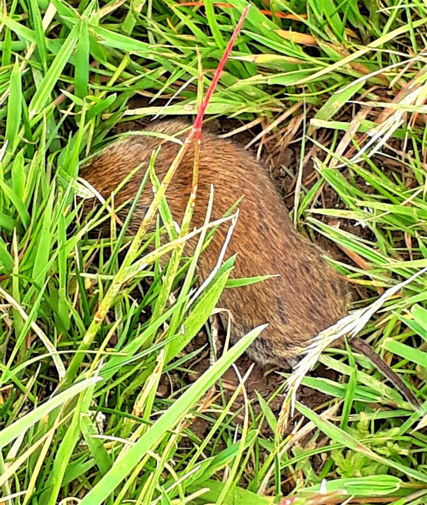
Apparently Peewits are common here, I saw one yesterday. An abundance of wild flowers, and I had an encounter with a field vole, I think? He was very smart, and lay perfectly still and flat. Kites are ever present and a vole would make a tasty snack.
Another hiker, heading for the Courthill Centre, paused for a chat and we reflected on the isolated nature of this route and the challenges.
This part of the route is a cyclist’s paradise and would be more comfortably traveled that way. I was wishing for a bike or a horse, the packed surface is hard on the legs. I was glad of the occasional incline to put weight on a different part of my feet.
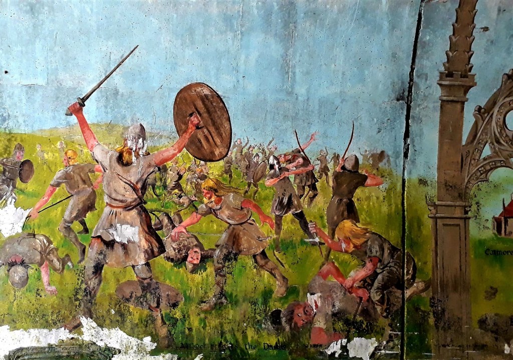
The ‘Tunnel de Art’ ‘under the A34, was pleasant and interesting surprise. A lovely mural, depicting the history of the area and marauding Vikings.
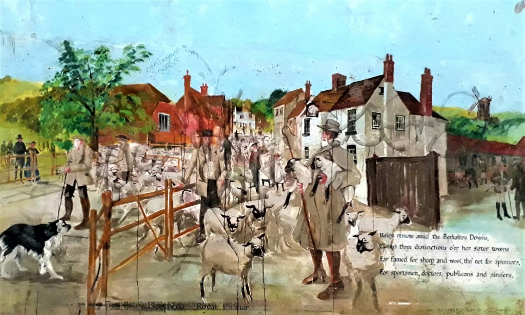
The verse reads:-
“Ilsley remote amid the Berkshire Downs.
Claims three distinctions o’er her sister towns
Far famed for sheep and wool tho’ not for spinners
For sportsmen doctors publicans and sinners”
I think that’s actually 5 distinctions… poetic license?
After a 2 mile slog by road, I reached the outskirts of Streatley about 3 pm. And had a much needed pit stop at the Bull Inn, before the final push, a couple more miles into Goring.
What a pretty place Goring is, beautiful gardens, riverside pubs, and Kites literally everywhere. I could hear them calling to each other, a strange mournful sound. I looked up and spotted one sitting on a chimney pot, while others were whirling in the sky… magical
Found my B&B, a nice red brick town house, a short walk from the Ridgeway. I can’t believe how lucky I have been finding places so close to the trail. I’m looking forward to walking the Thames Path tomorrow, there are pubs and cafes on route and the weather looks good.
Only three more days to go, normally at this point on my hikes, my mood drops, I don’t want to go home. This time I’m punching the air, I’m worn out, maybe I’m getting too old for this shit? But… for whatever reason, and I’m still figuring this out, I set myself a challenge so big that I had to grow into it…
Until tomorrow…
1st June 2022
Day 14: Goring to WATLINGTON (Approx 14.59 miles White Mark Farm Campsite)
A disturbed night’s sleep, it was hot and I kept waking, unused to being indoors. I woke to a pleasant morning, Kites calling outside. I’m very enchanted by these masters of the sky
The host of this establishment, Rose, is a granny with an eye for business. God knows how many rooms she has here, at least 4 in a small red brick town house, its like a tardis inside. She has thought of everything, a range of teas, and products for hair and skin, I’ve slapped as much moisturiser on as possible, and I smelled good
Breakfast was a veritable banquet, vast quantities of fruit, cereal, juice, yoghurt, tea, coffee and cooked options. So, I packed as much down as possible, as there would be no food till WATLINGTON
Muesli with Strawberries, Scrambled egg on toast, Toast and Marmalade, all washed down with orange juice and coffee. I waddled out the door about 9.30 am. It’s the 1st of June, and finally there was a bit of warmth in the air
I’ve felt a bit off colour the last couple of days, and had an ‘upset stomach’ again yesterday. As I dashed for some shrubbery, I realised with horror, I’d used my last wet wipes the previous morning, thank god I stole loads of toilet paper from Court Hill Centre and still have dog poo bags…
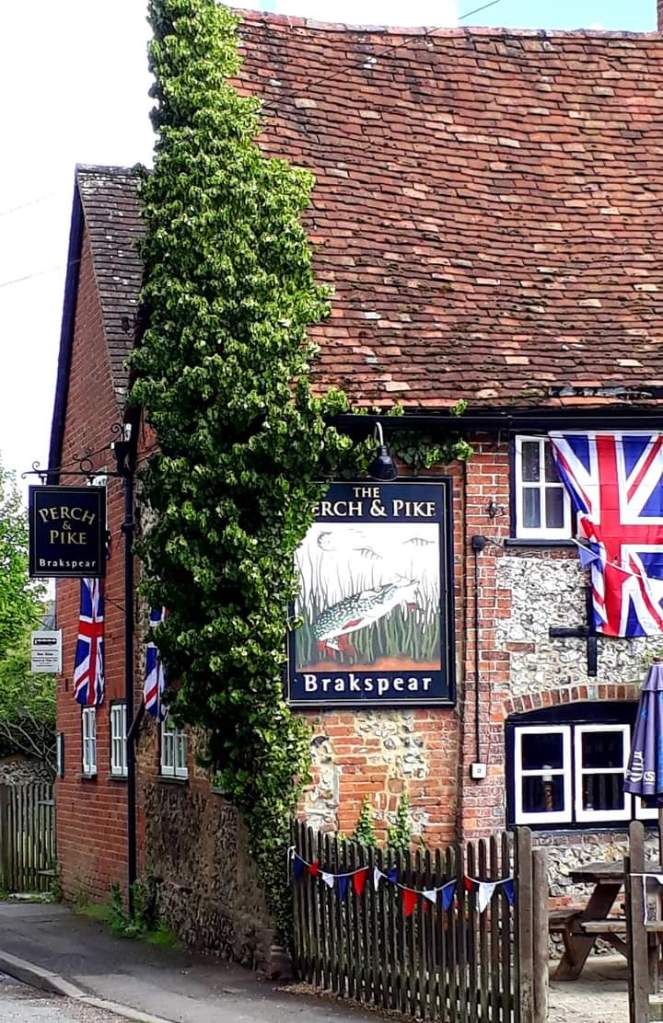
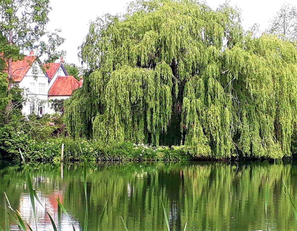
Today the trail went through Withymead nature reserve, and followed the Thames Path, to South Stoke. Lots of stylish homes with gardens leading down to the waterfront. This is the land of beautiful red brick buildings, roses, wisteria and weeping willows. The local pub, the Perch and Pike, was closed
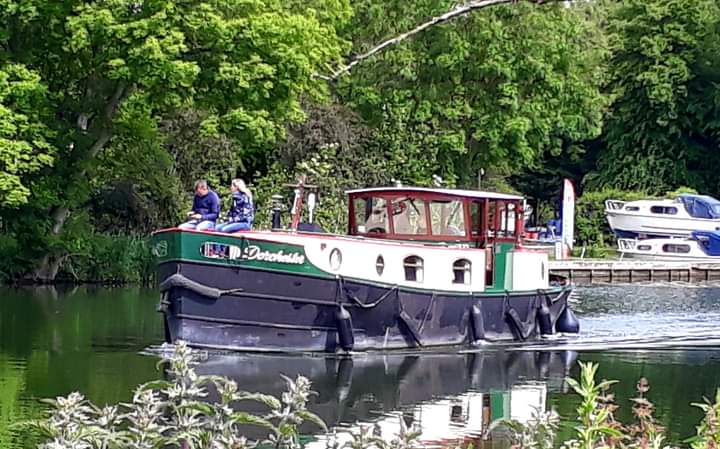
The Thames path was easy walking, with river side properties to die for and canal boats lazily idling along the waters
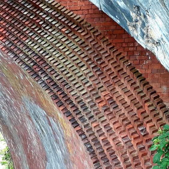
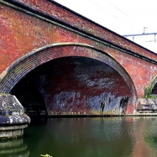
The trail takes you under the beautifully crafted Moulford Railway Bridge, with its red brick and characteristic ‘skew arch’. Built between 1838 and 1840, and designed by Isambard Kingdom Brunel, no less.
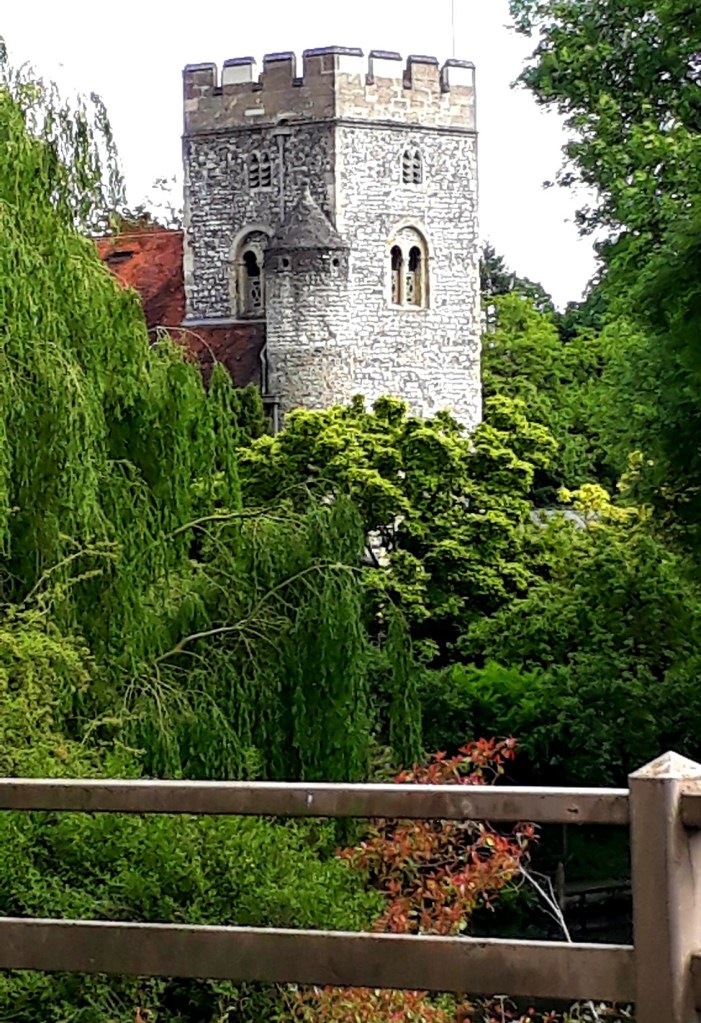
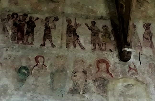
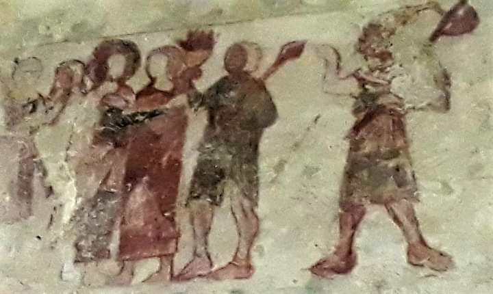
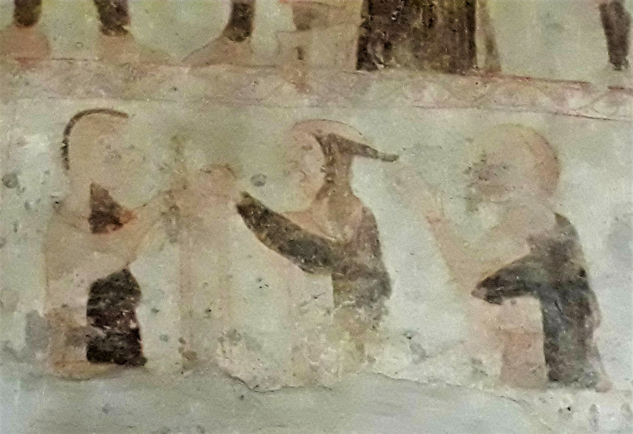
St Mary’s Church, in North stoke, has the most amazing medieval wall paintings. This church is the only one, anywhere on the entire length of the Ridgeway, where the path actually runs through the churchyard. It has a very interesting history
After North Stoke, the Ridgeway leaves the Thames behind, and the path travels through soft woodland trails and olde beech avenues for the rest of the day. Apart from the beautiful Avebury section, this was my next favourite day, so very pretty and peaceful.
In complete contrast to yesterday, although I felt very tired, time went by much more quickly. I spent a portion of the day on automatic pilot, just putting one foot in front of the other, but the miles go quickly when surrounded by beauty. Yesterday I was just counting the miles. I also came upon a handy water tap by a farm (OX10 6QN)
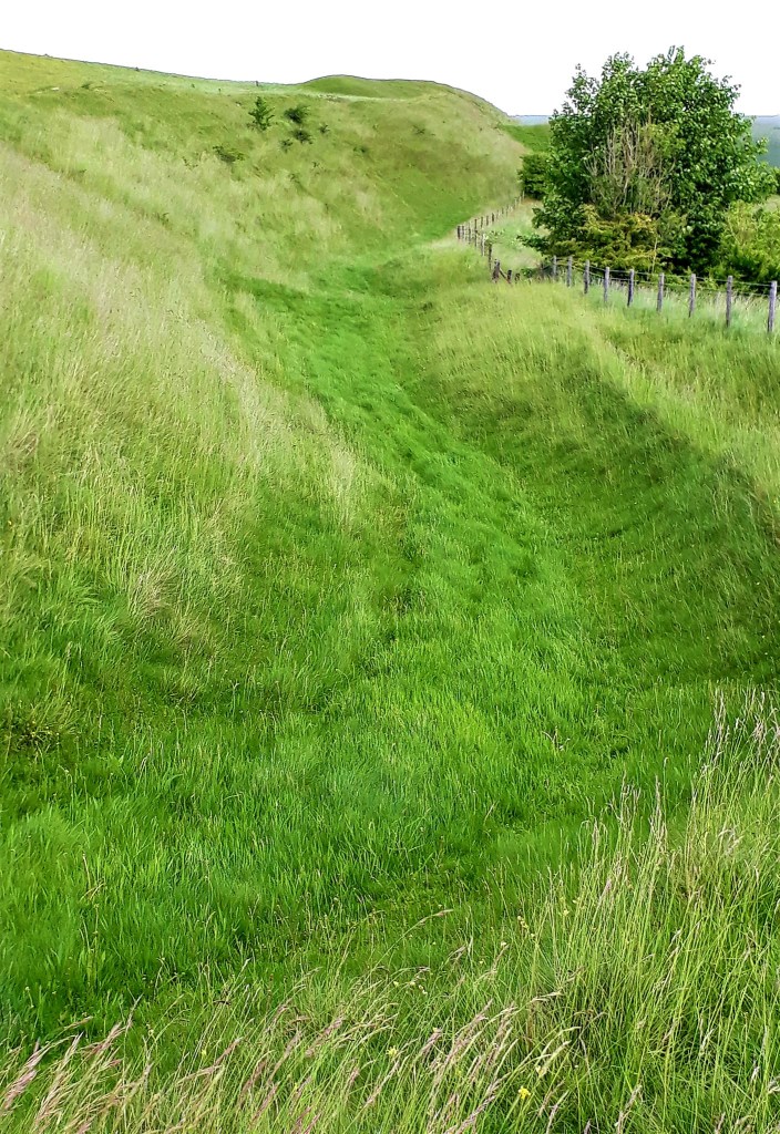
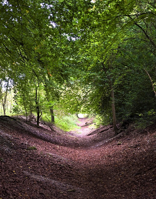
The trail is now in the Chilterns and travelled through the ancient Grimm’s Ditch, which was delightful walking, it really is a great long ditch through woodlands of beech. The tales this sunken trail could tell and the the feet and carts that have travelled upon it
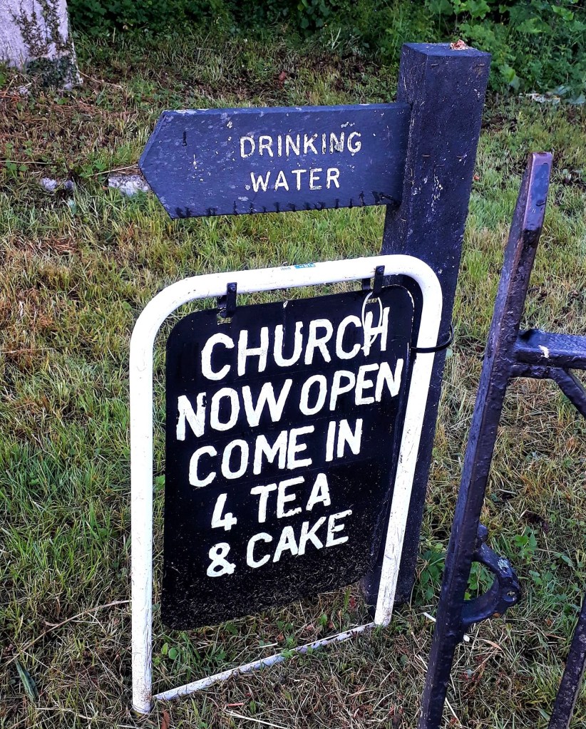
Feeling very weary on route to Nuffield, I stumbled upon cakey tea, at the Holy Trinity Church and more water. Fuelled by the holy cakey tea, I continued my journey with renewed vigour
The greatest challenge of the day was traversing a golf course, lots of posh people thwacking balls everywhere. The final miles went through fields, from one woodland to another. I’m definitely a woodland walker, you can feel the history in the land and there’s something about the dappled light, I guess this is forest bathing
Back in rolling landscapes once more, the trails rose up and down, with moderate climbs. I reached WATLINTON and ‘a campsite’ at 4 pm. A little confused… this was not Bridge Villa Campsite… I checked the location, and that campsite was back in WALLINGFORD
So correct town, wrong campsite… I’d only spent days hassling Bridge Villa to find me a place, what a plank. It seems my feet knew where I was going, even if my brain didn’t. But to be fare the names were very similar…
Anyhow, I blagged my way onto White Mark Farm Campsite. She seemed to remember our non-existent conversation and remarked that she had forgotten to write me in the book… I smiled politely and she was happy to snatch a tenner out my hand, tax free, so all’s good
There are warning signs everywhere, about the Red Kites, apparently they will have ya dinner faster than a St Ives Seagull will snatch ya pasty…
I noticed Icknield House on route, and the path touches on the Icknield Way. Tomorrow will be another long dry stage, so I took a short walk into town to top up with provisions. The local tavern, The Spire and Spoke, was a great place to partake of some fine food and ale.
After a wobbly walk back to my tent, a tiny bit pickled, it felt nice to be camping legitimately. Tomorrow is my penultimate day, approx. 17 miles, but my final day is much shorter, I’m rather excited to be near the end of this incredible journey – well half of it…
Goodnight ….
June 2nd
Day 15: WATLINGTON to Wendover Woods (Approx 20.52 miles, Hill Farm Campsite)
Woof … it was a very long day penultimate day
A Dutch couple that I met on route to camp yesterday, were pitched next to me. Apparently they have walked ALL of our national trails. They are walking smaller stages, so no company for me. They commented that I’m travelling light and fast… it sure didn’t feel that way.
On my return from the tavern last night, my freshly washed clothes were spotted with bird poo… damn pigeons. So I had to re rinse it all and hang it in the tent, not good when a bit tiddled. It was still wet this morning, the trials of hiking life
Sleep was elusive, a jolly fun family tent across the way, thought it would be great to regale everyone with loud banter till late into the night. Then there was the slidey air mattress to contend with
The Wood Pidgeon’s, woke me at stupid o’clock, I hate their boring, loud asthmatic cooing… SHUT UP!! Breakfast 7 am, the last of my freeze dried cereal. A leisurely decamp, then hit the trail just after 9 am. My stomach still felt ‘unpredictable’ so I swallowed two of those tiny blue capsules just in case
It was beautiful and sunny for most of the day, with a fresh breeze. The trail started off through beech woodland, then under the M40, which disturbed my peace, then back onto cycle trails, not unlike the stretch from Sparsholt to Goring. It’s part of a disused railway and passed old quarries.
It was a good 2 hrs walking, and cyclists were ever present, the trail heavily populated, bank holiday traffic I’m guessing. People stopped to me ask how far I was going and how far I’d walked.
The Ridgeway, intersected the Icknield way a lot today, and other than two stretches of cycle route, before and after Princes Risborough, I was mostly walking in the shade of beech woods, and rolling green hills.
It’s so important to look up at the landscape. The diverse colours of leaves and the bark on trees, birds, wild flowers and butterflies. So often when hiking, we focus on the ground, for trip hazards, and we miss so much.
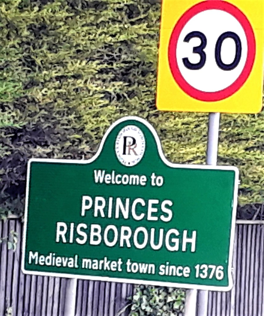
Princes Risborough took forever to reach, then I came upon The Plough at Cadsen, a much needed coffee stop. But it was filter coffee, not holy coffee, so it didn’t have the same effect. It was too hot by early afternoon, I think I sweat my body weight, walking along the scorching hot cycle path of doom.
Old paths have been erased and replaced with modern convenience. I find myself disassociating on these stretches, to avoid the relentless slog.
Clouds appeared around 4 pm and it was much cooler. There were some hefty climbs today, very reminiscent of the Wessex Ridgeway, and despite my increased fitness, no easier. I don’t understand, when a third of the contents of my pack has been used, it still feels just as heavy?
At last I reached a handy bench, a perfect rest stop on top of the world, where I could see for miles across Aylesbury and the Chilterns
The cycle paths now behind me, it was good to be off the dusty hard tracks, and back onto soft earthen hills and woodland. Ravens honked in the distance, and I was treated to a hare sighting. Some real close encounters with Red Kites, ever present today in larger groups. Patrolling hay fields looking for mice no doubt
Part way through the day, I dreamt of rice pudding, I know not why?
On long stretches its tempting to keep checking the map, how much further it is. Don’t torture yourself, your feet, knees and hips will tell you… and mine hurt today, pain killers later. Just keep walking, one foot in front of the other, 5 miles, another 5 miles, and another, before you know it you are nearly there.
The trail passed right across the Chequers estate, security cameras everywhere – very surreal. Across the road, is Buckmoorland cafe, not as dry a stage as I thought. I wondered if Boris got his morning cup of Joe from here?
From here it was 4.5 miles to Wendover, the longest 4.5 miles ever, then further yet up to the campsite. Wendover was loud and confusing, and I became disorientated, signs for the Ridgeway vanished in the high street. The gpx route led to a dead end in a housing estate.
There were plenty of places to eat or buy food, but it was getting late so I pressed on. To stay on the ‘Greater Ridgeway’, walk down the high street to the clock tower, turn right onto Heron Path, then left at the end of the playing field. Here the route diverts onto the Icknield Way, which skirts Wendover Wood on Hale Lane. Don’t follow the Ridgeway signs, if you end up at St Mary’s Church you have gone too far
At Wendover Woods, I left the trail and took the long walk up Boddington Hill to Hill Farm Campsite. Here I was greeted with a hearty congratulations and given a token for the shower, a very quick 5 min shower
It was quite blustery up there, so I hunkered down in the tent, the site was busy with excited children, goooo to bed… as must I. Its my last day tomorrow, it should be a short day. I am off route a bit, which accounts for the extra miles today.
It would be great to walk the last stage with some folk, if anyone is around… but I know parties will be happening everywhere, as its the Queens Jubilee. Until tomorrow and the final push… I can’t believe I managed to get ahead and make up the days that I miscalculated – Ivinghoe Beacon here I come…
June 3rd
Day 16: Wendover Woods to IVINGHOE BEACON – Finis …. (Approx 10.93 Miles Town Farm Campsite)
A very restful day, ambling to my final destination, for now…
It was a cool blustery night, the tent rattled like a bin bag. But I had a pretty restful sleep, with the aid of painkillers. I woke to an overcast and mild morning, feeling restored
Approx. 10 miles to walk today, so I took my time packing away, then had to unroll the tent again, because I’d wrapped my sunglasses inside. Leaving the hustle and bustle of the campsite behind, 9.20 am, I made my way slowly back down to the Icknield Way.
There was a bit of road walking at first, until I found a woodland track. Back in the peace and quiet, just me, the birds, the wind stirring the leaves. Wandering along, I had nowhere to be in a hurry, drinking in my last day in the wilderness.
30 mins later I was back on the Icknield Way, via a lovely little hollow way (Bridleway). Which was much faster than yesterday’s slog up through the woods. Taking this route back down, I missed out the long road walk, along Hale Lane and was shortly back on the Ridgeway
Confused? The Greater Ridgeway, traverses both the Ridgeway and the Icknield Way. You can follow the Ridgeway, from Wendover, it would bring you to the same place, but its a less direct route – see map below
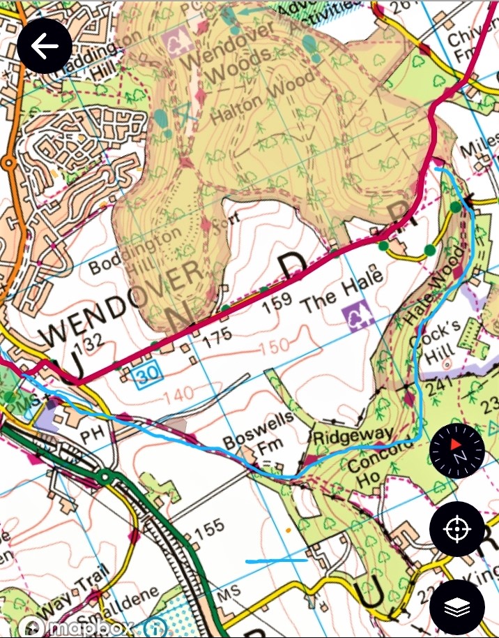
It wasn’t long before I encountered cyclists, whizzing past, and later I was very nearly mown down, by enthusiastic lady hikers, complete with sticks
It’s been difficult to get a sense of where I am geographically, when immersed in the lanscape. But, i’m now in Buckinghamshire. I’ve walked through so many counties, towns and villages, that I’ve never heard of, or been to before. I never imagined I would ever find myself at Chequers… I know more about the geography of the UK, from just walking through it, I feel very learned.
I found myself noticeably dragging my feet today, and not just because I had plenty of time. Now that the end of my journey was near, I wanted to continue. What a wonderful feeling, just when I thought I’d lost my hiking mojo.
So many times on this journey, I thought “I’m never doing anything like this again”. Now I wish I had all the time in the world just to keep roaming this beautiful land… on a sunny day of course…
“If you are in a bad mood, go for a walk. If you are still in a bad mood, go for another walk.”—Hippocrates
Well I certainly did that and it feels like the earth and my wellbeing has tilted back onto its axis… hopefully it will stay there
Around 11.30 am, I wandered into Tring Park, already half way to Ivinghoe Beacon. A dog walker stopped to chat, he told me all about the history of the park, the eccentric Rothschild’s and the cart pulled by Zebras. He told me Ivinghoe Beacon would be very busy and there would be ice cream.
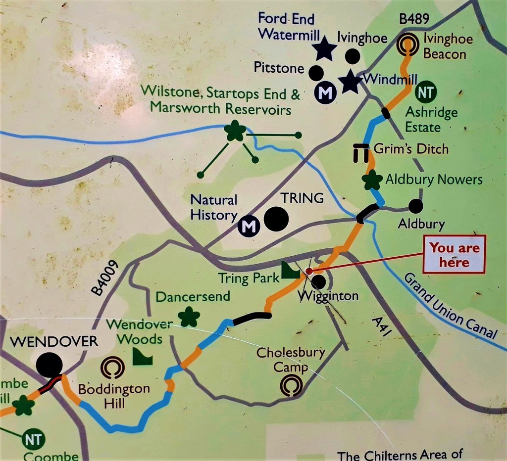
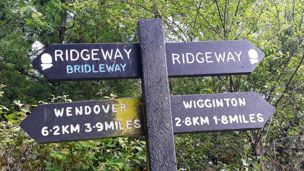
Tring Park is quite a place, after my history lesson, I imagined what this grand estate might have looked like in Rothschild’s time. Gentile ladies with parasols, gentlemen in tops hats, and where wallabies once roamed free
Tring Park sits in the Chilterns Area of Outstanding Natural Beauty in Hertfordshire, from the estate grounds there are verdant panoramic views
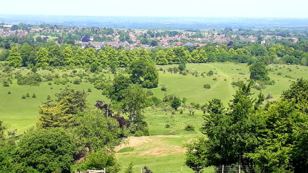
It was only 11.45 am, so I detoured into Wigginton, to while away some time. The Greyhound Pub didn’t open until Midday, so I sat in the garden to wait. Just staying long enough to eat, I enjoyed a healthy salad in the sun, some coffee for fuel, not that I needed it today. I struggled with the noise and the crowds after being in the wilds.
Shortly after returning to the trail I caught my first view of the Beacon. The trail continued through Aldbury Nowers, chalk grassland, found on the Chiltern escarpment. Its one of the finest remaining areas of this habitat in the county and as such, one of the best places to discover butterflies and solitary bees.
On this my last stage, I couldn’t have hoped for a better day. Verdant landscapes, woodland trails and the climb up to the Beacon. Grasshoppers’ chirped loudly in the chalk grassland, as I made my way to the top.
Red Kites, had been absent all day, neither sight nor sound… I missed them. As I started my climb to the summit, one appeared from nowhere. As if guiding me on to the finish. It rose up high above the Beacon, and then with a subtle tilt of the wing, was gone…
Heading for the summit, I joined a small trickle of other people, and reached the top 3.30 pm. It wasn’t too crowded and there was no ice cream… But as ever there was an handy man to take my picture at the trig point
The trail today was super easy, in fact, accept for Wendover, I barely had to navigate the Ridgeway.
This adventure has been emotional, but I’m less emotional than when I started. From exhaustion, anguish, and at times despair, to appreciation, peace and improved physical and mental well-being
All that’s left to do is walk down to the campsite. My last night on the Greater Ridgeway… for now…
The evening was spent in Ivinghoe, doing a recce for the bus stop for my journey home tomorrow, and of course, I had some fine food and ale in the local tavern
Total miles: 234.52 (According to National records)
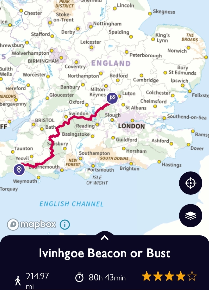
Thank you to to all those who sent words of encouragement, well wishes, provisions and for virtually joining me on this lone odyssey, it really kept me going… I will be back …
Greater Ridgeway Part 2 – Spring 2023- Ivinghoe Beacon to Norfolk… until then
If you enjoyed this Tale from the Trail – you may consider buying me a Coffee – Thank you

Leave a reply to tonyurwin Cancel reply